New Bloomfield in Perry County, Pennsylvania — The American Northeast (Mid-Atlantic)
The Center of Perry County Government
Perry County Bicentennial
| — | 1820 - 2020 | — |
Photographed by Devry Becker Jones (CC0), February 23, 2024
1. The Center of Perry County Government Marker
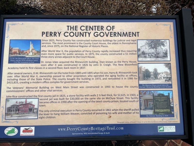
Since 1825, Perry County has constructed numerous buildings for judicial and legal services. The most prominent is the County Court House, the oldest in Pennsylvania and, since 1975, on the National Register of Historic Places.
After World War II, the population of Perry County rapidly increased thus requiring even more space for public spaces. In 1975, the county constructed a $1 million three-story annex adjacent to the Court House.
Dr. Jonas Ickes acquired the Rhinesmith building, then known as the Pery House, soon after it was constructed in 1826 by John D. Creigh. The New Bloomfield Academy held its first classes in a second-floor, back room in 1837.
After several owners, D.M. Rhinesmith ran the hotel room from 1889 until 1895 when his son, Harry B. Rhinesmith took over. After World War II, ownership passed to other proprietors who operated the aging facility as offices, including those of the State Police. The county bought the building in 1973, and remodeled it in 1986 for $415,833, creating a modern office complex for government services.
The Veterans' Memorial Building on West Main Street was constructed
this page online
John Rice constructed the first county jail in 1825, a stone facility with walls 2 ½ feet thick, for $2,625. In 1903, a second jail was built for $30,000 on the same site on McClure Street. This facility became offices in 1990 after the opening of the latest county prison, located south of town.
The only criminal execution in Perry County occurred in 1861 when the sheriff pulled the lever to hang William Weaver, convicted of poisoning his wife and mother of his eight children.
Erected 2020 by WSL Incorporated; Historical Society of Perry County.
Topics and series. This historical marker is listed in these topic lists: Government & Politics • Law Enforcement • Political Subdivisions. In addition, it is included in the Pennsylvania, Perry County Heritage Trail series list. A significant historical year for this entry is 1825.
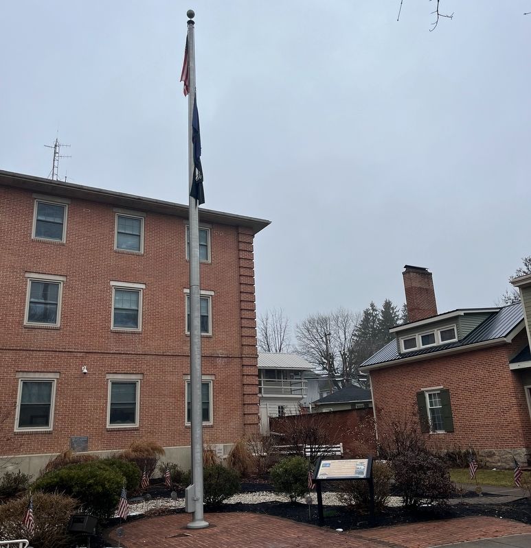
Location. 40° 25.204′ N, 77° 11.215′ W. Marker is in New Bloomfield, Pennsylvania, in Perry County. It is on East Main Street (Pennsylvania Route 34) west of Printers Alley, on the right when traveling west. Touch for map.
Photographed by Devry Becker Jones (CC0), February 23, 2024
2. The Center of Perry County Government Marker

Regionally, this marker is in South-Central Pennsylvania, in the Susquehanna Valley, and in Greater Harrisburg. It is also in the American Northeast, in the Mid-Atlantic, in Appalachia, and specifically in Northern Appalachia. Globally, it is in North America, the Western Hemisphere, the Western World, and the Anglosphere. Historically, it finds itself in what was once the Haudenosaunee (Iroquois) Confederacy and also one of the original Thirteen Colonies.
Other nearby markers. At least 8 other markers are within walking distance of this marker: New Bloomfield (here, next to this marker); Perry County (a few steps from this marker); New Bloomfield World War I Memorial (a few steps from this marker); Perry County Civil War Memorial (within shouting distance of this marker); The Academies on the Hill (within shouting distance of this marker); Original site of Bloomfield Academy (within shouting distance of this marker); The Rhinesmith Building (within shouting distance of this marker); The Civil War Monument (within shouting distance of this marker). Touch for a list and map of all markers in New Bloomfield.
Also see . . . Perry County Courthouse Nomination Form.
This form was prepared in 1973 by Janet C. Smith, Student Aide with the Pennsylvania Historical and Museum Commission. A statement of significance can be found on page 3:
The Perry County Courthouse was built in 1826 and completed the next year, settling one of the county's gravest instances of dissention — that of selecting the county seat. Previous to 1820, the settlers north of the Blue Hills or Kittatinny Mountains, (then part of Cumberland County), complained of having to cross the mountains to reach the seat in Carlisle. At certain times of the year the mountains were impassible and even in the best weather a trip to Carlisle meant an overnight stay. The Sherman Valley "separatists," comprising an area of seven townships, eventually petitioned the state government, and the act creating Perry County was signed on March 22, 1820, by Govenor William Findley.(Submitted on February 26, 2024, by Devry Becker Jones of Washington, District of Columbia.)
Credits. This page was last revised on February 26, 2024. It was originally submitted on February 26, 2024, by Devry Becker Jones of Washington, District of Columbia. This page has been viewed 337 times since then and 30 times this year. Photos: 1, 2. submitted on February 26, 2024, by Devry Becker Jones of Washington, District of Columbia.
