Spring Township near Elliottsburg in Perry County, Pennsylvania — The American Northeast (Mid-Atlantic)
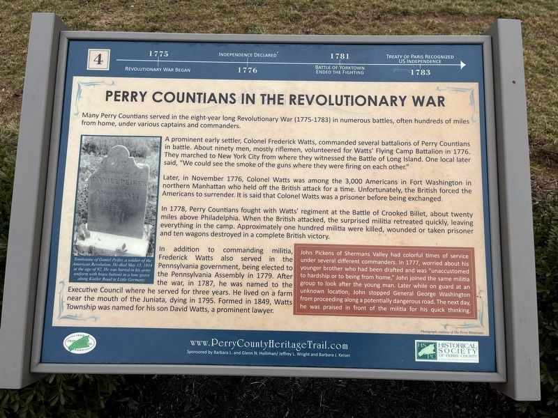
Perry Countians in the Revolutionary War
Perry County Bicentennial
— 1820 - 2020 —

Photographed By Devry Becker Jones (CC0), February 23, 2024
1. Perry Countians in the Revolutionary War Marker
1775: Revolutionary War began.
1776: Independence declared.
1781: Battle of Yorktown ended the fighting.
1783: Treaty of Paris recognized US independence.
Many Perry Countians served in the eight-year long Revolutionary War (1775-1783) in numerous battles, often hundreds of miles from home, under various captains and commanders.
,br> A prominent early settler, Colonel Frederick Watts, commanded several battalions of Perry Countians in battle. About ninety men, mostly riflemen, volunteered for Watts' Flying Camp Battalion in 1776. They marched to New York City from where they witnessed the Battle of Long Island. One local later said, "We could see the smoke of the guns where they were firing on each other."
,br> Later, in November 1776, Colonel Watts was among the 3,000 Americans in Fort Washington in northern Manhattan who held off the British attack for a time. Unfortunately, the British forced the Americans to surrender. It is said that Colonel Watts was a prisoner before being exchanged.
In 1778, Perry Countians fought with Watts' regiment at the Battle of Crooked Billet, about twenty miles above Philadelphia. When the British attacked, the surprised militia retreated quickly, leaving everything in the camp. Approximately one hundred militia were killed, wounded or taken prisoner and ten wagons destroyed in a complete British victory.
In addition to commanding militia, Frederick Watts also served in the Pennsylvania government, being elected to the Pennsylvania Assembly in 1779. After the war, in 1787, he was named to the Executive Council where he served for three years. He lived on a farm near the mouth of the Juniata, dying in 1795. Formed in 1849, Watts Township was named for his son David Watts, a prominent lawyer.
[Sidebar:]
John Pickens of Shermans Valley had color times of the service under several different commanders. In 1777, worried about his younger brother who had been drafted and was "unaccustomed to hardship or to being from home," John joined the same militia group to look after the young man. Later while on guard at an unknown location, John stopped General George Washington from proceeding along a potentially dangerous road. The next day, he was praised in front of the militia for his quick thinking.
[Captions:]
Tombstone of Daniel Peifer, a soldier of the American Revolution. He died May 13, 1814 at the age of 92. He was buried in his army uniform with brass buttons in a lone grave along Kistler Road in Little Germany.
Erected 2020 by Historical Society of Perry

Photographed By Devry Becker Jones (CC0), February 23, 2024
2. Perry Countians in the Revolutionary War Marker
Topics and series. This historical marker is listed in these topic lists: Cemeteries & Burial Sites • Government & Politics • War, US Revolutionary. In addition, it is included in the Perry County Heritage Trail in Pennsylvania. series list. A significant historical date for this entry is May 13, 1814.
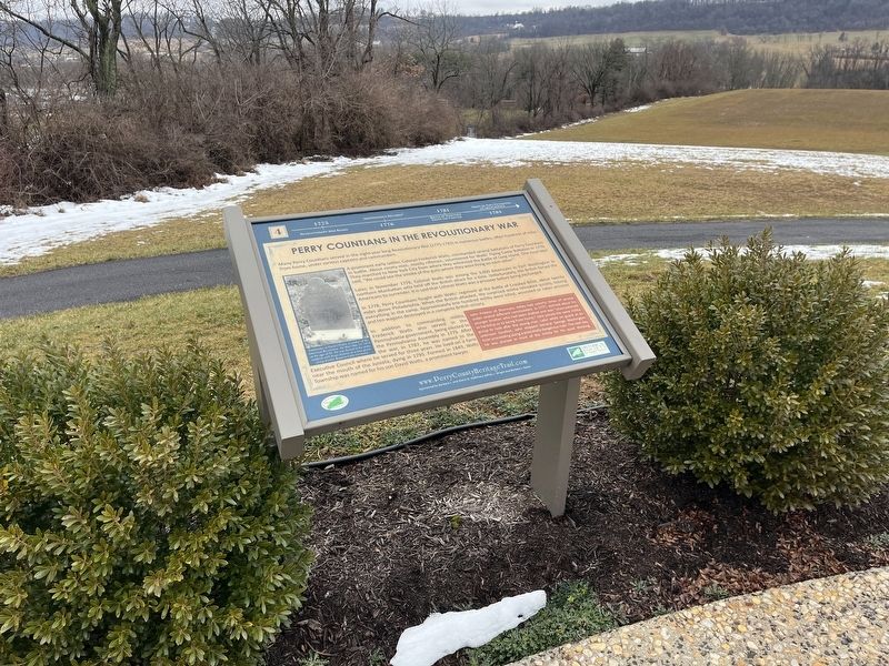
Location. 40° 23.082′ N, 77° 17.862′ W. Marker is near Elliottsburg, Pennsylvania, in Perry County. It is in Spring Township. Marker can be reached from Shermans Valley Road (Pennsylvania Route 274) 0.4 miles east of Veterans Way (Pennsylvania Route 74), on the right when traveling west. Touch for map. Marker is at or near this postal address: 2471 Shermans Valley Rd, Elliottsburg PA 17024, United States of America. Touch for directions.
Other nearby markers. At least 8 other markers are within walking distance of this marker. Life in the Great Depression (here, next to this marker); Birth of a New County! (here, next to this marker); WW I and Its Aftermath (here, next to this marker); Life in the Pennsylvania Backcountry (here, next to this marker); A Perry County Civil War Soldier: Sergeant John Jones (here, next to this marker); Perry County Covered Bridges (here, next to this marker); The Greatest Generation Goes to War (here, next to this marker); Indian Attacks in Shermans Valley (here, next to this marker). Touch for a list and map of all markers in Elliottsburg.
Credits. This page was last revised on February 27, 2024. It was originally submitted on February 27, 2024, by Devry Becker Jones of Washington, District of Columbia. This page has been viewed 54 times since then. Photos: 1, 2. submitted on February 27, 2024, by Devry Becker Jones of Washington, District of Columbia.