Quadrate in Mannheim, Baden-Württemberg, Germany — Central Europe
Strohmarkt und Planken / Straw Market and Planks
Inscription.
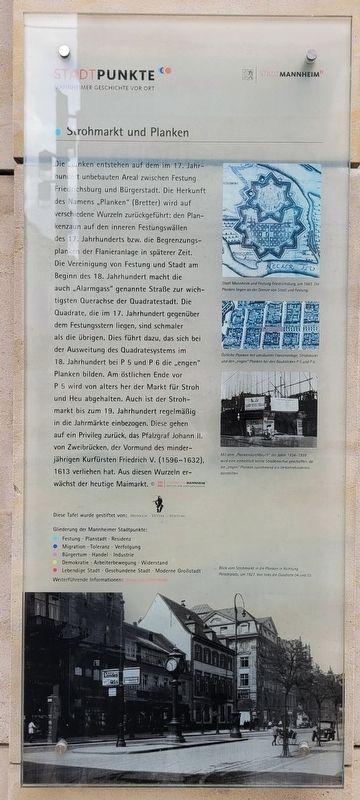
Die Planken entstehen auf dem im 17. Jahrhuntdert unbebauten Areal zwischen Festung Friedrichsburg und Bürgerstadt. Die Herkunft des Namens „Planken" (Bretter) wird auf verschiedene Wurzeln zurückgeführt: den Plankenzaun auf den inneren Festungswällen des 17. Jahrhunderts bzw. die Begrenzungsplanken der Flanieranlage in späterer Zeit. Die Vereinigung von Festung und Stadt am Beginn des 18. Jahrhundert macht die auch „Alarmgass" genannte Straße zur wichtigsten Querachse der Quadratestadt. Die Quadrate, die im 17. Jahrhundert gegenüber dem Festungsstern liegen, sind schmaler als die übrigen. Dies führt dazu, das sich bei der Ausweitung des Quadratesystems im 18. Jahrhundert bei P 5 und P 6 die „engen" Planken bilden. Am östlichen Ende vor P 5 wird von alters her der Markt für Stroh und Heu abgehalten. Auch ist der Strohmarkt bis zum 19. Jahrhundert regelmäßig in die Jahrmärkte einbezogen. Diese gehen auf ein Privileg zurück, das Pfalzgraf Johann II. von Zweibrücken, der Vormund des minderjährigen Kurfürsten Friedrich V. (1596-1632), 1613 verliehen hat. Aus diesen Wurzeln erwächst der heutige Maimarkt.
Bildunterschriften
Stadt Mannheim und Festung Friedrichsburg, um 1663. Die Planken liegen an der Grenze van Stadt und Festung.
Östliche Planken mit umzäunter Flanieranlage, Strohmarkt und den „engen" Planken bei den Baublöcken P5 und P6.
Mit dem „Plankendurchbruch" der Jahre 1934-1939 wird eine einheitlich breite Straßenachse geschaffen, da die „engen" Planken zunehmend ein Verkehrshindernis darstellten.
Blick vom Strohmarkt in die Planken in Richtung Paradeplatz, um 1927. Von links die Quadrate 04 und 03.
The planks are created on the area between Friedrichsburg Fortress and Bürgerstadt that was undeveloped in the 17th century. The origin of the name “Planken” (boards) is traced back to various roots: the plank fence on the inner fortress ramparts in the 17th century or the perimeter planks of the promenade in later times. The union of the fortress and the city at the beginning of the 18th century made the street, also known as "Alarmgass", the most important cross-axis of the city of squares. The squares that lie opposite the fortress star in the 17th century are narrower than the rest. This led to the “narrow” planks forming at P 5 and P 6 when the square system was expanded in the 18th century. The market for straw and hay has always been held at the eastern end in front of P 5. The straw market
was also regularly included in the annual fairs until the 19th century. These go back to a privilege granted by Count Palatine Johann II of Zweibrücken, the guardian of the minor Elector Friedrich V (1596-1632), in 1613. Today's fairground grows from these roots May market.
Captions
City of Mannheim and Friedrichsburg Fortress, around 1663. The planks lie on the border of the city and fortress.
Eastern planks with fenced-in strolling area, straw market and the "narrow" planks at building blocks P5 and P6.
With the "plank breakthrough" of the years 1934-1939, a uniformly wide street axis was created, as the "narrow" planks increasingly represented an obstacle to traffic.
View from the Strohmarkt into the Planken towards Paradeplatz, around 1927. From the left, squares 04 and 03.
Erected by Stadtpunkte Mannheimer Geschichte Vor Ort and Stadt Mannheim.
Topics. This historical marker is listed in these topic lists: Forts and Castles • Roads & Vehicles. A significant historical year for this entry is 1613.
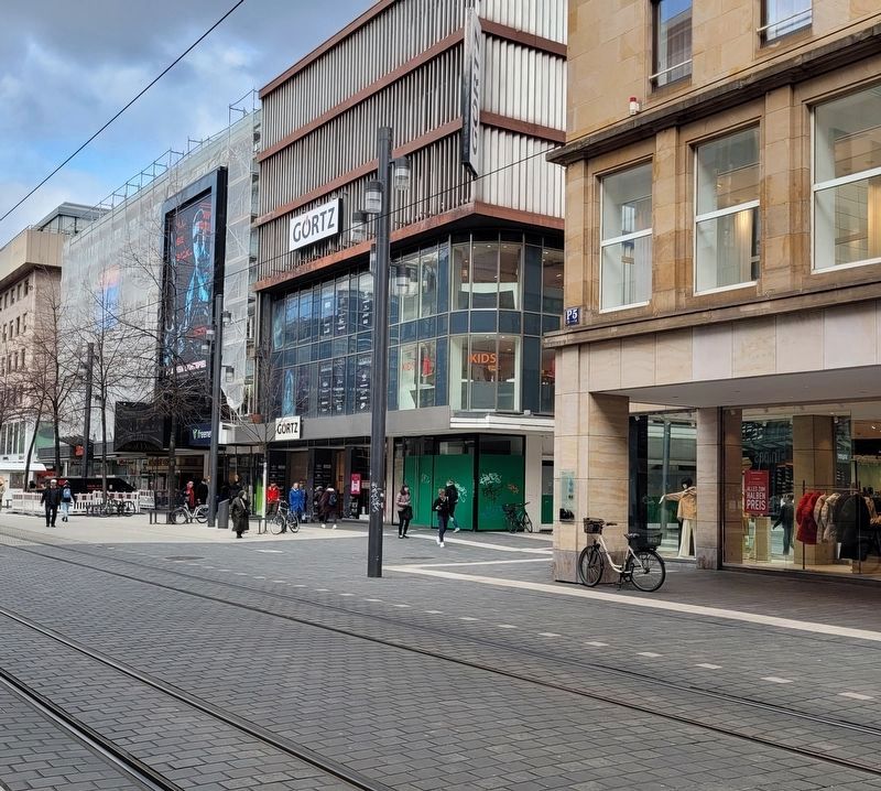
Location. 49° 29.19′ N, 8° 28.181′ E. Marker is in Mannheim, Baden-Württemberg. It is in Quadrate. Marker is at the intersection of Planken and P5, on the right when traveling west on Planken. The marker is located along the corner of the building. Touch for map. Marker is at or near this postal address: P5 16, Mannheim BW 68161, Germany. Touch for directions.
Other nearby markers. At least 8 other markers are within walking distance of this marker. Badische Bank O 4, 4 (within shouting distance of this marker); Bierbraukunst und Wirtshäuser in P 2 / Beer Brewing and Taverns in P 2 (about 150 meters away, measured in a direct line); Altes Rathaus / Old Town Hall (approx. 0.4 kilometers away); Harmonie-gesellschaft / Harmony Society (approx. 0.4 kilometers away); Die Klaussynagoge / The Klaus Synagogue (approx. 0.4 kilometers away); Marktplatzbrunnen / Market Square Fountain (approx. 0.4 kilometers away); Mannheim-Gen (approx. half a kilometer away); SAP (approx. half a kilometer away). Touch for a list and map of all markers in Mannheim.
Credits. This page was last revised on February 28, 2024. It was originally submitted on February 28, 2024, by James Hulse of Medina, Texas. This page has been viewed 42 times since then. Photos: 1, 2. submitted on February 28, 2024, by James Hulse of Medina, Texas.

