Spring Township near Elliottsburg in Perry County, Pennsylvania — The American Northeast (Mid-Atlantic)
Birth of a New County!
Perry County Bicentennial
— 1820 - 2020 —
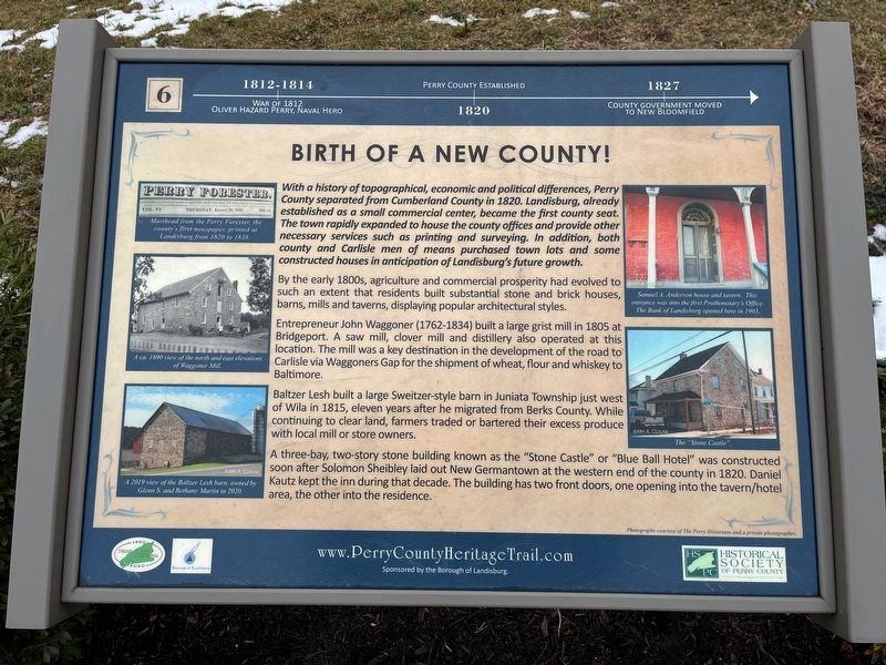
1812-1814: War of 1812, Oliver Hazard Perry, Naval Hero.
1820: Perry County established.
1827: County government moved to New Bloomfield
With a history of topographical, economic and political differences, Perry County separated from Cumberland in 1820. Landisburg, already established as a small commercial center, became the first county seat. The town rapidly expanded to house the county offices and provide other necessary services such as printing and surveying. In addition, both county and Carlisle men of means purchased town lots and some constructed houses in an anticipation of Landisburg's future growth.
By the early 1800s, agricultural and commercial prosperity had evolved to such an extent that residents built substantial stone and brick houses, barns, mills and taverns, displaying popular architectural styles.
Entrepreneur John Waggoner (1762-1834) built a large grist mill at Bridgeport. A saw mill, clover mill and distillery also operated at this location. The mill was a key destination in the development of the road to Carlisle via Waggoners Gap for the shipment of wheat, flour and whiskey to Baltimore.
,br> Baltzer Lesh built a large Sweitzer-style barn in Juniata Township just west of Wila in 1815, elevated years after he migrated from Berks County. While continuing to clear land, farmers traded or bartered their excess produce with local mill or store owners.
A three-bay, two-story stone building known as the "Stone Castle" or "Blue Ball Hotel" was constructed soon after Solomon Sheibley laid out New Germantown at the western end of the county in 1820. Daniel Kautz kept the inn during that decade. The building has two front doors, one opening into the tavern/hotel area, the other into the residence.
[Captions:]
Masthead from the Perry Forester, the county's first newspaper, printed in Landisburg from 1820 to 1828.
A ca. 1890 view of the north and east elevations of Waggoner Mill.
A 2019 view of the Balter Lesh barn, owned by Glenn S. and Bethany Martin in 2020.
Samuel A. Anderson house and tavern. This entrance was into the first Prothonotory's Office. The Bank of Landisburg opened here in 1903.
The "Stone Castle".
Erected 2020 by Borough of Landisburg; Historical Society of Perry County. (Marker Number 6.)
Topics and series. This historical marker is listed in these topic lists: Agriculture • Industry & Commerce • Political Subdivisions
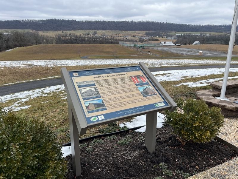
Location. 40° 23.084′ N, 77° 17.861′ W. Marker is near Elliottsburg, Pennsylvania, in Perry County. It is in Spring Township. Marker is on Shermans Valley Road (Pennsylvania Route 274) 0.4 miles east of Veterans Way (Pennsylvania Route 74), on the right when traveling west. Touch for map. Marker is at or near this postal address: 2471 Shermans Valley Rd, Elliottsburg PA 17024, United States of America. Touch for directions.
Other nearby markers. At least 8 other markers are within walking distance of this marker. Life in the Pennsylvania Backcountry (here, next to this marker); A Perry County Civil War Soldier: Sergeant John Jones (here, next to this marker); Life in the Great Depression (here, next to this marker); Perry Countians in the Revolutionary War (here, next to this marker); The Greatest Generation Goes to War (here, next to this marker); WW I and Its Aftermath (here, next to this marker); Perry County Covered Bridges (here, next to this marker); A New Century (a few steps from this marker). Touch for a list and map of all markers in Elliottsburg.
Credits. This page was last revised on February 28, 2024. It was originally submitted on February 28, 2024, by Devry Becker Jones of Washington, District of Columbia. This page has been viewed 47 times since then. Photos: 1, 2. submitted on February 28, 2024, by Devry Becker Jones of Washington, District of Columbia.

