Spring Township near Elliottsburg in Perry County, Pennsylvania — The American Northeast (Mid-Atlantic)
Most Visible Changes 1945-2020
Perry County Bicentennial
— 1820 - 2020 —

Photographed By Devry Becker Jones (CC0), February 23, 2024
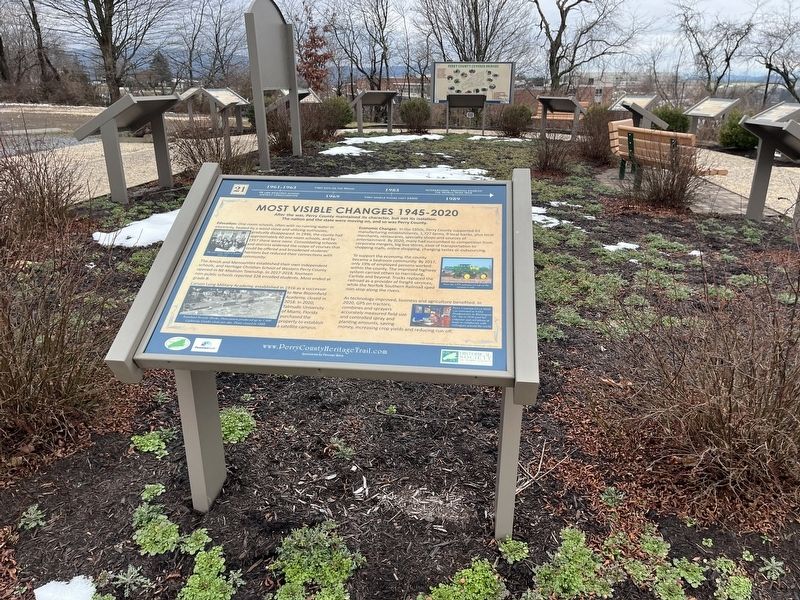
1. Most Visible Changes 1945-2020 Marker
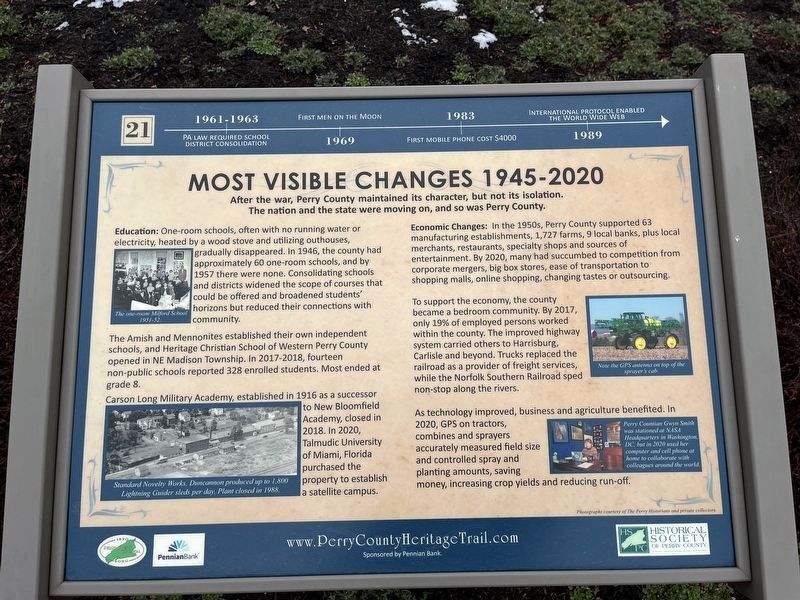
1961-1963: PA law required school district consolidation.
1969: First men on the moon.
1983: First mobile phone cost $4000.
1989: International protocol enabled the World Wide Web
After the war, Perry County maintained its character, but not its isolation. The nation and the state were moving on, and so was Perry County.
Education: One-room schools, often with no running water or electricity, heated by a wood stove and utilizing outhouses, gradually disappeared. In 1946, the county had approximately 60 one-room schools, and by 1957 there were none. Consolidating schools and districts widened the scope of courses that could be offered and broadened students' horizons but reduced their connections with community.
The Amish and Mennonites established their own independent schools, and Heritage Christian School of Western Perry County opened in NE Madison Township. In 2017-2018, fourteen non-public schools reported 328 enrolled students. Most ended at grade 8.
Carson Long Military Academy, established as a successor to New Bloomfield Academy, closed in 2018. In 2020, Talmudic University of Miami, Florida purchased the property to establish a satellite campus.
Economic Changes: In the 1950s, Perry County supported 63 manufacturing establishments, 1,727 farms, 9 local banks, plus local merchants, restaurants, specialty shops and sources of entertainment. By 2020, many had succumbed to competition from corporate mergers, big box stores, ease of transportation to shopping malls, online shopping, changing tastes or outsourcing.
To support the economy, the county became a bedroom community. In 2017, only 19% of employed persons worked within the county. The improved highway system carried others to Harrisburg, Carlisle and beyond. Trucks replaced the railroad as a provider of freight services, while the Norfolk Southern Railroad sped non-stop along the rivers.
As technology improved, business and agriculture benefited. In 2020, GPS on tractors, combines and sprayers accurately measured field size and controlled spray and planting amounts, saving money, increasing crop yields and reducing run-off.
[Captions:]
The one-room Milford School 1951-52.
Standard Novelty Works, Duncannon produced up to 1,800 Lightning Guider sleds per day. Plant closed in 1988.
Note the GPS antenna on top of the sprayer's cab.
Perry Countian Gwyn Smith was stationed at NASA Headquarters in Washington, DC, but in 2020 used here computer and cell phone at home to collaborate with her colleagues around the world.

Photographed By Devry Becker Jones (CC0), February 23, 2024
2. Most Visible Changes 1945-2020 Marker
Erected 2020 by Pennian Bank; Historical Society of Perry County. (Marker Number 21.)
Topics and series. This historical marker is listed in these topic lists: Agriculture • Communications • Education • Industry & Commerce. In addition, it is included in the Perry County Heritage Trail in Pennsylvania. series list. A significant historical year for this entry is 1969.
Location. 40° 23.085′ N, 77° 17.85′ W. Marker is near Elliottsburg, Pennsylvania, in Perry County. It is in Spring Township. Marker is on Shermans Valley Road (Pennsylvania Route 274) 0.4 miles east of Veterans Way (Pennsylvania Route 74), on the right when traveling west. Touch for map. Marker is at or near this postal address: 2471 Shermans Valley Rd, Elliottsburg PA 17024, United States of America. Touch for directions.
Other nearby markers. At least 8 other markers are within walking distance of this marker. Forces of Change 1945-2020 (here, next to this marker); Building on the Past as We March into the Future (here, next to this marker); Perry County at Gettysburg: Summer of 1863 (here, next to this marker); Pre-Civil War Transportation Development (here, next to this marker); Post-Civil War Traditions: Veterans' Reunions & Grand Army of the Republic (GAR Posts) (here, next to this marker); Post-Civil War Transformation (here, next to this marker); The Perry County Bicentennial Plaza (here, next to this marker); Early Schools, Academies and Religious Institutions (here, next to this marker). Touch for a list and map of all markers in Elliottsburg.
Additional keywords. telework; telecommunications; Global Positioning System (GPS)
Credits. This page was last revised on February 29, 2024. It was originally submitted on February 29, 2024, by Devry Becker Jones of Washington, District of Columbia. This page has been viewed 41 times since then. Photos: 1, 2. submitted on February 29, 2024, by Devry Becker Jones of Washington, District of Columbia.