Koningswijk in Bruxelles, Brussels, Belgium — Northwestern Europe
Le Parc de Bruxelles / Warandepark / The Park of Brussels
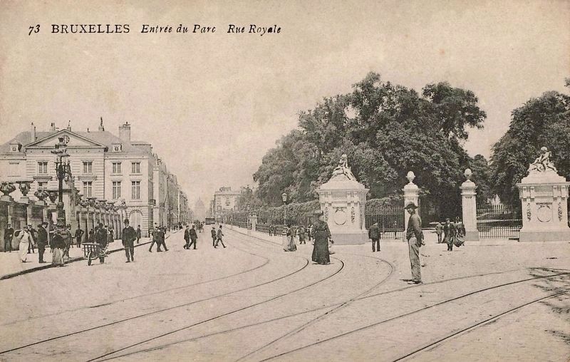
Entrée Royale / Koninklijke ingang
Inscription.
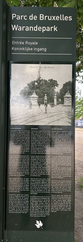
Conçu dans la foulée de la construction en 1774, de la place Royale, le projet de création du parc de Bruxelles a nécessité d'énormes travaux de terrassement en raison du relief très accidenté et sauvage des anciens jardins de la Cour, la Warande. La Ville de Bruxelles accepta de niveler les trois grandes avenues qui devaient encadrer le Parc, soit la rue Ducale, la rue de la Loi et la rue Royale, le nivellement de cette dernière s'appuyant sur les vestiges de la première enceinte. En échange, elle reçut un tiers du prix de vente des terrains destinés à la construction des immeubles entourant le futur parc.
C'est l'architecte Barnabé Guimard (1731-1805) qui signa les plans du Parc, comme de la place Royale, mais c'est avec l'aide du jardinier de la Cour, Joachim Zinner (1742-1814), qu'il dirigea les travaux d'exécution. Les travaux durèrent de 1775 à 1783. La «patte d'oie» prévue dans le plan ainsi que les deux transversales ont été tracées dans le prolongement des rues qui mènent au Parc. L'allée centrale se prolongeait par une rue qui passait entre les deux bâtiments qui, une fois réunis, ont formé le Palais Royal, la rue Héraldique.
Après abattage des arbres, les alignements projetés furent tracés, les déblais nécessaires servant en partie à remblayer les dénivellations rue Royale et du côté de l'actuelle place des Palais. Ces déblais furent cependant insuffisants pour aplanir l'ensemble du quartier, ce qui explique le maintien des deux bas-fonds situés du côté du Palais royal.
Quarante-deux statues furent prélevées du parc du château de Tervueren et de nombreuses autres ont été rajoutées. Plusieurs d'entre elles dû être remplacées par des copies suite aux dégâts du temps ou des ravages de la Révolution de 1830. La grille entourant le parc ne fut pas exécutée tout de suite en raison de son coût. Ce n'est qu'en 1849 qu'elle fut installée, par voie de souscription publique, sur base de dessins de architecte Tilman-François Suys (1783-1861).
In de pas van de aanleg van het Koningsplein in 1774, waren er enorme grondwerken nodig om het Park van Brussel te kunnen aanleggen op de ruïnes van de grillige en verwilderde hoftuinen van de Warande. De Stad Brussel stemde in met de nivellering van de drie grote lanen die het park zouden omsluiten: de Hertogsstraat, de Wetstraat en de Koningsstraat. Bij de nivellering van die laatste, stootte men op de overblijfselen van de eerste stadsomwalling. In ruil ontving de Stad een derde van de verkoopprijs van de terreinen waarop ter de gebouwen rond het park
Photographed By Andrew Ruppenstein, May 14, 2023
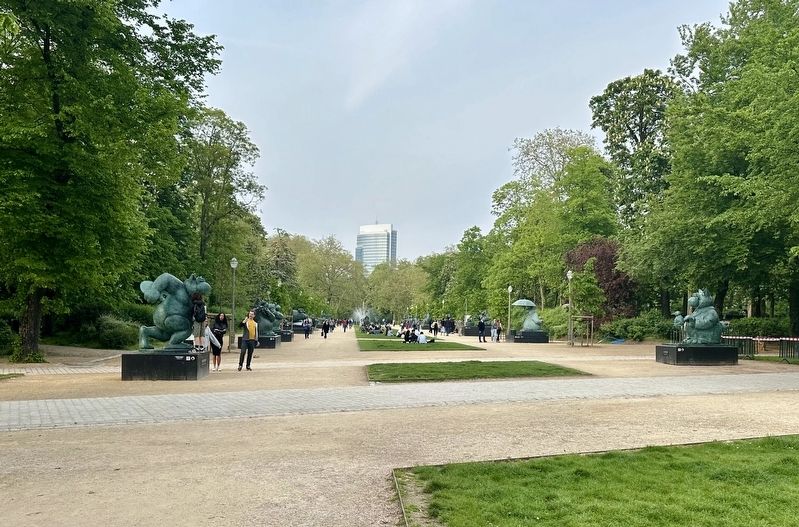
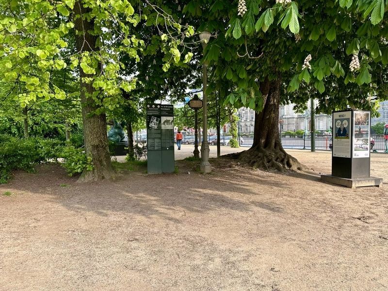
2. Le Parc de Bruxelles / Warandepark / The Park of Brussels Marker - wide view
The marker is visible under some trees just within the park as one enters by the Entrée Royale (“Royal Entance”). The panel to the left of the marker is a map of the park and various park rules.
Architect Barnabé Guimard (1731-1805) tekende de plannen voor het Park en het Koningsplein. Met de hulp van hoftuinier Joachim Zinner (1742-1814), leidde hij de uitvoeringswerken in goede banen. De werken duurden van 1775 tot 1783. De geplande ganzevoet en de twee dwarse dreven werden aangelegd in het verlengde van de straten die op het Park uitgeven. De centrale laan liep uit op een straat tussen twee gebouwen die vroeger samen het Koninklijk Paleis vormden: de Heraldische straat.
Nadat de bomen waren gerooid, werden de geplande rooilijnen uitgezet. De grond van de noodzakelijke graafwerken werd gedeeltelijk gebruikt om de Koningsstraat en de zijde van het huidige Paleizenplein aan te aarden. Die grond volstond echter niet om de hele wijk af te vlakken, wat meteen de aanwezigheid van de twee ondiepten aan de kant van het Koninklijk Paleis verklaart.
Uit het park rond het kasteel van Tervuren werden tweeënveertig standbeelden weggehaald en er wamen er nog wat bij. Verschillende beelden moesten door kopieën worden vervangen omdat ze te lijden kregen onder de tand des tijds of onder de ravage die tijdens de Revolutie van 1830 werd aangericht. Omwille van de hoge kostprijs werd het hek rond het park niet meteen geplaatst. Dat kwam er pas in 1849, na een openbare aanbesteding op basis van schetsen van architect Tilman-François Suys (1783-1861).
Park of Brussels
Designed during the construction of the Place Royale in 1774, the creation of the Parc de Bruxelles required huge amounts of levelling work due to the extremely wild uneven terrain of the former Court Gardens, La Warande. The City of Brussels agreed to level the three main avenues that were due to surround the Park, i.e. Rue Ducale, Rue de la Loi and Rue Royale; the levelling of the latter built on the remains of the first surrounding walls. In exchange, it received one third of the sales price of the land intended for the construction of the buildings surrounding the future park. It was the architect Barnabé Guimard (1731-1805) who signed the plans for the park, as well as those for the Place Royale; he also directed the work with the assistance of Court gardener Joachim Zinner (1742-1814). The work lasted from 1775 to 1783. The goose «foot», designed in the plan and the two cross-streets were designed to extend from the roads that led to the park. The central pathway extended into a street between the two buildings that, once joined together, formed the Palais Royal, on Rue Héraldique.
After the trees were cut down, the planned alignments were mapped out and some of the rubble was used to level the Rue Royale and the current Place des Palais side. However, there was not enough rubble to flatten the entire district, which explains why there are still two shallows on the Palais
Royal side.
Forty-two statues were removed from Château de Tervueren park and others were added, Some of them had to be replaced by copies following weather damage or the ravages of the 1830 Revolution. The railings surrounding the park were not erected immediately due to the cost. They were not installed until 1849, using public funding and based on designs by the architect Tilman-François Suys (1783-1861).
Topics. This historical marker is listed in this topic list: Parks & Recreational Areas. A significant historical year for this entry is 1774.
Location. 50° 50.602′ N, 4° 21.662′ E. Marker is in Bruxelles, Brussels. It is in Koningswijk. Marker can be reached from the intersection of Rue Royale and Place des Palais. Touch for map. Marker is in this post office area: Bruxelles, Brussels 1000, Belgium. Touch for directions.
Other nearby markers. At least 8 other markers are within walking distance of this marker. Musée de la Dynastie / Museum van de Dynastie / The Dynasty Museum / Das Museum der Dynastie (within shouting distance of this marker); Charlotte and Emily Brontë (about 120 meters away, measured in a direct line); a different marker also named Charlotte and Emily Brontë (about 150 meters away); Godefroid de Bouillon / Godevaart van Bullioen / Godfrey of Bouillon (about 150 meters away); Hôtel Ravenstein (about 150 meters away); Eglise Saint-Jacques / Kerk Sint-Jakob / Saint Jacques’ Church / Saint-Jacques-Kirche
(about 180 meters away); Koning Albert / Le Roi Albert / King Albert (about 210 meters away); Hommage aux Justes / Ere van de Rechtvaardigen / Tribute to the Righteous (about 240 meters away). Touch for a list and map of all markers in Bruxelles.
Also see . . . Brussels Park (Wikipedia).
Overview: Brussels Park (French: Parc de Bruxelles, Dutch: Warandepark) is the largest urban public park in central Brussels, Belgium. Formerly known and still sometimes colloquially referred to as the Royal Park (French: Parc royal, Dutch: Koninklijk Park), it was the city's first public park, being originally laid out between 1776 and 1783 in a neoclassical style by the French architect Gilles-Barnabé Guimard and the Austrian landscape architect Joachim Zinner, as part of an urban project including the Place Royale/Koningsplein. The area of the rectangular park is 13.1 ha (32 acres).(Submitted on February 29, 2024.)
Credits. This page was last revised on February 29, 2024. It was originally submitted on February 29, 2024, by Andrew Ruppenstein of Lamorinda, California. This page has been viewed 49 times since then. Photos: 1, 2, 3, 4, 5. submitted on February 29, 2024, by Andrew Ruppenstein of Lamorinda, California.
