Valley City in Barnes County, North Dakota — The American Midwest (Upper Plains)
High Above the Sheyenne
High Line Bridge
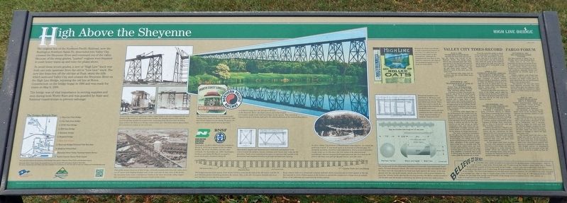
The original line of the Northern Pacific Railroad, now the Burlington Northern Santa Fe, descended into Valley City, crossed the Sheyenne River and continued out of the valley. Because of the steep grades, "pusher" engines were required to push heavy trains up and onto the plains above.
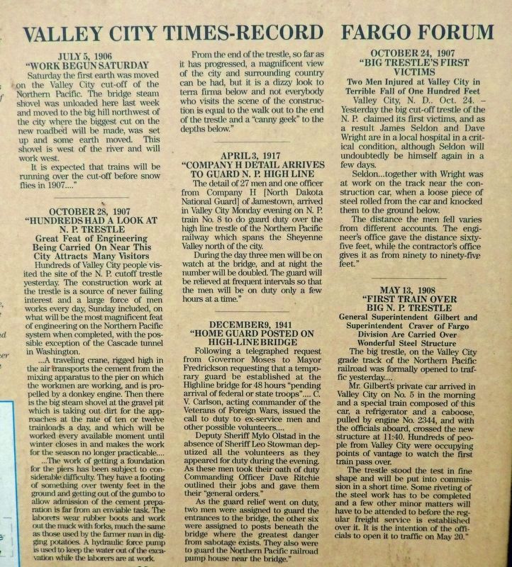
To avoid these severe grades, a new or "High Line" track was built one mile upstream from the old or "Low Line" track. The new line branches off the old line at Peak, skirts the hills which surround Valley City and crosses the Sheyenne River on the High Line Bridge, rejoining the old line at Berea. Construction on the bridge began in 1906 and was ready for trains on May 8, 1908.
The bridge was of vital importance in moving supplies and men during both World Wars and was guarded by State and National Guard troops to prevent sabotage.
Believe It or Not!
❖ 1,250,000 cubic yards of earth were moved in the grading phase of this project — that's a wall of earth 1 yard wide, 30 feet high and 70 miles long, the distance from Valley City to Fargo.
❖ 14,000,000 pounds of steel was used on the bridge — empty coal cars weighing 23 tons each, making a train that's over 3 miles long.
❖ Approximately 1,000,000 rivets were used in the construction of the bridge. The rivet head diameter is one and seven sixteenths inches. If 1,000,000 rivets were arranged in a straight line, edge to edge, it would create a line of rivets 22.7 miles long.
❖ The original price, in 1908 dollars, for the High Line Bridge was $750,000. If the bridge were reconstructed in 1999, exactly as built, it would cost nearly $50,000,000.
[photo captions]
• The North Coast Limited, a transcontinental luxury train, made its debut on April 29, 1900, and served Valley City for nearly 70 years. The above is a lid for cigars sold on the train.
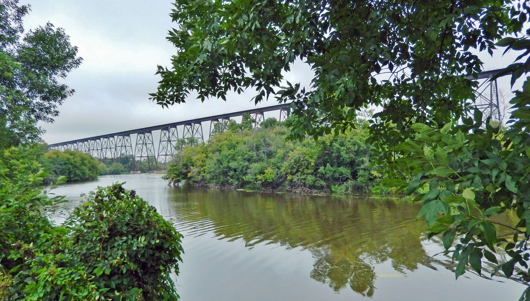
• At 3,860 feet long and 162 feet above the bed of the Sheyenne River, the High Line is one of the longest and highest single track railroad bridges in the nation. This marvel of engineering is a striking sight after the relative flatness of the surrounding plains.
• Burlington Northern Railroad was created on March 2, 1970, by a merger of the Northern Pacific, the Great Northern and two other railroads. On September 22, 1995, Burlington Northern and Santa Fe Pacific merged to create Burlington Northern Santa Fe (BNSF).
• Steel plates, angles and channels were combined and fastened with rivets to form the girders, beams, columns and trusses that make up the structure. Each tower consists of two pair of columns tied together with horizontal and diagonal bracing to provide strength and rigidity.
• The bridge consists of 61
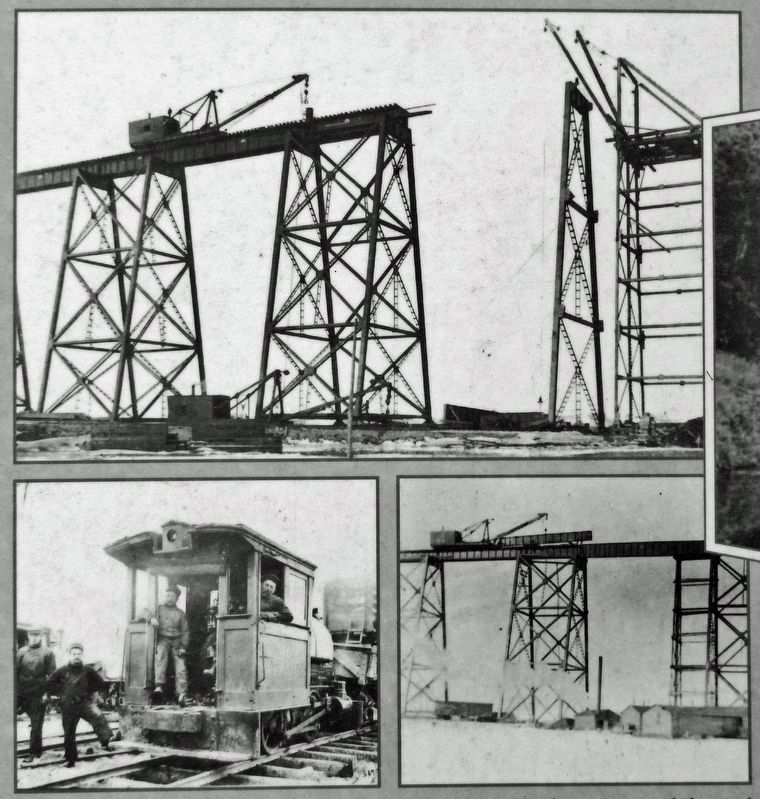
Courtesy Barnes County Historical Society, George Dutton
2. Marker detail: Traveling Crane
A traveling crane (top and lower right), rigged high in the air, transported the steel beams to the trestle on which the men worked. The donkey engine (left) was the work horse that hauled the construction materials from the Low Line in Valley City north to the High Line Bridge construction site. This little engine also pushed the construction cranes to the work site.
• In 1911, Valley City formed a “Chautauqua” organization for which the park was named. It was based upon a movement in Chautauqua, NY, stressing morality, education and inspiration. Every summer families would camp out in this grove for two weeks to be educated and entertained. Several suspension bridges spanned the river here as the area to the east, now part of the golf course, was also used.
• Because the High Line Bridge is such a prominent feature of our city, it is often seen in business logos such as this oatmeal box. Although the manufacturer and date of this label are unknown, the style of the packaging appears to be from the mid-1930’s.
• Structural members were fabricated in Michigan and transported by rail to the site, assembled and erected. While bolts were used to attach the tower legs to the pedestals and the girder ends to the crossmembers, nearly all other connections were made with rivets.
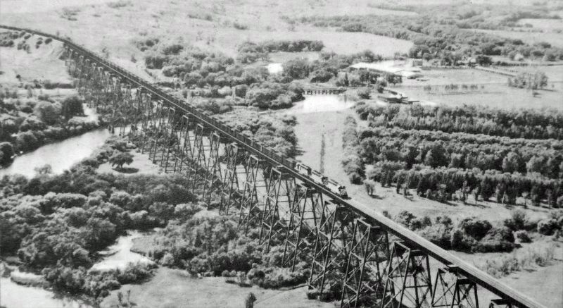
Courtesy Barnes County Historical Society, George Dutton
3. Marker detail: High Line Bridge – Aerial View
One of the unique features of this bridge, virtually undetectable from the valley floor, is a 2° curve with slightly banked rails on the west end. In this view of the bridge, the enormous man-made embankment visible at the west end of the valley (upper left) was built to accommodate the great height of the tracks.
• The rivets used in this structure consisted of a rounded "manufactured" head and a 7/8 inch diameter shank. The rivet was heated red hot and inserted into the holes until the manufactured head was tight against the metal. A die was placed over the end of the shank, which was driven with a power hammer to form the "driven" head. During the driving process, the shank would expand to fill the hole and the heads would bring the pieces of steel into tight contact.
Erected by The City of Valley City and Valley City Bridges Task Force.
Topics and series. This historical marker is listed in these topic lists: Architecture • Bridges & Viaducts • Railroads & Streetcars • Waterways & Vessels. In addition, it is included in the ASCE Civil Engineering Landmarks, and the Believe It or Not series lists. A significant historical date for this entry is May 8, 1908.
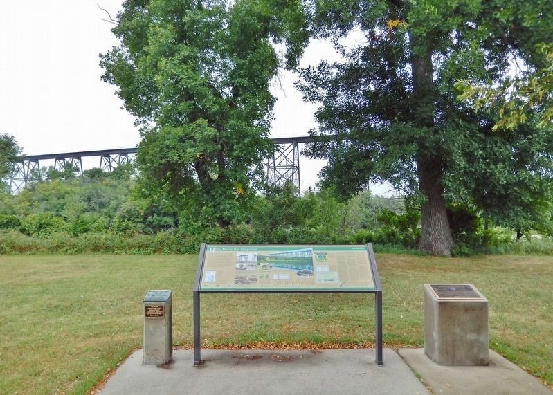
Location. 46° 56.201′ N, 97° 59.403′ W. Marker is in Valley City, North Dakota, in Barnes County. Marker can be reached from 12th Street Northeast, 0.2 miles east of 6th Avenue Northeast (Chautauqua Boulevard), on the left when traveling east. The marker is located on the north side of Chautauqua Park, overlooking the High Line Bridge and the Sheyenne River. Touch for map. Marker is at or near this postal address: 933 12th Street Northeast, Valley City ND 58072, United States of America. Touch for directions.
Other nearby markers. At least 8 other markers are within 2 miles of this marker, measured as the crow flies. First Boy Scout Encampment in North Dakota (here, next to this marker); Northern Pacific High Line Bridge No. 64 (here, next to this marker); Our Sheyenne River (approx. half a mile away); Rainbow on the Sheyenne (approx. 0.9 miles away); Votes For Women (approx. one mile away); Herman Stern (approx. 1.1 miles away); Caboose (approx. 1.1 miles away); Rosebud Visitor Center Along the Byway (approx. 1.2 miles away). Touch for a list and map of all markers in Valley City.
Related markers. Click here for a list of markers that are related to this marker. Valley City Historic Bridges Tour
Also see . . . Hi-Line Railroad Bridge (Wikipedia). Excerpt:
When opened on May 8, 1908, it was the longest bridge for its height in the world. It currently remains one of the longest and highest single track railroad viaducts in the United States and was designated as a National Historic Civil Engineering Landmark by the American Society of Civil Engineers in 2005.(Submitted on March 4, 2024, by Cosmos Mariner of Cape Canaveral, Florida.)
Credits. This page was last revised on March 6, 2024. It was originally submitted on March 3, 2024, by Cosmos Mariner of Cape Canaveral, Florida. This page has been viewed 49 times since then. Photos: 1, 2, 3, 4, 5, 6. submitted on March 4, 2024, by Cosmos Mariner of Cape Canaveral, Florida.
