Gauley Bridge in Fayette County, West Virginia — The American South (Appalachia)
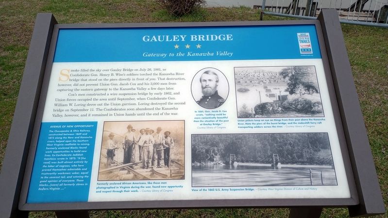
Gauley Bridge
Gateway to the Kanawha Valley
— West Virginia Civil War Trails —
Smoke filled the sky over Gauley Bridge on July 26, 1861, as Confederate Gen. Henry B. Wise's soldiers torched the Kanawha River bridge that stood on the piers directly in front of you. That destruction, however, did not prevent Union Gen. Jacob Cox and his 3,000 men from capturing the eastern gateway to the Kanawha Valley a few days later.
Cox's men constructed a wire suspension bridge by early 1862, and Union forces occupied the area until September, when Confederate Gen. William W. Loring drove out the Union garrison. Loring destroyed the second bridge on September 11. The Confederates soon abandoned the Kanawha Valley, however, and it remained in Union hands until the end of the war.
(captions)
Formerly enslaved African Americans, like these men photographed in Virginia during the war, found new opportunity and respect through their work. - Courtesy Library of Congress
In 1861, Gen. Jacob D. Cox wrote, "nothing could be more romantically beautiful than the situation of the post at Gauley Bridge." Courtesy Library of Congress
Union pickets keep an eye on things from their post above the Kanawha River. Note the piers of the burnt bridge, and the makeshift ferry raft transporting soldiers across the river. - Courtesy Library of Congress
View of the 1862 U.S. Army Suspension Bridge. - Courtesy West Virginia Division of Culture and History
(sidebar) Avenue Of New Opportunity
The Chesapeake & Ohio Railway, constructed between 1869 and 1873 along the New and Kanawha rivers, helped open the Southern West Virginia coalfields to mining. Formerly enslaved Blacks found work opportunities to build new lives. Ex-Confederate Jedidiah Hotchkiss wrote in 1873: "It [the road] was built almost entirely by the labor of negroes, who here proved themselves admirable and trustworthy workmen; sober, equal to the severest toil, and winning the good opinion of everyone. These blacks...[were] all formerly slaves in Eastern. Virginia ...."
Erected by West Virginia Civil War Trails.
Topics and series. This historical marker is listed in these topic lists: Bridges & Viaducts • War, US Civil. In addition, it is included in the West Virginia Civil War Trails series list. A significant historical date for this entry is July 26, 1861.
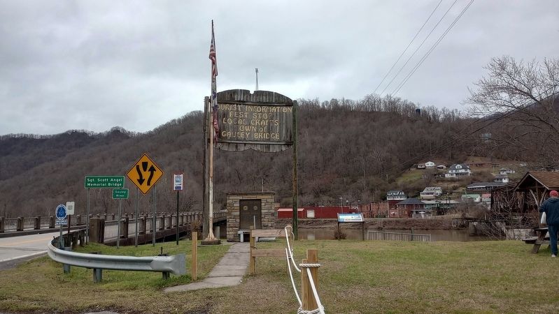
Location. 38° 9.752′ N, 81° 11.689′ W. Marker is in Gauley Bridge, West Virginia, in Fayette County. Marker is on Midland Trail (U.S. 60), on the right when traveling west. Touch for map. Marker is at or near this postal address: 10731 Midland Trail, Gauley Bridge WV 25085, United States of America. Touch for directions.
Other nearby markers. At least 8 other markers are within 5 miles of this marker, measured as the crow flies. Veterans Memorial (here, next to this marker); Less We Forget (here, next to this marker); a different marker also named Gauley Bridge (within shouting distance of this marker); Gauley Bridge War Memorial (approx. 0.2 miles away); Camp Reynolds (approx. 1.4 miles away); Christopher Q. Tompkins / Gauley Mount (approx. 2.1 miles away); Hawk's Nest Tunnel Disaster (approx. 4.6 miles away); Hawk’s Nest (approx. 4.6 miles away). Touch for a list and map of all markers in Gauley Bridge.
Related marker. Click here for another marker that is related to this marker. Old CWT Marker At This Location titled "Battles For The Bridges".
Credits. This page was last revised on March 15, 2024. It was originally submitted on March 6, 2024, by Craig Doda of Napoleon, Ohio. This page has been viewed 55 times since then. Photos: 1, 2. submitted on March 6, 2024, by Craig Doda of Napoleon, Ohio. • Bernard Fisher was the editor who published this page.

