North Newton Township in Shippensburg in Cumberland County, Pennsylvania — The American Northeast (Mid-Atlantic)
Farmland Preservation
Cumberland Valley Rail Trail
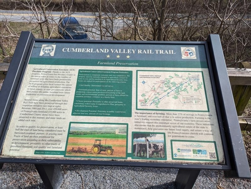
Several farms along the Cumberland Valley Rail Trail have been preserved through this important initiative (see map at right). Between 1989 and 2012, over 459,000 acres of Pennsylvania farmland (15,000 acres in Cumberland County alone) have been protected in this manner, and more lands are added each year.
In order to qualify for preservation, at least half the tract of land being considered must be harvested cropland, pasture, or grazing land. Tracts of land are then prioritized for preservation according to their vulnerability to development, proximity to other tracts of preserved farmland, soil quality and farmland potential.
The importance of farming: More than 27% of acreage in Pennsylvania is farmland, and over half of that is in active production. Farming is the state's leading economic enterprise. Pennsylvania's farm preservation initiatives support this important sector of our economy. These initiatives also ensure that the predominantly agricultural nature of the state is maintained, help guarantee our future food supply, and assure a way of life Pennsylvanians cherish will continue for generations to come.
Agricultural Conservation Easement Program Particulars
Participation is completely voluntary and very competitive. The property must be currently engaged in agriculture, at least 52 acres in size and be enrolled in an Agricultural Security Area. Farms are ranked for participation on the following criteria:
• Soil Quality: Determined via soil survey
• Farmland potential: Size of farm, percent of farm in production, conservation practices/stewardship of the land, scenic and environmental qualities, percent of farm offered for easement purchase, existence as a family farm
• Cluster potential: Proximity to other preserved farms, consistency with County Comprehensive Plan, proximity to Agricultural Security Areas
• Development Potential: Proximity to public water/sewer. adjacent land use, amount of road frontage
Topics. This historical marker is listed in these topic lists: Agriculture • Government & Politics.
Location. 40° 6.887′ N, 77° 28.163′ W. Marker is in Shippensburg, Pennsylvania, in Cumberland County. It is in North Newton Township. Marker is on Clouse Road, 0.2 miles north of Ott Road, on the left when traveling north. This marker is along the Cumberland Valley Rail Trail but can be seen from this location. There is a path that leads to the marker. Touch for map. Marker is at or near this postal address: 140 Clouse Road, Walnut Bottom PA 17266, United States of America. Touch for directions.
Other nearby markers. At least 8 other markers are within 5 miles of this marker, measured as the crow flies. Agriculture in the Cumberland Valley (approx. 1.1 miles away); Cumberland Valley Railroad and the Battle of Antietam (approx. 1.1 miles away); Roadside and Farmers' Markets (approx. 1˝ miles away); Confederate Invasion of the Cumberland Valley (approx. 1˝ miles away); Forbes Road - Raystown Path (approx. 3.2 miles away); Hagerstown Silt Loam (approx. 4.2 miles away); High-Speed Ammunition Run on the Cumberland Valley Railroad (approx. 4.2 miles away); Shippensburg (approx. 4.3 miles away). Touch for a list and map of all markers in Shippensburg.
Credits. This page was last revised on March 11, 2024. It was originally submitted on March 7, 2024, by William Pope of Marietta, Pennsylvania. This page has been viewed 29 times since then. Photos: 1, 2. submitted on March 7, 2024, by William Pope of Marietta, Pennsylvania. • Bill Pfingsten was the editor who published this page.

