Yokne'am Illit in Yizrael, Northern District, Israel — West Asia (the Levant in the Middle East)
The Lion's Trail - Yokneam
Photographed by Jerry Klinger
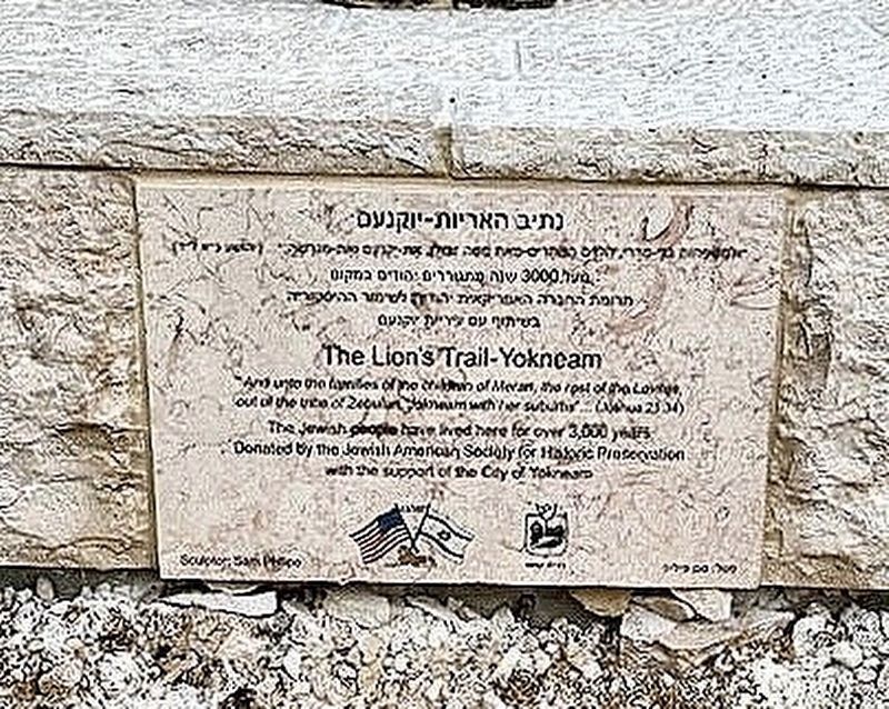
1. The Lion's Trail - Yokneam Marker
The Lion's Trail - Yokneam
"And unto the families of the children of Merari, the rest of the Levites out of the tribe of Zebulun, Jokneam and her suburbs"... Joshua 21:34
The Jewish people have lived here for over 3,000 years.
Donated by the Jewish American Society for Historic Preservation with the support of the City of Yokneam
Erected 2024 by Jewish American Society for Historic Preservation.
Topics and series. This historical marker is listed in this topic list: Settlements & Settlers. In addition, it is included in the Jewish American Society for Historic Preservation. series list.
Location. 32° 39.151′ N, 35° 6.432′ E. Marker is in Yokne'am Illit, Northern District, in Yizrael. It is at the intersection of Sderot Yitshak Rabin and Hazait Street, in the median on Sderot Yitshak Rabin. Touch for map. Marker is at or near this postal address: Klil Hachorest St Circle, Yokne'am Illit, Northern District, Israel. Touch for directions.

Regionally, it is in Asia, specifically in West Asia, in the Middle East, in The Levant, on the Red Sea, in a coastal
this page online
Other nearby markers. At least 8 other markers are within 11 kilometers of this marker, measured as the crow flies: Wilfrid Israel (approx. 1.2 kilometers away); The City-Gate (approx. 10.3 kilometers away in Haifa District); a different marker also named The City-Gate (approx. 10.3 kilometers away in Haifa District); The Water System (approx. 10.4 kilometers away in Haifa District); Tel Megiddo National Park (approx. 10.4 kilometers away in Haifa District); From Megiddo to Armageddon (approx. 10.4 kilometers away in Haifa District); The Southern Stables (approx. 10.4 kilometers away in Haifa District); The Northern Stables (approx. 10.4 kilometers away in Haifa District).
More about this marker. It is sited on a roundabout below the historical Tell of Yokneam.
Regarding The Lion's Trail - Yokneam. The Lion of Yokneam is part of a series of national historical sculptures outlining Jewish historical presence.
Also see . . .
1. Yokneam Illit.
Photographed by Jerry Klinger, 2024
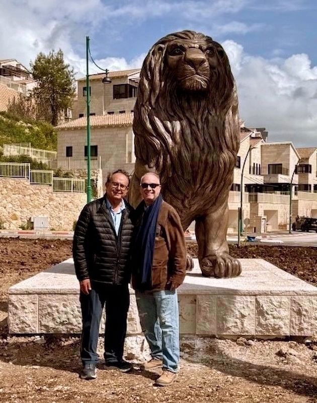
2. The Lion's Trail - Yokneam Marker
Sam Philipe (r), sculptor and Simon Alfasil, Mayor of Yokneam
2. Biblical Walks.
Tel Yokneam stands as a gate to the entrance of a pass through Mount Carmel towards the south. This steep hill was a mighty city in the Biblical times, and due to its strategic location played an important role in ancient history of the region. It was one of Manasseh tribe cities and a Levite city.(Submitted on March 8, 2024, by Jerry Klinger of Boynton Beach, Florida.)
Joshua 12, 22: “the king of Jokneam in Carmel, one”.
3. Off the Beaten Track - Exploring Tel Yokneam.
The Samaritans have an interesting legend about this tel. They believe that Shaubak, king of Persia, came here to kill Joshua to avenge his father’s death at the hands of the Israelites, amassing a coalition of Canaanite armies. Shaubak uses magic to create iron walls to enclose Joshua and his army. Suddenly a dove appeared to which Joshua sent to Nabih king of Gilead who came and freed him with a shout, then defeating the Canaanites and their allies.(Submitted on March 8, 2024, by Jerry Klinger of Boynton Beach, Florida.)
4. Youtube view of Yokneam.
Photographed by Jerry Klinger
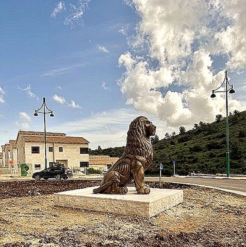
3. The Lion's Trail - Yokneam Marker

Photographed by Jerry Klinger, January 29, 2024
4. View from The Lion's Trail - Yokneam Marker
Credits. This page was last revised on October 6, 2024. It was originally submitted on March 8, 2024, by Jerry Klinger of Boynton Beach, Florida. This page has been viewed 181 times since then and 27 times this year. Photos: 1, 2, 3. submitted on March 8, 2024, by Jerry Klinger of Boynton Beach, Florida. 4. submitted on April 20, 2024, by Jerry Klinger of Boynton Beach, Florida. • J. Makali Bruton was the editor who published this page.
