Rothenburg ob der Tauber in Ansbach, Bavaria, Germany — Central Europe
St.-Michaels-Kapelle Rothenburg ob der Tauber / St Michaels Chapel
Inscription.
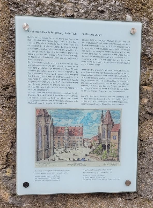
Östlich der St.-Jakobs-Kirche, wo heute der Garten des Hotels Reichsküchenmeister liegt, stand in den Jahren 1411 bis 1804 die St.-Michaels-Kapelle. Hier befand sich der Friedhof der St.-Jakobs-Kirche. Die Kapelle war ein achteckiger Zentralbau mit einem steilen Pyramidendach. Im Untergeschoss befand sich das Beinhaus (Karner), im Obergeschoss der Andachtsraum. Zum Friedhof hin hatte die Kapelle eine überdachte Kanzel und ein aufgesetztes Glockentürmchen.
Die St.-Michaels-Kapelle beherbergte zwei Altäre: einen Michaels-Altar (1449) und den Heilig-Kreuz-Altar, der im Jahre 1510 vom Würzburger Bildschnitzer Tilman Riemenschneider geschaffen wurde. Als 1560 der Friedhof vor die Tore Rothenburgs verlegt wurde, verlor die Totenkapelle ihre Bedeutung und wurde als Bibliothek benutzt. Im Jahre 1653 wurde der Heilig-Kreuz-Altar aus der Michaels-Kapelle ausgebaut, verkleinert und in die St.-Peter-und-Pauls-Kirche nach Detwang gebracht, wo er heute noch steht. Im Jahre 1804 wurde die kleine St.-Michaels-Kapelle verkauft und abgebrochen.
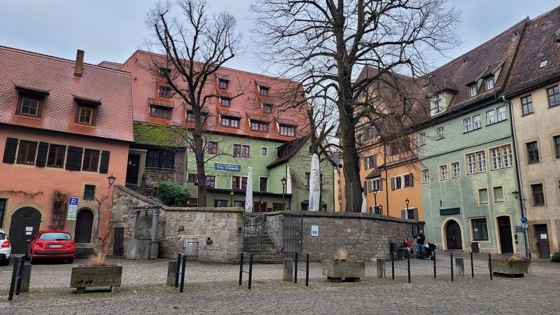
In einer Suite des Hotels Reichsküchenmeister ist ein originaler Türstock der alten St.-Michaels-Kapelle verbaut. Die heute noch sichtbare Freitreppe führte einst zu dem hoch gelegenen ehemaligen Kirchenraum selbst. Auch ein Maßwerkfenster der Kapelle ist noch erhalten.
Bildunterschriften
Ansicht der ehemaligen Michaelskapelle von Westen
Lavierte Federzeichnung von J. L. Schaeffer (1729)
„Prospect des Kirchhofes zu St. Jacob"
von Johann Friedrich Schmidt (1762),
rechts die ehe malige Michaelskapelle
Between 1411 and 1804, St Michaels Chapel stood just east of St Jacobs Church, where today the garden of Hotel Reichsküchenmeister is located. It is also the place where the cemetery of the St Jacobs was situated. The Chapel was built as an octagonal central building with a steep pyramid-style roof. The basement of the Chapel housed the so-called Beinhaus (ossuary), where the bones of the deceased were kept. On the upper level was the prayer room. Facing the cemetery, the Chapel had a covered pulpit and a little bell tower.
There were two altars in St Michaels Chapel, St Michaels Altar (1449) and the Holy Cross Altar, crafted by the famous sculptor and woodcarver Tilman Riemenschneider in 1510. After the cemetery had been moved outside Rothenburgs town walls in 1560, the Chapel lost its importance and was used as a library. In 1653, the
Holy Cross Altar was removed, diminished and taken to St Peter and Pauls in the village of Detwang, where it still can be seen today. In 1804, St Michaels Chapel was sold and demolished.
One of its doorframes, however, has been used for a suite in Hotel Reichsküchenmeister. The still visible flight of outdoor steps lead to the upper floor of the chapel. Also a tracery window from the Chapel has been preserved.
Captions
View of the St Michaels Chapel from the west
Washed pen drawing by J. L. Schaeffer (1729)
Prospect of St Jacobs Churchyard
by Johann Friedrich Schmidt (1762),
with the then still-existing St Michaels Chapel on the right
Topics. This historical marker is listed in these topic lists: Cemeteries & Burial Sites • Churches & Religion. A significant historical year for this entry is 1411.
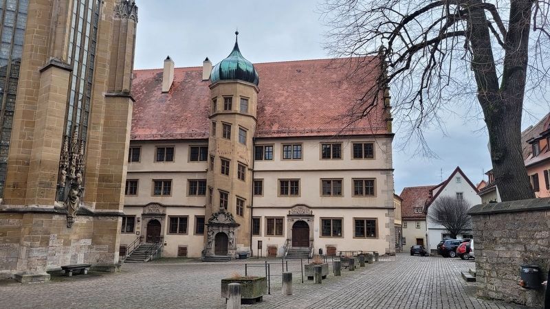
Location. 49° 22.682′ N, 10° 10.714′ E. Marker is in Rothenburg ob der Tauber, Bayern (Bavaria), in Ansbach. Marker is on Kirchplatz just east of Grüner Markt. The marker is located east of the entrance to the Church of St. James. Touch for map. Marker is at or near this postal address: Kirchpl 9, Rothenburg ob der Tauber BY 91541, Germany. Touch for directions.
Other nearby markers. At least 8 other markers are within walking distance of this marker. St. Jakob's Church World War I Memorial (within shouting distance of this marker); Jews's Alley and Jewish Quarter (within shouting distance of this marker); Neues Rathaus / New Town Hall
(about 90 meters away, measured in a direct line); Christian I (about 120 meters away); Rabbi Meir ben Baruch von Rothenburg (about 120 meters away); Altes Rathaus / Old Town Hall (about 120 meters away); Maximilian I (about 120 meters away); Schrannenscheune / Grain Storage Barn (about 120 meters away). Touch for a list and map of all markers in Rothenburg ob der Tauber.
Credits. This page was last revised on March 10, 2024. It was originally submitted on March 9, 2024, by James Hulse of Medina, Texas. This page has been viewed 39 times since then. Photos: 1, 2, 3. submitted on March 10, 2024, by James Hulse of Medina, Texas.


