Boerum Hill in Brooklyn in Kings County, New York — The American Northeast (Mid-Atlantic)
Fort Masonic
1814 - 1914
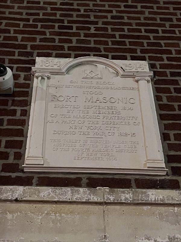
midway between Nevins and Bond Streets
stood
Fort Masonic
Erected 1914 by the Temple Club of the Fourth Masonic District of New York.
Topics. This memorial is listed in these topic lists: Forts and Castles • Fraternal or Sororal Organizations • War of 1812. A significant historical month for this entry is September 1814.
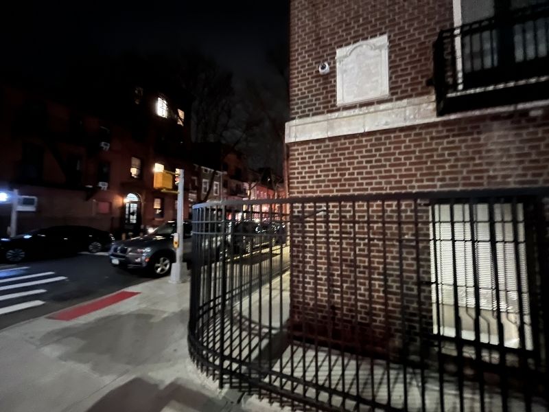
Location. 40° 41.212′ N, 73° 58.937′ W. Memorial is in Brooklyn, New York, in Kings County. It is in Boerum Hill. It is at the intersection of State Street and Nevins Street, on the left when traveling east on State Street. Touch for map. Memorial is at or near this postal address: 450 State St, Brooklyn NY 11217, United States of America. Touch for directions.

Regionally, this memorial is in New York City and on Long Island. It is also in the American Northeast, in the Mid-Atlantic, and on the Eastern Seaboard. Globally, it is in the North Atlantic Region, North America, the Western Hemisphere, the Western World, and the Anglosphere. Historically,
this page online
Other nearby markers. At least 8 other markers are within walking distance of this marker: The Baptist Temple (about 600 feet away, measured in a direct line); St. Cyril's of Turau Cathedral (about 600 feet away); Did You Know? (about 600 feet away); a different marker also named Did You Know? (about 700 feet away); a different marker also named Did You Know? (about 700 feet away); a different marker also named Did You Know? (about 700 feet away); a different marker also named Did You Know? (about 700 feet away); An 18th Century Well (approx. 0.2 miles away). Touch for a list and map of all markers in Brooklyn.
Credits. This page was last revised on November 22, 2025. It was originally submitted on March 10, 2024, by Devry Becker Jones of Washington, District of Columbia. This page has been viewed 270 times since then and 75 times this year. Photos: 1, 2. submitted on March 10, 2024, by Devry Becker Jones of Washington, District of Columbia.
Editor’s want-list for this marker. Clear, daylight photos of the marker and its context. • Can you help?
