Devils Lake in Ramsey County, North Dakota — The American Midwest (Upper Plains)
Devils Lake Flood Management
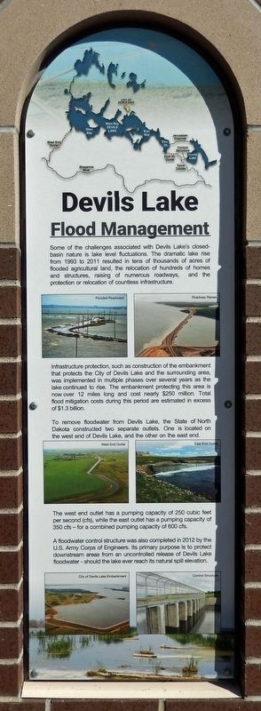
Some of the challenges associated with Devils Lake's closed-basin nature is lake level fluctuations. The dramatic lake rise from 1993 to 2011 resulted in tens of thousands of acres of flooded agricultural land, the relocation of hundreds of homes and structures, raising of numerous roadways, and the protection or relocation of countless infrastructure.
Infrastructure protection, such as construction of the embankment that protects the City of Devils Lake and the surrounding area, was implemented in multiple phases over several years as the lake continued to rise. The embankment protecting this area is now over 12 miles long and cost nearly $250 million. Total flood mitigation costs during this period are estimated in excess of $1.3 billion.
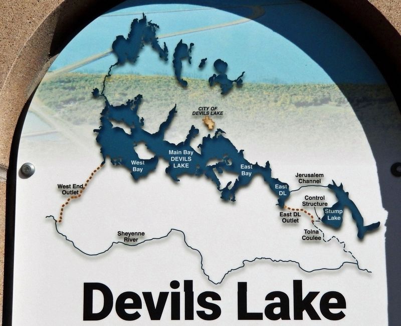
To remove floodwater from Devils Lake, the State of North Dakota constructed two separate outlets. One is located on the west end of Devils Lake, and the other on the east end.
The west end outlet has a pumping capacity of 250 cubic feet per second (cfs), while the east outlet has a pumping capacity of 350 cfs — for a combined pumping capacity of 600 cfs.
A floodwater control structure was also completed in 2012 by the U.S. Army Corps of Engineers. Its primary purpose is to protect downstream areas from an uncontrolled release of Devils Lake floodwater — should the lake ever reach its natural spill elevation.
[photo captions]
• Flooded Roadways
• Roadway Raises
• West End Outlet
• East End Outlet
• City of Devils Lake Embankment
• Control Structure
Topics. This historical marker is listed in these topic lists: Bridges & Viaducts • Waterways & Vessels. A significant historical year for this entry is 1993.
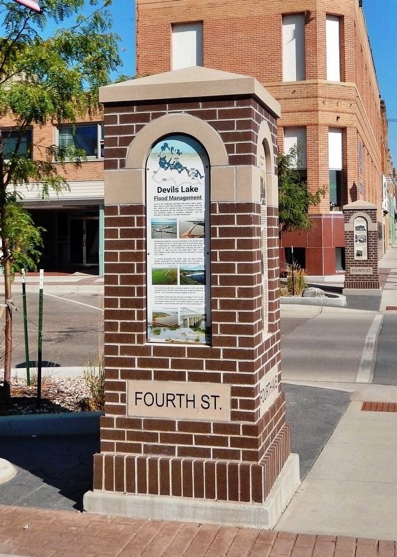
Location. 48° 6.7′ N, 98° 51.634′ W. Marker is in Devils Lake, North Dakota, in Ramsey County. Marker is at the intersection of 4th Avenue Northeast and 4th Street Northeast, on the left when traveling north on 4th Avenue Northeast. The marker is located on the sidewalk at the southwest corner of the intersection, facing south. Touch for map. Marker is at or near this postal address: 324 4th Street Northeast, Devils Lake ND 58301, United States of America. Touch for directions.
Other nearby markers. At least 8 other markers are within walking distance of this marker. Historic Devils Lake Commercial District (here, next to this marker); Devils Lake State Bank (here, next to this marker); The Origin of Devils Lake (within shouting distance of this marker); Bangs-Wineman Block (within shouting distance of this marker); Mac's Lounge (within shouting distance of this marker); History of Devils Lake (within shouting distance of this marker); The Lake “Mníwakháŋ” (within shouting distance of this marker); Jamieson Block (within shouting distance of this marker). Touch for a list and map of all markers in Devils Lake.
Also see . . . Devils Lake Flood Mitigation. Excerpt:
Devils Lake is a terminal lake in the Devils Lake basin, which means that water leaves Devils Lake through evapotranspiration or when its elevation is high enough to overflow the basin’s boundary. Because Devils Lake does not have a natural outlet at its current elevation, it is either rising or falling in response to climatic conditions, a situation that has led to numerous challenges since settlement times. Over the course of the last couple of decades, the Devils Lake basin has been affected by tremendous flood-related impacts. The State of North Dakota has identified three broad strategies to attempt to mitigate water issues in the basin: including outlets to the Sheyenne River, basin water management, and infrastructure protection.(Submitted on March 11, 2024, by Cosmos Mariner of Cape Canaveral, Florida.)
Credits. This page was last revised on March 11, 2024. It was originally submitted on March 10, 2024, by Cosmos Mariner of Cape Canaveral, Florida. This page has been viewed 41 times since then. Photos: 1, 2, 3, 4. submitted on March 11, 2024, by Cosmos Mariner of Cape Canaveral, Florida.


