Rothenburg ob der Tauber in Ansbach, Bavaria, Germany — Central Europe
Streichwehr
⎯⎯⎯
Invasion Defence
Rothenburg ob der Tauber
Photographed by James Hulse, February 19, 2024
1. Streichwehr / Invasion Defence - German Marker

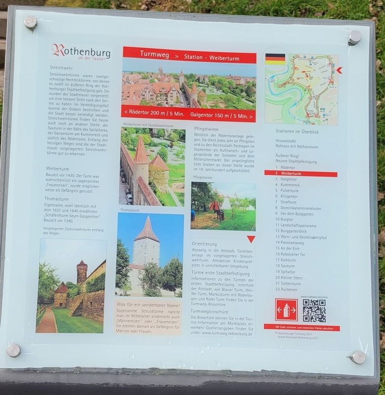
Streichwehr
Streichwehrtürme waren zweigeschossige Rechtecktürme, von denen es zwölf im äußeren Ring der Rothenburger Stadtbefestigung gab. Sie wurden der Stadtmauer vorgestellt, um eine bessere Sicht nach den Seiten zu haben. Im Verteidigungsfall konnte der Graben bestrichen und die Stadt besser verteidigt werden. Streichwehrtürme finden Sie heute auch noch an anderer Stelle: der Sauturm in der Nähe des Spitaltores, der Ganserturm am Kummereck und südlich des Rödertores. Entlang des heutigen Weges sind die der Stadtmauer vorgelagerten Streichwehrtürme gut zu erkennen.
Weiberturm
Bauzeit vor 1430. Der Turm war wahrscheinlich ein sogenanntes „Fraueneisen", wurde möglicherweise als Gefängnis genutzt.
Thomasturm
Eigenname, wohl identisch mit dem 1631 und 1645 erwähnten „Schäferthurm beym Galgenthor". Bauzeit um 1340.
Was für ein sonderbarer Name!
Sogenannte Schuldtürme nannte man im Mittelalter andernorts auch „Männereisen" oder „Fraueneisen". Sie dienten damals als Gefängnis für Männer oder Frauen.
Pfingstwiese
Nördlich der Rödertoranlage gelegen. Sie dient jedes Jahr an Pfingsten und zu den
this page online
Bildunterschriften
Vorgelagerter Streichwehrturm entlang des Weges
Weiberturm mit Streichwehrturm
Thomasturm
Pfingstwiese
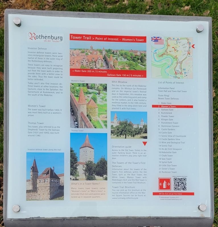
Invasion Defence
Invasion defense towers were two-story rectangular towers. There were twelve of these in the outer ring of the Rothenburg defenses.
These towers are easy to recognize because they were built projecting out from the town walls in order to provide them with a better view to the sides. Thus the town could be better defended.
Today you'll also find invasion defense towers at other locations: the Sauturm, close to the Spitaltor; the Ganserturm at Kummereck; and to the south of the Rödertor.
Women's Tower
The tower was built before 1430. It was most likely built as a women's prison.
Thomas Tower
This tower, also referred to as the Shepherds' Tower by the Gallows Gate (1631 and 1645), was built around 1340.
What's in a Tower Name?
Many towns have towers called "Women's Irons"
Photographed by James Hulse, February 19, 2024
2. Streichwehr / Invasion Defence Marker
Whit Meadow
This lies to the north of the Rödertor complex. On Whitsun (or Pentecost) and on the imperial town's festival days in September, this meadow was used as the collecting point and camp for the soldiers, and it also hosted a medieval market. In the 19th century, they filled in the deep ditch here and planted it with fruit trees.
Captions
Invasion defense tower along the trail
Women's Tower
Thomas Tower
Erected by Rothenburg ob der Tauber.
Topics. This historical marker is listed in these topic lists: Forts and Castles • Industry & Commerce • Settlements & Settlers. A significant historical year for this entry is 1430.
Location. 49° 22.711′ N, 10° 11.067′ E. Marker is in Rothenburg ob der Tauber, Bayern (Bavaria), in Ansbach. It is on Hornburgweg close to Röderschütt. The marker is located near the defensive wall and parking lot. Touch for map. Marker is at or near this postal address: Hornburgweg 25, Rothenburg ob der Tauber BY 91541, Germany. Touch for directions.

Regionally, this marker is in German Franconia and on
Photographed by James Hulse, February 19, 2024
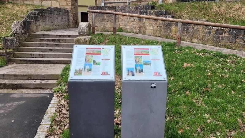
3. The view of the Streichwehr / Invasion Defence Markers
Other nearby markers. At least 8 other markers are within walking distance of this marker: Thomasturm / Thomas Tower (within shouting distance of this marker); Galgentorturm / Gallows Gate Tower (about 120 meters away, measured in a direct line); Galgen- oder Würzburger-Tor / Gallows Gate (about 120 meters away); Büttelhaus / Bailiff's House (approx. 0.3 kilometers away); Hohennersturm (approx. 0.3 kilometers away); Zum Gedenken an Unsere / In Memory of our Jewish Fellow Citizens (approx. 0.3 kilometers away); Rabbi-Meir-Gärtchen und „Judentanzhaus" / Rabbi-Meir-Garden and the Former Jewish Community Hall (approx. 0.3 kilometers away); Henkersturm / Executioner's Storm (approx. 0.3 kilometers away). Touch for a list and map of all markers in Rothenburg ob der Tauber.
Also see . . . Town wall and town gates. Rothenburg ob der Tauber (Submitted on March 11, 2024, by James Hulse of Medina, Texas.)

Photographed by James Hulse, February 19, 2024
4. The view of the markers in front of a pathway to the town through the wall
Credits. This page was last revised on March 13, 2024. It was originally submitted on March 11, 2024, by James Hulse of Medina, Texas. This page has been viewed 184 times since then and 34 times this year. Photos: 1, 2, 3, 4. submitted on March 11, 2024, by James Hulse of Medina, Texas.
