Brownsville in Brooklyn in Kings County, New York — The American Northeast (Mid-Atlantic)
Howard Playground
1 acre
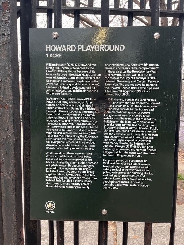
William Howard (1725-1777) owned the Rising Sun Tavern, also known as the Howard Halfway House because of its location between Brooklyn Village and the town of Jamaica at the intersection of the Bedford and Jamaica Turnpikes (now the corner of Broadway and Jamaica Avenue). The tavern lodged travelers, served as a gathering place, and sold basic supplies to the area farmers.
In August 1776, British General William Howe (1729-1814) advanced on American troops, an action which culminated in the Battle of Brooklyn. During the middle of the night, Howe stopped at the Rising Sun Tavern and took Howard and his family prisoner. Howard supported American independence and tried to refuse aiding the general. However, Howe threatened to have Howard shot in the head if he did not comply, so Howard and his fourteen year-old son, also named William (1762-1854), led the British along the Rockaway Path (which ran through what is now the Evergreen Cemetery). They avoided Jamaica Pass, which they thought was heavily defended by American troops.
As it turned out, there were only five American soldiers at Jamaica Pass. These soldiers were supposed to fall back and raise the alarm at the approach of British troops. By circumventing the pass with Howard's help, the English took the lookout by surprise and easily captured these few guards. The British then attacked the American troops from behind their fortified position, nearly destroying it in this military defeat. General George Washington barely escaped from New York with his troops. Howard and family remained prominent in the area after the Revolutionary War, and Howard Avenue was laid out on the Map of the City of Brooklyn in 1839 between Broadway and Eastern Parkway Extension. The avenue gave its name to the Howard Houses (1955), which passed it to Howard Playground (1956), and Howard Pool (1968).
In 1953 the city bought the land for this park along with the site where the Howard Houses would be built. The houses were intended to provide better homes and more recreational space for people living in what was considered to be substandard housing. While most of the buildings on the block were demolished to make room for the new housing, the Brownsville Branch of the Brooklyn Public Library (1908) stood and remains next to the park. It was one of many libraries built throughout the United States, England, and other English speaking countries with money donated by industrialist Andrew Carnegie (1835-1919). The park was originally named the Howard Houses Playground, but the name was shortened to Howard Playground in 1987.
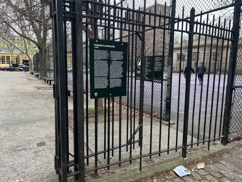
The park opened on September 12, 1956, and includes basketball courts, handball courts, and a play area with safety
Erected by NYC Parks.
Topics and series. This historical marker is listed in these topic lists: Charity & Public Work • Education • Parks & Recreational Areas • War, US Revolutionary. In addition, it is included in the Carnegie Libraries, and the NYC Parks series lists. A significant historical month for this entry is August 1776.
Location. 40° 40.317′ N, 73° 54.475′ W. Marker is in Brooklyn, New York, in Kings County. It is in Brownsville. Marker can be reached from Mother Gaston Boulevard north of Glenmore Avenue, on the right when traveling south. Touch for map. Marker is at or near this postal address: 290 Mother Gaston Blvd, Brooklyn NY 11212, United States of America. Touch for directions.
Other nearby markers. At least 8 other markers are within walking distance of this marker. A different marker also named Howard Playground (within shouting distance of this marker); Hilltop Playground (approx. 0.4 miles away); New Hope Pentecostal Church of Greater Mt. Zion Inc. (approx. half a mile away); Callahan-Kelly Playground (approx. half a mile away); Van Dyke Playground (approx. half a mile away); Hull Street Community Garden (approx. 0.6 miles away); Heaven Bound Church of Christ Holy Temple, Inc. (approx. 0.6 miles away); Rock of Ages Baptist Church and Social Center, Inc. (approx. 0.7 miles away). Touch for a list and map of all markers in Brooklyn.
Related marker. Click here for another marker that is related to this marker. An identical marker can be found elsewhere on the perimeter of the park.
Credits. This page was last revised on March 13, 2024. It was originally submitted on March 13, 2024, by Devry Becker Jones of Washington, District of Columbia. This page has been viewed 30 times since then. Photos: 1, 2. submitted on March 13, 2024, by Devry Becker Jones of Washington, District of Columbia.

