
Dryden in Kenora District, Ontario — Central Canada (North America)
The Railway
Photographed by Cosmos Mariner, June 12, 2022
1. The Railway Marker
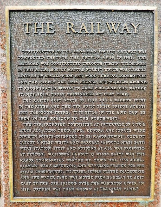
Construction of the Canadian Pacific Railway was completed through the Dryden area in 1882. The railroad was constructed through virgin wilderness in this area, mostly mature forest which was readily ignited by sparks from the wood burning locomotives and the forest was soon burned off for miles around. It regenerated mostly in Jack Pine and the mature stands seen today originated at that time.
The rapids just north of here are a narrow point in the river and the CPR built their bridge across the Wabigoon there. It is still in use and can be seen on the horizon to the northwest.
The CPR proposed townsites at intervals of 6 to 8 miles all along their line. Kenora and Ignace were division points, intended to be major towns; Oxdrift (about 6 miles west) and Barclay (about 3 miles east) were station stops and nothing at all was proposed at Dryden. Wabigoon (about 13 miles east) was the major commercial centre or town for the area. Barclay was a refueling and watering station for the steam locomotives, its water supply proved inadequate and the water tank was moved from Barclay to just east of the CPR bridge over the Wabigoon
this page online
Topics. This historical marker is listed in these topic lists: Bridges & Viaducts • Railroads & Streetcars • Settlements & Settlers. A significant historical year for this entry is 1882.
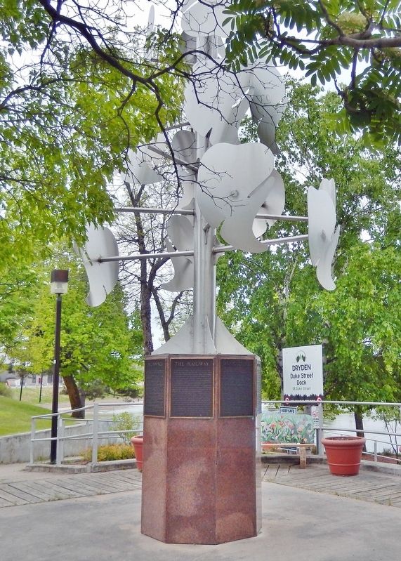
Location. 49° 46.915′ N, 92° 50.462′ W. Marker is in Dryden, Ontario, in Kenora District. It is at the intersection of West River Road (Duke Street) (Provincial Highway 594) and Earl Avenue, on the right when traveling east on West River Road (Duke Street). The marker is mounted on the base of a metal sculpture at the southwest corner of the intersection, overlooking the Duke Street Dock. Touch for map. Marker is at or near this postal address: 18 Duke Street, Dryden ON P8N 1Y1, Canada. Touch for directions.

Regionally, this marker is in Northern Ontario and specifically in Northwest Ontario. It is also in Central Canada. Globally, it is in North America, the Great North Woods, the Western Hemisphere, the Western World, and the Anglosphere. Historically, it finds itself in what was once a British colony, the Viceroyalty of New France, the Haudenosaunee (Iroquois) Confederacy,
Photographed by Cosmos Mariner, June 12, 2022
2. The Railway Marker
One of 8 local history tablets mounted around the granite-faced octagonal base of this metal sculpture.
Other nearby markers. At least 8 other markers are within walking distance of this marker: Beginnings (here, next to this marker); Agriculture (here, next to this marker); Gold Fever (here, next to this marker); The Present (here, next to this marker); Pulp and Paper (here, next to this marker); Booming Wood (here, next to this marker); Recreation (here, next to this marker); Alan Durance (within shouting distance of this marker). Touch for a list and map of all markers in Dryden.
Also see . . .
1. City of Dryden History (theDrydenObserver.ca). Excerpt:
In 1893, John Dryden was on-board a passenger train that made its stop at what was known as Barclay Tank for re-watering. During the train stop, Dryden saw clover growing by the railroad. The clover sprouted from seeds left by colonists who made their way west. Based on this keen observation, he then thought that clover sprouting from these lands in huge quantities would be a good idea for farming. Dryden then made the decision to build an experimental farm for this sole purpose. In January 1895, Dryden, Ontario’s Minister of Agriculture, declared that the province of Ontario would institute a Pioneer Farm located in Wabigoon Country. He set this up as a way to attract colonists to North-western Ontario.(Submitted on March 15, 2024, by Cosmos Mariner of Cape Canaveral, Florida.)
2. Canadian Pacific Railway (thecanadianencyclopedia.ca). Excerpt:
The Canadian Pacific Railway company (CPR) was incorporated in 1881. Its original purpose was the construction of a transcontinental railway, a promise to British Columbia upon its entry into Confederation. The railway — completed in 1885 — connected Eastern Canada to British Columbia and played an important role in the development of the nation.(Submitted on March 15, 2024, by Cosmos Mariner of Cape Canaveral, Florida.)
3. Canadian Pacific Railway (Wikipedia). Excerpt:
The CPR was Canada's first transcontinental railway. Primarily a freight railway, the CPR was for decades the only practical means of long-distance passenger transport in most regions of Canada and was instrumental in the settlement and development of Western Canada.(Submitted on March 15, 2024, by Cosmos Mariner of Cape Canaveral, Florida.)
Credits. This page was last revised on July 19, 2026. It was originally submitted on March 14, 2024, by Cosmos Mariner of Cape Canaveral, Florida. This page has been viewed 467 times since then and 95 times this year. Photos: 1, 2. submitted on March 15, 2024, by Cosmos Mariner of Cape Canaveral, Florida.
