Schlicht in Vilseck in Amberg-Sulzbach, Bavaria, Germany — Central Europe
Geschichte Der Stadt Vilseck / History of Vilseck
Inscription.
Entdecken Sie unsere Sehenswürdigkeiten und tauchen Sie ein in unsere Geschichte.
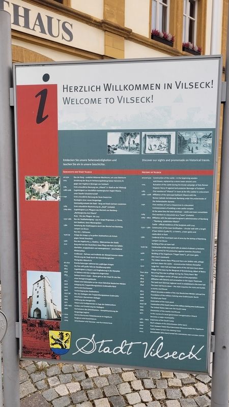
Geschichte Der Stadt Vilseck
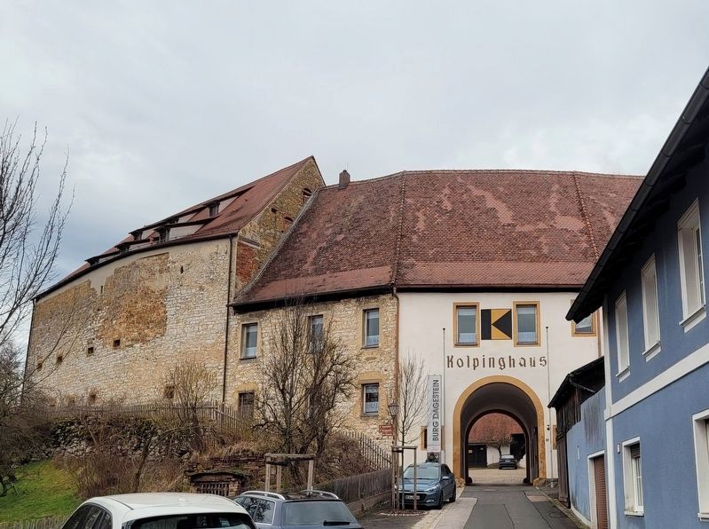
um 930 • Bau der Burg-zunächst hölzerner Wachtturm, um 1200 Steinturm
1104 • Zerstörung der Burg im Verheerungsfeldzug Kaiser Heinrichs IV. gegen den Vogtherrn Berengar von Sulzbach
1185 • Erste urkundliche Nennung von „Vilseck" (= Stadt an der Vilsburg)
1188-1268 • Zugehörigkeit zur bischöflich-bambergischen Vogtei Vilseck, unter Staufer Schutzherrschaft
1190 • Erste urkundliche Nennung der Burg Dagestein Baubeginn einer neuen Burganlage Gleichzeitig entsteht die Stadt - Burg und Stadt wachsen zusammen
1269 • Erste urkundliche Bezeichnung als „Stadt" (civitatis)
1269-1802 • Zugehörigkeit zum Pflegamt des Bischofs von Bamberg - „Bambergisches Amt Vilseck" Burg - Sitz des Pflegers bis 1745
1332-1380 • Bau der Stadtbefestigung - 940 m lange Ringmauer, 17 Türme, drei Stadttore, davor Wassergraben
1380 • Verleihung des Stadtwappens durch den Bischof von Bamberg, Lampert von Brunn Bau des 1. Rathauses
1430/39 • Anlage des knapp 13 ha großen Stadtweihers als Schutz gegen Feinde (Hussiten)
1466 • Bau des Vogelturms, 4. Stadttor, (Wahrzeichen der Stadt)
1512 • Burg wird von den Raubrittern Hans Pflug und Hans von Selbitz überfallen, ausgeplündert und niedergebrannt - anschließend Wiederaufbau
1522 • Großbrand - Rathaus und Großteile der Altstadt brennen nieder Plünderung der Stadt durch den brandenburgischen Markgrafen Albrecht IV.
ab 1620 • Brandschatzungen während des 30jährigen Krieges
1634 • Die Pest rafft große Teile der Bevölkerung dahin
1803 • Zugehörigkeit zu Bayern und Eingliederung in die Oberpfalz
1838 • Im Rathaus wird das Landgericht eingerichtet
1864 • Rathaus brennt nieder - Ruine geht an den Staat für den Bau eines Amtsgerichtsgebäudes
1875 • Vilseck wird Haltestation an der neuen Bahnlinie Neukirchen-Weiden
1908 • Anlegung des Truppenübungsplatzes Grafenwöhr-Nord
1909 • Jahrhunderthochwasser
1926 • Trockenlegung des Stadtweihers
1937/38 • Bau des Südlagers des Truppenübungsplatzes Grafenwöhr
1945 • Amerikaner übernehmen Südlager
1969 • Auflösung des Amtsgerichts
1971 • Vilseck wird Großgemeinde im Zuge der Gebietsreform
1990 • Dacheinsturz des Zehentkastens - Komplettsanierung der Burganlage beginnt
2000 • Erstes Deutsches Türmermuseum im Vogelturm
2001 • Burgturm wird Aussichtsturm
2004 • Zehentkasten wird Tagungs- und Kulturzentrum
Discover our sights and promenade on historical traces.
History of Vilseck
around 930 • Construction of the castle - in the beginning wooden watchtower, replaced by a stone tower around 1200
1104 • Ruination of the castle during the brutal campaign of Holy Roman Emperor Henry IV against lord protector Berengar of Sulzbach
1185 • First mention of "Vilseck" (= town at the Vils castle) in a document
1188-1268 • Affiliation of the episcopal bailiwick Vilseck with the Roman Catholic Archdiocese Bamberg under the protectorate of the Hohenstaufen dynasty
1190 • First mention of Castle Dagestein in a document, Commencement of building a new castle complex, At the same time the town develops - castle and town consolidate
1269 • First mention in a document as a "town" (civitatis)
1269-1802 • Affiliation with the episcopal burgrave's administration of Bamberg - "Bamberg, subdivision Vilseck", Castle - official residence of the burgrave until 1745
1332-1380 • Construction of the town fortification - circular wall with a length of 940 meters (3,084 ft.), 17 towers, 3 town gates and castle ditch in front
1380 • Conferral of the municipal coat of arms by the bishop of Bamberg, Lampert von Brunn, Building of the 1st town hall
1430/39 • Construction of the town pond with an extent of almost 13 hectares (32,123 acres) for the protection against enemies (Hussites)
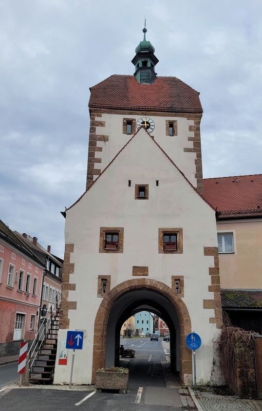
1466 • Building of the Vogelturm ("Vogel Tower"), 4th town gate, (the town's landmark)
1512 • The robber barons Hans Pflug and Hans von Selbitz raid, pillage and burn down the castle - reconstruction follows thereafter
1522 • Large fire - town hall and large parts of the old town burn down, Pillage of the town by the Margrave of Brandenburg, Albert of Mainz
from 1620 • Recurring fires due to pillage during the Thirty Years' War
1634 • The black plague carries off large parts of the population
1803 • Affiliation with Bavaria and annexation to the Upper Palatinate
1838 • The Land court (German regional court) is established in the town hall
1846 • The town hall burns down - the state acquires the ruins and builds a county courthouse
1875 • Vilseck becomes a station of the new Neukirchen-Weiden railroad line
1908 • Foundation of the military training area Grafenwoehr North
1909 • Hundred-year flood
1926 • Exsiccation of the town pond
1937/38 • Construction of the South Camp of the military training area Grafenwoehr
1945 • The United States take over the South Camp
1969 • Dissolution of the county courthouse
1971 • In the course of a local government reorganization Vilseck becomes a major municipality
1981-1993 • Expansion of the South Camp
1990 • Roof collapse of the Zehentkasten (tithe barn)
2000 • First German Tower Nightwatchman Museum inside the Vogelturm
2001 • Castle tower turned into viewing tower
2004 • Zehentkasten (tithe barn) turned into Conference and Cultural Center
Erected by Stadt Vilseck.
Topics. This historical marker is listed in this topic list: Notable Events. A significant historical year for this entry is 1200.
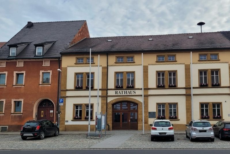
Location. 49° 36.721′ N, 11° 48.402′ E. Marker is in Vilseck, Bayern (Bavaria), in Amberg-Sulzbach. It is in Schlicht. Marker is on Marktplatz, 0.1 kilometers west of Breite G., on the left when traveling west. The marker is located in front of the town hall building. Touch for map. Marker is at or near this postal address: Marktpl 11, Vilseck BY 92249, Germany. Touch for directions.
Other nearby markers. At least 8 other markers are within walking distance of this marker. Geburtshaus von E.J. Reichenberger / Birthplace of E.J. Reichenberger (a few steps from this marker); Wünnenberghaus (within shouting distance of this marker); Herzlich Willkommen in Vilseck! / Welcome to Vilseck! (within shouting distance of this marker); „Angerer" (within shouting distance of this marker); „Bäcker-Michl-Haus" / "Baker-Michl-House" (about 90 meters away, measured in a direct line); „Färberhaus“ / "Dyer House" (about 90 meters away); Vogelturm (about 90 meters away); Ackerbürgerhaus (about 90 meters away). Touch for a list and map of all markers in Vilseck.
Also see . . . Vilseck. Wikipedia
Vilseck is a town in the Oberpfalz region of northeastern Bavaria, Germany, situated on the river Vils, a tributary of the Naab river.(Submitted on March 16, 2024, by James Hulse of Medina, Texas.)
The town is geographically separate from a nearby large American military base known as the Rose Barracks but more commonly referred to as Vilseck. The base, built in 1937–1938, was captured during World War II from the Germans; it was previously known as Südlager.
Credits. This page was last revised on March 16, 2024. It was originally submitted on March 15, 2024, by James Hulse of Medina, Texas. This page has been viewed 46 times since then. Photos: 1, 2, 3, 4. submitted on March 16, 2024, by James Hulse of Medina, Texas.


