
Central Hill in Somerville in Middlesex County, Massachusetts — The American Northeast (New England)
The French Redoubt

Photographed by Marc Posner, October 26, 2023
1. The French Redoubt Marker
Gen. Putnam set up the French Redoubt after retreating from Bunker Hill. Along with others, the French Redoubt successfully held out against British advances and became a strategic fortification extended from what is not the back of the high school to Prospect Hill and Winter Hill. The battery was built from granite and was shaped in a semi-circle. Four large cannons were mounted on iron trucks within the enclosure in commemoration of the Revolution. The cannons were donated during World War II for scrap.
Erected Nov. 1974. S. Lester Ralph - Mayor
Erected 1974 by City of Somerville.
Topics. This historical marker is listed in these topic lists: Forts and Castles • War, US Revolutionary. A significant historical month for this entry is June 1775.
Location. 42° 23.142′ N, 71° 5.669′ W. Marker is in Somerville, Massachusetts, in Middlesex County. It is in Central Hill. It can be reached from the intersection of Highland Avenue and Walnut Street, on the left when traveling east. Located on the Somerville Public Library. Touch for map. Marker is at or near this postal address: 79 Highland Avenue, Somerville MA 02143, United
this page online

Regionally, this marker is in Historic Boston and specifically in Greater Boston. It is also in the American Northeast, in New England, and on the Eastern Seaboard. Globally, it is in the North Atlantic Region, North America, the Western Hemisphere, the Western World, and the Anglosphere. Historically, it finds itself in what was once one of the original Thirteen Colonies.
Other nearby markers. At least 8 other markers are within walking distance of this marker: Central Hill Playground (within shouting distance of this marker); Edward Leathers Community Park (about 500 feet away, measured in a direct line); Edward L. Leathers (about 500 feet away); The First Congregational Unitarian Society in Somerville (approx. 0.2 miles away); Winter Hill Station (approx. 0.2 miles away); Gilman Square (approx. 0.2 miles away); George Dilboy (approx. 0.2 miles away); Nunziato Field (approx. 0.3 miles away). Touch for a list and map of all markers in Somerville.
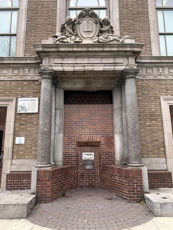
Photographed by Marc Posner, April 5, 2024
2. French Redoubt marker on Somerville Public Library (Central Library)
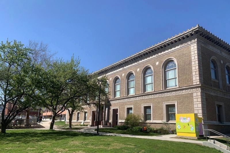
Photographed by Marc Posner, April 23, 2024
3. Somerville Public Library (Central Library)
Credits. This page was last revised on June 14, 2024. It was originally submitted on March 15, 2024, by Marc Posner of Somerville, Massachusetts. This page has been viewed 616 times since then and 61 times this year. Photos: 1. submitted on March 15, 2024, by Marc Posner of Somerville, Massachusetts. 2, 3. submitted on June 6, 2024, by Marc Posner of Somerville, Massachusetts. • Michael Herrick was the editor who published this page.
Editor’s want-list for this marker. A wide view photo of the marker and its surroundings. • Can you help?
