Long Beach in Harrison County, Mississippi — The American South (East South Central)
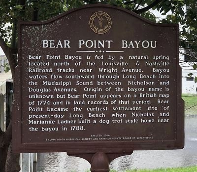
Bear Point Bayou
Erected 2004 by Long Beach Historical Society • Harrison County Board of Supervisors.
Topics. This historical marker is listed in these topic lists: Settlements & Settlers • Waterways & Vessels. A significant historical year for this entry is 1774.
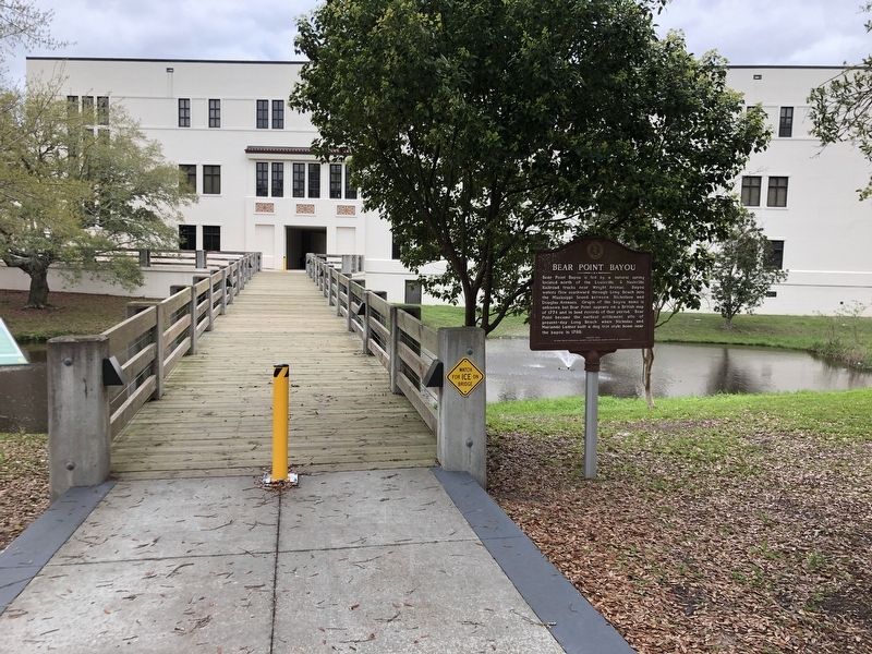
Location. 30° 21.202′ N, 89° 8.196′ W. Marker is in Long Beach, Mississippi, in Harrison County. Marker can be reached from Friendship Oak Circle west of Beach Park Place, on the right when traveling west. Marker is near a pedestrian bridge between Gulf Park Library and the Fleming Education Center on the University of Southern Mississippi Gulf Park campus. Touch for map. Marker is in this post office area: Long Beach MS 39560, United States of America. Touch for directions.
Other nearby markers. At least 8 other markers are within walking distance of this marker. Administration Building (about 400 feet away, measured in a direct line); "Friendship Oak" (about 600 feet away); a different marker also named Friendship Oak (about 700 feet away); Gulf Park College (about 700 feet away); Early Long Beach (approx. ¼ mile away); St. Thomas the Apostle Catholic Church (approx. ¼ mile away); a different marker also named Early Long Beach (approx. half a mile away); Long Beach Presbyterian Church (approx. ¾ mile away). Touch for a list and map of all markers in Long Beach.
Also see . . .
1. Brief History of Long Beach. Native Americans inhabited this area long before any records were kept and the creation of a British map in 1774 shows Bear Point, the first name of the village that would eventually become Long Beach. (Long Beach Historical Society) (Submitted on March 16, 2024, by Duane and Tracy Marsteller of Murfreesboro, Tennessee.)
2. Long Beach: City of Many Names. The name Long Beach didn’t appear until 1882. This area was first seen on a British map in 1774 listed as Bear Point. Perhaps the British may have named the little Indian village with its crystal clear stream and the occasional bear. (Mississippi Gulf Coast Museum of Historical Photography) (Submitted on March 16, 2024, by Duane and Tracy Marsteller of Murfreesboro, Tennessee.)
Credits. This page was last revised on March 16, 2024. It was originally submitted on March 16, 2024, by Duane and Tracy Marsteller of Murfreesboro, Tennessee. This page has been viewed 34 times since then. Photos: 1, 2. submitted on March 16, 2024, by Duane and Tracy Marsteller of Murfreesboro, Tennessee.

