Near Petersburg in Dinwiddie County, Virginia — The American South (Mid-Atlantic)
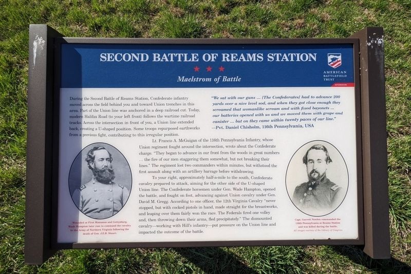
Second Battle Of Reams Station
Maelstrom of Battle
—Pvt. Daniel Chisholm, 116th Pennsylvania, USA
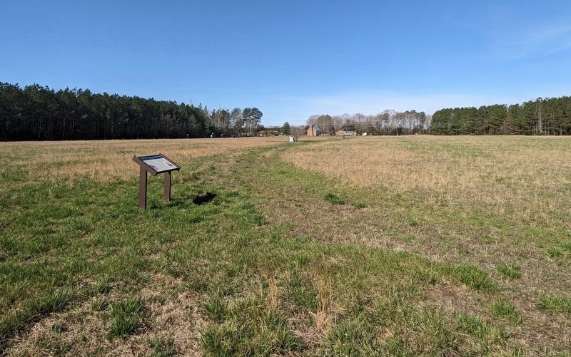
During the Second Battle of Reams Station, Confederate infantry moved across the field behind you and toward Union trenches in this area. Part of the Union line was anchored in a deep railroad cut. Today, modern Halifax Road (to your left front) follows the wartime railroad tracks. Across the intersection in front of you, a Union line extended back, creating a U-shaped position. Some troops repurposed earthworks from a previous fight, contributing to this irregular position.
Lt. Francis A. McGuigan of the 116th Pennsylvania Infantry, whose Union regiment fought around the intersection, wrote about the Confederate charge. "They began to advance in our front from the woods in great numbers...the fire of our men staggering them somewhat, but not breaking their lines." The regiment lost two commanders within minutes, but withstood the first assault along with an artillery barrage before withdrawing.
To your right, approximately half-a-mile to the south, Confederate cavalry prepared to attack, aiming for the other side of the U-shaped Union line. The Confederate horsemen under Gen. Wade Hampton, opened the battle, and fought on foot, advancing against Union cavalry under Gen. David M. Gregg. According to one officer, the 12th Virginia Cavalry "never stopped, but with cocked pistols in hand, made straight for the breastworks, and leaping over them fairly won the race. The Federals fired one volley and, then throwing down their arms, fled precipitately." The dismounted cavalry—working with Hill's infantry—put pressure on the Union line and impacted the outcome of the battle.
(captions)
Wounded at First Manassas and Gettysburg, Wade Hampton later rose to command the cavalry in the Army of Northern Virginia following the death of Gen. J.E.B. Stuart.
Capt. Garrett Nowlen commanded the 116th Pennsylvania at Reams Station and was killed during the battle. All images courtesy Library of Congress
Erected by American Battlefield Trust.
Topics. This historical marker is listed in these topic lists: Railroads & Streetcars • War, US Civil. A significant historical date for this entry is August 25, 1864.
Location. 37° 5.647′ N, 77° 25.324′ W. Marker is near Petersburg, Virginia, in Dinwiddie County. Marker can be reached from Reams Drive (Virginia Route 606) 0.1 miles west of Halifax Road (Virginia Route 604), on the right when traveling west. Touch for map. Marker is in this post office area: Petersburg VA 23805, United States of America. Touch for directions.
Other nearby markers. At least 8 other markers are within 5 miles of this marker, measured as the crow flies. North Carolina (within shouting distance of this marker); a different marker also named Second Battle Of Reams Station (about 300 feet away, measured in a direct line); Fighting At Reams Station (about 500 feet away); a different marker also named Second Battle Of Reams Station (about 600 feet away); Ream's Station (about 800 feet away); Second Battle of Reams Station (approx. 0.2 miles away); a different marker also named Reams Station (approx. 4.1 miles away); The Petersburg Railroad (approx. 4½ miles away). Touch for a list and map of all markers in Petersburg.
Also see . . . Reams Station Battlefield. American Battlefield Trust (ABT) (Submitted on March 19, 2024.)
Credits. This page was last revised on March 20, 2024. It was originally submitted on March 19, 2024, by Bernard Fisher of Richmond, Virginia. This page has been viewed 52 times since then. Photos: 1, 2. submitted on March 19, 2024, by Bernard Fisher of Richmond, Virginia. 3. submitted on March 20, 2024, by Bernard Fisher of Richmond, Virginia.


