
Ignace in Kenora District, Ontario — Central Canada (North America)
History of the Fire Tower
Photographed by Cosmos Mariner, June 11, 2022
1. History of the Fire Tower Marker
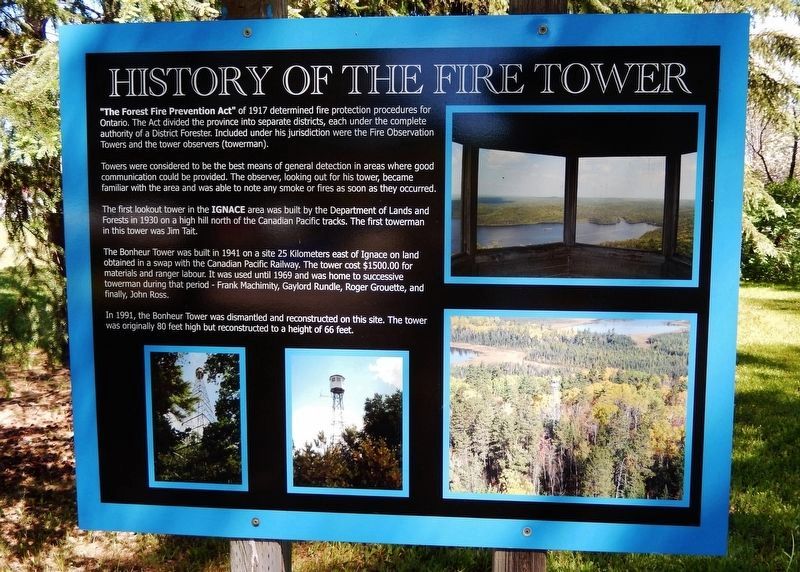
"The Forest Fire Prevention Act" of 1917 determined fire protection procedures for Ontario. The Act divided the province into separate districts, each under the complete authority of a District Forester. Included under his jurisdiction were the Fire Observation Towers and the tower observers (towerman).
Towers were considered to be the best means of general detection in areas where good communication could be provided. The observer, looking out for his tower, became familiar with the area and was able to note any smoke or fires as soon as they occurred.
The first lookout tower in the Ignace area was built by the Department of Lands and Forests in 1930 on a high hill north of the Canadian Pacific tracks. The first towerman in this tower was Jim Tait.
The Bonheur Tower was built in 1941 on a site 25 kilometers east of Ignace on land obtained in a swap with the Canadian Pacific Railway. The tower cost $1500.00 for materials and ranger labour. It was used until 1969 and was home to successive towerman during that period - Frank Machimity, Gaylord Rundle, Roger Grouette, and finally, John Ross.
In 1991, the Bonheur Tower was
this page online
Topics. This historical marker is listed in these topic lists: Charity & Public Work • Communications • Horticulture & Forestry. A significant historical year for this entry is 1941.
Location. 49° 24.973′ N, 91° 39.968′ W. Marker is in Ignace, Ontario, in Kenora District. It can be reached from Main Street (Trans-Canada Highway) (Provincial Highway 17) just west of West Street, on the left when traveling west. The marker and fire tower exhibit are located on the south side of the Ignace Public Library. Touch for map. Marker is at or near this postal address: 36 Main Street, Ignace ON P0T 1T0, Canada. Touch for directions.

Regionally, this marker is in Northern Ontario and specifically in Northwest Ontario. It is also in Central Canada. Globally, it is in North America, the Great North Woods, the Western Hemisphere, the Western World, and the Anglosphere. Historically, it finds itself in what was once a British colony, the Viceroyalty of New France, the Haudenosaunee (Iroquois) Confederacy,

Photographed by Cosmos Mariner, June 11, 2022
2. History of the Fire Tower Marker
Other nearby markers. At least 4 other markers are within walking distance of this marker: Maple Mountain Tower (here, next to this marker); The Towerman (a few steps from this marker); Mary Berglund (within shouting distance of this marker); Beech 18 (approx. half a kilometer away).
Related markers. Click here for a list of markers that are related to this marker.
Also see . . . First Ignace Fire Tower Built 80 Years Ago (pdf). Excerpt:
(By Dennis Smyk, Editor, Ignace Driftwood, May 19, 2010) The first fire lookout towers in Ontario appeared on the scene in the 1920's. These early towers were constructed of wood; some were simply platforms in tall trees. By 1947, there were 52 wooden, and 227 steel towers across Ontario. (Report of the Minister of Lands and Forests of the Province of Ontario, 1948)(Submitted on March 21, 2024, by Cosmos Mariner of Cape Canaveral, Florida.)
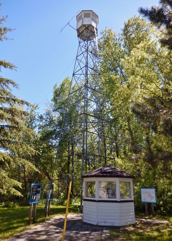
The demise of the tower detection system began in the late 1960's, when it was decided that aerial detection was a more cost-effective and efficient means of spotting forest fires. By the beginning of the 1970's, lookout towers were being taken out of operation; by 1973, the tower detection systemwas closed down entirely andreplaced with airplanes.Photographed by Cosmos Mariner, June 11, 20223. The Bonheur Fire TowerThis marker is on the far left.
Credits. This page was last revised on March 21, 2024. It was originally submitted on March 19, 2024, by Cosmos Mariner of Cape Canaveral, Florida. This page has been viewed 498 times since then and 43 times this year. Photos: 1. submitted on March 20, 2024, by Cosmos Mariner of Cape Canaveral, Florida. 2, 3. submitted on March 21, 2024, by Cosmos Mariner of Cape Canaveral, Florida.
