Colt in St. Francis County, Arkansas — The American South (West South Central)
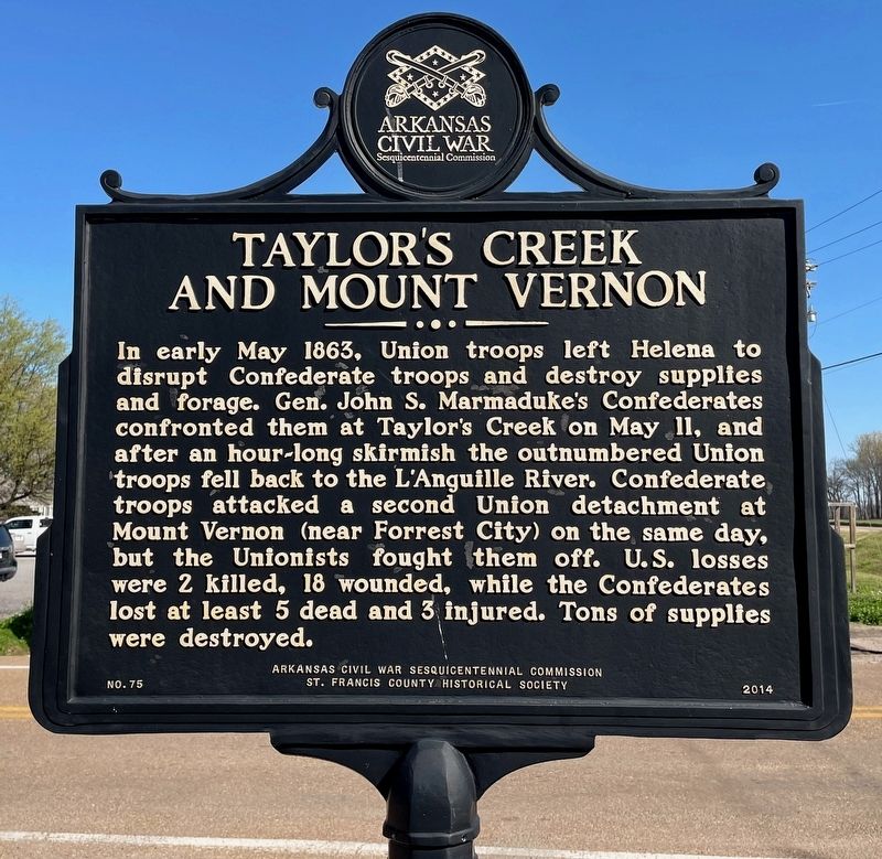
Taylor's Creek and Mount Vernon
Erected 2014 by Arkansas Civil War Sesquicentennial Commission · St. Francis County Historical Society. (Marker Number 75.)
Topics and series. This historical marker is listed in this topic list: War, US Civil. In addition, it is included in the Arkansas Civil War Sesquicentennial Commission series list. A significant historical month for this entry is May 1863.
Location. 35° 7.9′ N, 90° 48.707′ W. Marker is in Colt, Arkansas, in St. Francis County. Marker is at the intersection of Old Military Road West (Arkansas Route 306) and South Main Street (Arkansas Route 1), on the left when traveling west on Old Military Road West. Located in front of First National Bank. Touch for map. Marker is at or near this postal address: 8898 S Main St, Colt AR 72326, United States of America. Touch for directions.
Other nearby markers. At least 8 other markers are within 9 miles of this marker, measured as the crow flies. Old Military Road (here, next to this marker); The Trail of Tears along the Memphis to Little Rock Road (approx. 5.4 miles away); Cross County (approx. 6˝ miles away); Mt. Vernon Cemetery (approx. 7.6 miles away); Campbell House (approx. 8.4 miles away); St. Francis County Troops in the War Between the States (approx. 8.6 miles away); Forrest’s Camp (approx. 8.7 miles away); Wittsburg in the Civil War (approx. 8.7 miles away).
Also see . . . Skirmishes at Taylor's Creek and Mount Vernon (Encyclopedia of Arkansas). (Submitted on March 19, 2024, by Mark Hilton of Montgomery, Alabama.)
Credits. This page was last revised on March 19, 2024. It was originally submitted on March 19, 2024, by Mark Hilton of Montgomery, Alabama. This page has been viewed 40 times since then. Photos: 1, 2. submitted on March 19, 2024, by Mark Hilton of Montgomery, Alabama.

