Manti in Sanpete County, Utah — The American Mountains (Southwest)
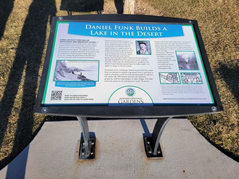
Daniel Funk Builds a Lake in the Desert
— Pioneer Heritage Gardens —
Daniel Buckley Funk was an industrious and innovative citizen of early Sanpete. He owned a mill, a farm made shoes and drums from animal hides and served in the military. Daniel had an entrepreneurial spirit. Throughout his life, he ventured into several avenues of business, but his attempt to build a man-made lake in a bene-dry valley would prove to be Daniel's most successful and innovative endeavor.
Daniel homesteaded a piece of land six miles south of Manti. The bowl-shaped property was dry and barren, but Daniel saw an opportunity to create a piece of lakefront property. He built a levy at the south end of the property and surveyed the area for water. The townspeople and Native Americans thought Daniel was foolish because no springs bubbled from the parched earth, and the nearest creek was far below Daniel's property line, which meant Daniel would have to make water run uphill in order to fill the valley.
Unafraid of the challenge, Daniel knew that the creek that ran below his valley originated from a spring at a higher elevation, and he engineered a way to capture the water. By 1873 water poured into Daniel's property, and his lake began to take shape. The lake took two years to fill and grew to cover 75 acres.
Daneil called the lake Eagle Park. He planted 6,500 trees near the lake and stocked the water with fish. He built a bowery, a private beach with dressing rooms, dance pavilions, and rowboats in order to create the pleasure resort he had envisioned. When the preparations were complete, he invited the surrounding communities to come and enjoy the recreationa area, now known as Palisades Park.
(caption) Daniels Funk's man-made lake is now Palisades State Park. Visitors can still experience this site and see the industrious work of Sanpete's early settlers.
(caption) Daniel found a way to make the lake profitable during the winter months, even after the visitors had gone away for the season. He cut ice from the lake and sold it to households in Manti. Ice that was not sold was stored and during the summer months it was used to make ice cream and was served in ice-cold sodas from the concession stand.
Erected by Central Utah Pioneer Heritage Association.
Topics. This historical marker is listed in these topic lists: Parks & Recreational Areas • Settlements & Settlers. A significant historical year for this entry is 1873.
Location. 39° 16.417′ N, 111° 38.14′ W. Marker is in Manti, Utah, in Sanpete County. Marker can be reached from 100 East. Marker location inside the Pioneer Heritage Gardens park. Touch for map. Marker is at or near this postal address: 525 N 100 E Street, Manti UT 84642, United States of America. Touch for directions.
Other nearby markers. At least 8 other markers are within walking distance of this marker. An Invitation to Settle (here, next to this marker); Pioneer Children's Experiences (a few steps from this marker); Pioneer Values: Industry (within shouting distance of this marker); Pioneer Values: Faith (within shouting distance of this marker); Pioneer Values: Education (within shouting distance of this marker); Gathering Zion (within shouting distance of this marker); Faith and Miracles (within shouting distance of this marker); A Temple in Zion (within shouting distance of this marker). Touch for a list and map of all markers in Manti.
Credits. This page was last revised on March 24, 2024. It was originally submitted on March 20, 2024, by Jeremy Snow of Cedar City, Utah. This page has been viewed 44 times since then. Photo 1. submitted on March 20, 2024, by Jeremy Snow of Cedar City, Utah. • Andrew Ruppenstein was the editor who published this page.
Editor’s want-list for this marker. phot of the marker within its surroundings • Can you help?
