Syracuse in Davis County, Utah — The American Mountains (Southwest)
Great Salt Lake
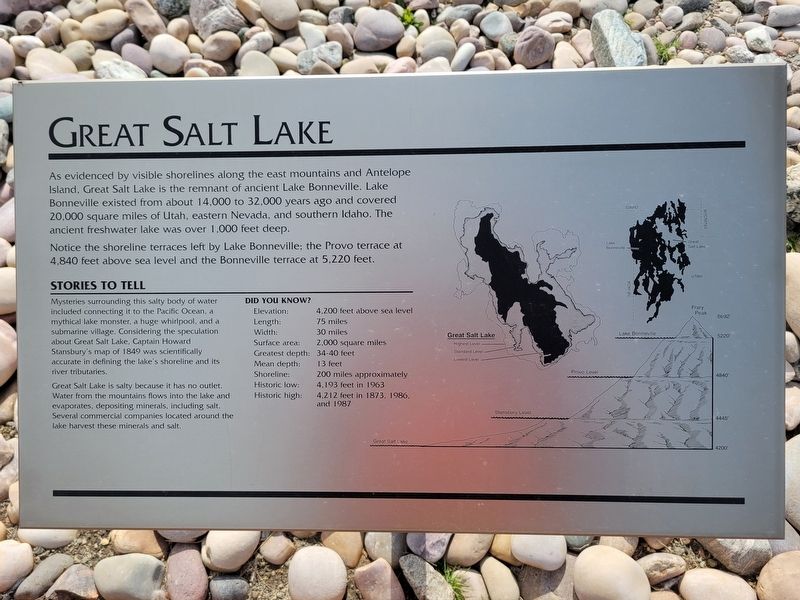
As evidenced by visible shorelines along the east mountains and Antelope Island, Great Salt Lake is the remnant of ancient Lake Bonneville. Lake Bonneville existed from about 14,000 to 32,000 years ago and covered 20,000 square miles of Utah, eastern Nevada, and southern Idaho. The ancient freshwater lake was over 1,000 feet deep. Notice the shoreline terraces left by Lake Bonneville: the Provo terrace at 4,840 feet above sea level and the Bonneville terrace at 5,220 feet.
Stories to tell
Mysteries surrounding this salty body of water included connecting it to the Pacific Ocean, a mythical lake monster, a huge whirlpool, and a submarine village. Considering the speculation about Great Salt Lake, Captain Howard Stansbury's map of 1849 was scientifically accurate in defining the lake's shoreline and its river tributaries.
Great Salt Lake is salty because it has no outlet. Water from the mountains flows into the lake and evaporates, depositing minerals, including salt. Several commercial companies located around the lake harvest these minerals and salt.
Did you know?
Elevation: 4.200 feet above sea level
Length: 75 miles
Width: 30 miles
Surface area: 2,000 square miles
Greatest depth: 34-40 feet
Mean depth: 13 feet
Shoreline: 200 miles approximately
Historic low: 4,193 feet in 1963
Historic high: 4,212 feet in 1873, 1986, and 1987
Topics. This historical marker is listed in these topic lists: Environment • Exploration. A significant historical year for this entry is 1849.
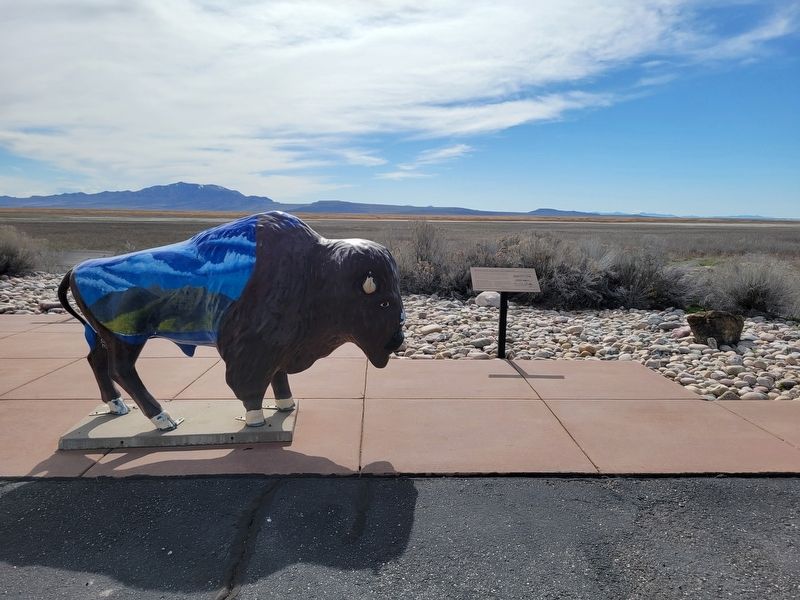
Location. 41° 5.339′ N, 112° 7.226′ W. Marker is in Syracuse, Utah, in Davis County. Marker can be reached from West 1700 South. Located in the picnic area just before the gatehouse to the Antelope Causeway. Touch for map. Marker is at or near this postal address: 4528 W 1700 S, Syracuse UT 84075, United States of America. Touch for directions.
Other nearby markers. At least 8 other markers are within 3 miles of this marker, measured as the crow flies. Antelope Island (here, next to this marker); Antelope Island Causeway (here, next to this marker); First School House (approx. 0.9 miles away); Walker Brothers Store (approx. 1.3 miles away); Hensley / Salt Lake Cutoff-Bluff Road (approx. 2 miles away); The Old Emigrant Road (approx. 2.8 miles away); Syracuse First Social Center (approx. 3 miles away); Historical Wilcox Cabin (approx. 3 miles away). Touch for a list and map of all markers in Syracuse.
Credits. This page was last revised on March 24, 2024. It was originally submitted on March 22, 2024, by Jeremy Snow of Cedar City, Utah. This page has been viewed 42 times since then. Photos: 1, 2. submitted on March 22, 2024, by Jeremy Snow of Cedar City, Utah. • Andrew Ruppenstein was the editor who published this page.

