Near Oktaha in Muskogee County, Oklahoma — The American South (West South Central)
Defending the Bridge · and other Fighting along Elk Creek
Honey Springs Battlefield
— Interpretive Trail Four · Battle at the Bridge —
Inscription.
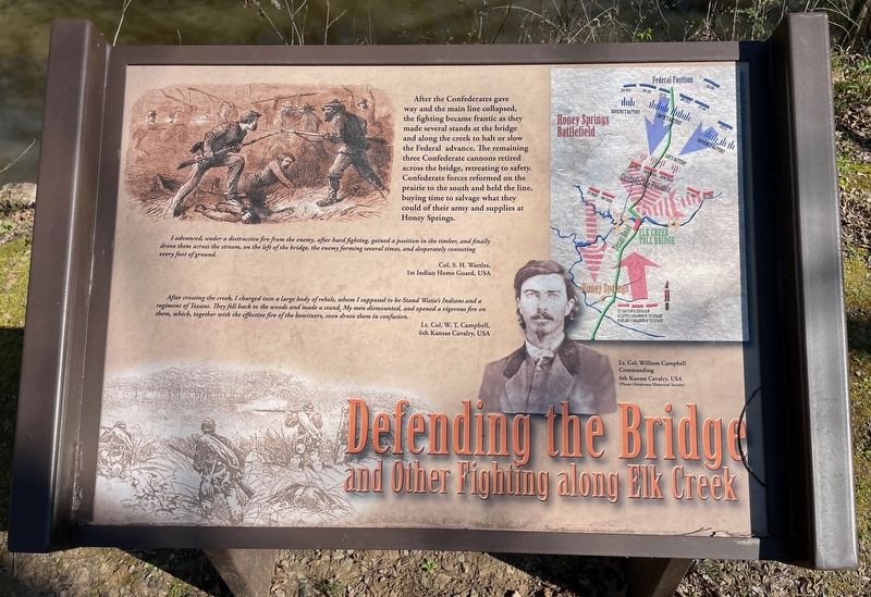
After the Confederates gave
way and the main line collapsed,
the fighting became frantic as they
made several stands at the bridge
and along the creek to halt or slow
the Federal advance. The remaining
three Confederate cannons retired
across the bridge, retreating to safety.
Confederate forces reformed on the
prairie to the south and held the line,
buying time to salvage what they
could of their army and supplies at
Honey Springs.
I advanced, under a destructive fire from the enemy, after hard fighting, gained a position in the timber, and finally drove them across the stream, on the left of the bridge, the enemy forming several times, and desperately contesting every foot of ground.
Col. S. H. Wattles,
1st Indian Home Guard, USA
After crossing the creek, I charged into a large body of rebels, whom I supposed to be Stand Watie's Indians and a regiment of Texans. They fell back to the woods and made a stand. My men dismounted, and opened a vigorous fire on them, which, together with the effective fire of the howitzers, soon drove them in confusion.
Lt. Col. W. T. Campbell,
6th Kansas Cavalry, USA
[Photo Caption:]
Lt. Col. William Campbell
Commanding
6th Kansas Cavalry, USA
(Photo Oklahoma Historical Society)
Erected 2019 by Friends of Honey Springs Battlefield.
Topics and series. This historical marker is listed in these topic lists: Bridges & Viaducts • War, US Civil. In addition, it is included in the Honey Springs Battlefield series list.
Location. 35° 33.151′ N, 95° 28.376′ W. Marker is near Oktaha, Oklahoma, in Muskogee County. Marker can be reached from Honey Springs Battlefield Road, 1˝ miles north of East 1020 Road, on the right when traveling north. Touch for map. Marker is in this post office area: Oktaha OK 74450, United States of America. Touch for directions.
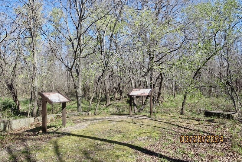
Other nearby markers. At least 8 other markers are within walking distance of this marker. The Toll Bridge and Fords · Crossing Elk Creek (here, next to this marker); Southern Camps (within shouting distance of this marker); How We Know What We Know · Official Reports (about 300 feet away, measured in a direct line); How We Know What We Know · Letters, Diaries, & On-The-Spot Reporting (about 500 feet away); Farming and Communities · along the Texas Road (about 600 feet away); How We Know What We Know · Archeological Surveys & Interviews (about 700 feet away); Battle for the Bridge (approx. 0.2 miles away); 1st and 2nd Regiments of Cherokee Mounted Rifles (approx. 0.3 miles away). Touch for a list and map of all markers in Oktaha.
Credits. This page was last revised on March 24, 2024. It was originally submitted on March 24, 2024, by Mark Hilton of Montgomery, Alabama. This page has been viewed 46 times since then. Photos: 1, 2. submitted on March 24, 2024, by Mark Hilton of Montgomery, Alabama.

