Near Oktaha in Muskogee County, Oklahoma — The American South (West South Central)
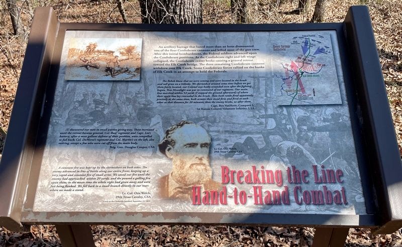
Breaking the Line, Hand-to-Hand Combat
Honey Springs Battlefield
— Interpretive Trail Three · Confederate Line —
The Rebels knew that we were coming and were located in the brush and tall grass on a hillside. We skirmished around some time before we got them fairly located, our Colonel was badly wounded soon after the fighting begun, Tom Moonlight was put in command of our regiment. Our main line marched within 52 yards (I stepped the ground afterward) of where their main line lay concealed in the brush. Then both ranks fired apparently precisely at the same time, both armies then stood firm and fired at each other at that distance for 20 minutes, then the enemy broke, us after them.
Capt. Ben VanHorn, Company I,
1st Kansas Colored Volunteer Infantry, USA
[I] discovered our men in small parties giving way. These increased until the retreat became general, Col. Bass' regiment and Capt. Lee's battery, after a most gallant defense of their position, were compelled to fall back; Col. DeMorse's regiment and Col. Martin's on the left, also retiring, except a few who were cut off from the main body.
Brig. Gen. Douglas Cooper, CSA
A constant fire was kept up by the skirmishers on both sides. The enemy advanced in line of battle along our entire front, keeping up a very rapid and constant fire of small arms. We saved our fire until the ememy had approached within 20 yards, and the poured a galling fire upon them; in the mean time the whole right had given away and were fast being flanked. We fell back to a small branch directly in our rear: where we made a stand.
Lt. Col. Otis Welch,
29th Texas Cavalry, CSA
(Letter to the Clarksville Standard, September 12, 1863)
Erected 2019 by Friends of Honey Springs Battlefield.
Topics and series. This historical marker is listed in this topic list: War, US Civil. In addition, it is included in the Honey Springs Battlefield series list. A significant day of the year for for this entry is September 12.
Location. 35° 33.448′ N, 95° 28.35′ W. Marker is near Oktaha, Oklahoma, in Muskogee County. Marker can be reached from Honey Springs Battlefield Road, 1.9 miles north of East 1020 Road, on the right when traveling north. Touch for map. Marker is in this post office area: Oktaha OK 74450, United States of America. Touch for directions.
Other nearby markers. At least 8 other markers are within walking distance of this marker. 1st and 2nd Regiments of Cherokee Mounted Rifles (within shouting distance of this marker); The Confederate Right (within shouting distance of this marker); 29th Texas Cavalry & 20th Texas Cavalry (within shouting distance of this marker); The Texas Road (within shouting distance of this marker); 1st and 2nd Regiments of Creek Mounted Volunteers (within shouting distance of this marker); 5th Texas Partisan Rangers and Lee's Light Battery (about 300 feet away, measured in a direct line); Primitive Trail to Elk Creek Overlook (about 300 feet away); The Confederate Center (about 300 feet away). Touch for a list and map of all markers in Oktaha.
Credits. This page was last revised on March 25, 2024. It was originally submitted on March 25, 2024, by Mark Hilton of Montgomery, Alabama. This page has been viewed 38 times since then. Photos: 1, 2. submitted on March 25, 2024, by Mark Hilton of Montgomery, Alabama.

