Kingston in Adams County, Mississippi — The American South (East South Central)
Kingston Methodist Church
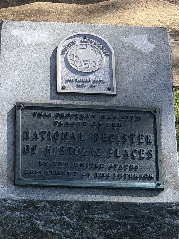
Photographed by Duane and Tracy Marsteller, March 10, 2024
1. Kingston Methodist Church Marker
[Bottom plaque] This property has been placed on the National Register of Historic Places by the United States Department of the Interior
Topics and series. This historical marker is listed in these topic lists: Architecture • Religion & Religious Structures. In addition, it is included in the National Register of Historic Places (NRHP), and the United Methodist Church Historic Sites series lists. A significant historical date for this entry is May 3, 1857.
Location. 31° 23.355′ N, 91° 16.722′ W. Marker is in Kingston, Mississippi, in Adams County. It can be reached from Hutchins Landing Road ¼ mile east of Hillside Plantation Road, on the right when traveling east. Touch for map. Marker is at or near this postal address: 1090 Hutchins Landing Rd, Natchez MS 39120, United States of America. Touch for directions.

Regionally, this marker is in Southwest Mississippi and in Natchez Trace Corridor. It is also in the American South, specifically in the Deep South, and in the Great River Road Region. Globally, it is in North America, a Gulf of Mexico state, the Western
this page online
Other nearby markers. At least 8 other markers are within 9 miles of this marker, measured as the crow flies: In Memory of Samuel Swayze (within shouting distance of this marker); Kingston (about 300 feet away, measured in a direct line); Jersey Settlers (about 300 feet away); a different marker also named Jersey Settlers (approx. one mile away); Wirt Adams's Raid (approx. 6.8 miles away); Mt. Plain B.C. (approx. 7½ miles away); The Forest Plantation (approx. 7.8 miles away); a different marker also named Kingston (approx. 8.4 miles away). Touch for a list and map of all markers in Kingston.
Regarding Kingston Methodist Church. Excerpt from the National Re3gister nomination:
The Kingston Methodist Church is a highly significant example of Greek Revival architecture. This significance is based on the high degree of architectural finish, the excellent exterior and interiorintegrity, the integrity of setting, and the unique manner in which the grand temple form is employed on a small scale in a church building designed to serve the needs of a rural, plantation community. The church was constructed shortly after February 13, 1856, when Alexander Farrar, “desirous of having a new church erected in the Jersey Settlement at or near Kingston for purposes of religious and moral culture,” deeded the present approximate eight-acre tract of land to the trustees of the church (Adams County Deed Book LL:382). Dedicated on May 3, 1857, the Kingston Methodist Church still holds regular religious services and has continually served as the cultural and social center of identity for the residents of the Kingston community.Photographed by Duane and Tracy Marsteller, March 10, 20242. Kingston Methodist Church MarkerMarkers are on the ground at the right corner of the church front.
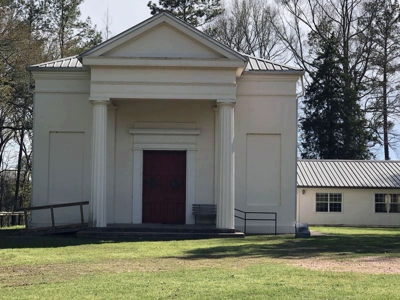
Also see . . . Kingston Methodist Church. National Register nomination (PDF) and photographs (separate PDF) submitted for the church, which was listed in 1982. (Prepared by Mary Warren Miller, Research Consultant to the Historic Natchez Foundation; via National Park Service) (Submitted on March 25, 2024, by Duane and Tracy Marsteller of Murfreesboro, Tennessee.)
Credits. This page was last revised on March 25, 2024. It was originally submitted on March 25, 2024, by Duane and Tracy Marsteller of Murfreesboro, Tennessee. This page has been viewed 321 times since then and 45 times this year. Photos: 1, 2. submitted on March 25, 2024, by Duane and Tracy Marsteller of Murfreesboro, Tennessee.
