East Dover Hundred in Kent County, Delaware — The American Northeast (Mid-Atlantic)
West Dover Hundred
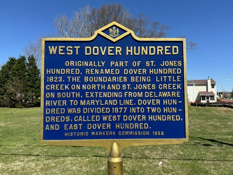
Photographed by Pete Skillman, March 25, 2024
1. West Dover Hundred Marker
Erected 1932 by Historic Markers Comission. (Marker Number KC-10.)
Topics and series. This historical marker is listed in this topic list: Political Subdivisions. In addition, it is included in the Delaware Public Archives series list. A significant historical year for this entry is 1877.
Location. 39° 9.547′ N, 75° 33.473′ W. Marker is in Dover, Delaware, in Kent County. It is in East Dover Hundred. It is on Forest Avenue (Delaware Route 8), on the right when traveling west. Touch for map. Marker is in this post office area: Dover DE 19904, United States of America. Touch for directions.

Regionally, this marker is in the American Mid-Atlantic, on the Delmarva Peninsula, and on the Eastern Seaboard. Globally, it is in the North Atlantic Region, North America, the Western Hemisphere, the Western World, and the Anglosphere.
this page online
Other nearby markers. At least 8 other markers are within 2 miles of this marker, measured as the crow flies: William W.M. Henry Comprehensive High School (approx. 0.9 miles away); Booker T. Washington School (approx. one mile away); Union Lodge No.7, A.F. & A.M. (approx. 1.1 miles away); Eden Hill Farm (approx. 1.2 miles away); Former Site of ILC Dover (approx. 1.2 miles away); Calvary Baptist Church (approx. 1.4 miles away); Mount Zion African Methodist Episcopal Church (approx. 1.4 miles away); Site of Dover's First Methodist Church (approx. 1.6 miles away). Touch for a list and map of all markers in Dover.
More about this marker. Although the marker itself does not have a number on it, the updated online records of the Delaware Public Archives identify it as number "KC-10".
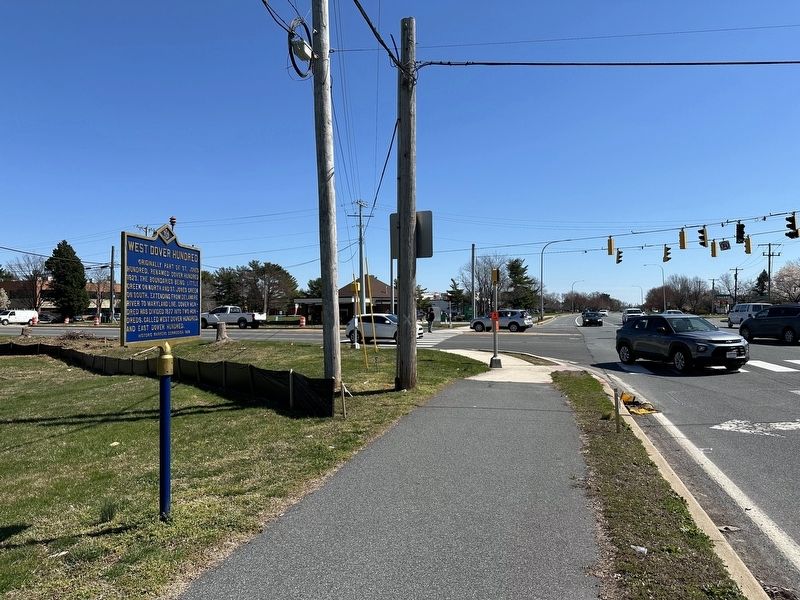
Photographed by Pete Skillman, March 25, 2024
2. West Dover Hundred Marker in context
Credits. This page was last revised on May 15, 2026. It was originally submitted on March 25, 2024, by Pete Skillman of Wilmington, Delaware. This page has been viewed 268 times since then and 23 times this year. Photos: 1, 2. submitted on March 25, 2024, by Pete Skillman of Wilmington, Delaware. • Bill Pfingsten was the editor who published this page.
