Saint Anthony Main in Minneapolis in Hennepin County, Minnesota — The American Midwest (Upper Plains)
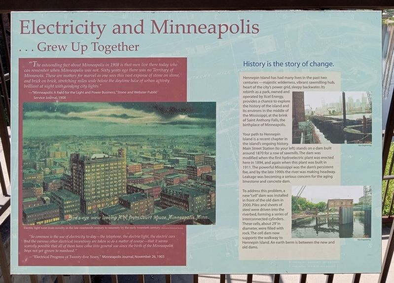
Electricity and Minneapolis
… Grew Up Together
"The astounding fact about Minneapolis in 198 is that men live there today who can remember when Minneapolis was not. Sixty years ago there was no Territory of Minnesota. These are matters for marvel as one sees this vast expanse of stone on stone, and brick on brick, stretching miles wide below the daytime haze of urban activity brilliant at night with winking city lights."
—"Minneapolis: A Field for the Light and Power Business," Stone and Webster Public Service Journal, 1908
Bird's-eye view looking N.W. from Court House, Minneapolis, Minn.
Electric light went from novelty in the late nineteenth century to necessity by the early twentieth century. Minnesota Historical Society
"So common is the use of electricity to-day—the telephone, the electric light, the electric cars and the various other electrical inventions are taken so as a matter of course—that it seems scarcely possible that all of them have come into general use since the birth of the Minneapolis boys not yet grown to manhood."
—"Electrical Progress of Twenty-five Years," Minneapolis Journal, November 26, 1903
History is the story of change.
Hennepin Island has had many lives in the past two centuries—majestic wilderness, vibrant sawmilling hub, heart of the city's power grid, sleepy backwater. Its rebirth as a part, owned and operated by Xcel Energy, provides a chance to explore the history of the island and its environs in the middle of the Mississippi, at the brink of Saint Anthony Falls, the birthplace of Minneapolis.
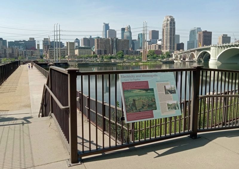
Your path to Hennepin Island is a recent chapter in the island's ongoing history. Main Street Station (to your left) stands on a dam built around 1870 for a row of sawmills. The dam was modified when the first hydroelectric plant was erected here in 1894, and again when this plant was built in 1911. The powerful Mississippi was the dam's persistent foe, and by the late 1990s the river was making headway. Leakage was becoming a serious concern for the aging limestone and concrete dam.
To address this problem, a new "cell" dam was installed in front of the old dam in 2000. Piles and sheets of steel were driven into the riverbed, forming a series of interconnected cylinders. These cells, about 29' in diameter, were filled with rock. The cell dam now supports the walkway to Hennepin Island. An earth berm is between the new and old dams.
Erected by Xcel Energy.
Topics. This historical marker is listed in these topic lists: Industry & Commerce
• Waterways & Vessels. A significant historical year for this entry is 1908.
Location. 44° 59.045′ N, 93° 15.283′ W. Marker is in Minneapolis, Minnesota, in Hennepin County. It is in Saint Anthony Main. Marker is on SE Main Street, on the right when traveling east. The marker is at the entrance to Water Power Park. Touch for map. Marker is at or near this postal address: 206 SE Main Street, Minneapolis MN 55414, United States of America. Touch for directions.
Other nearby markers. At least 8 other markers are within walking distance of this marker. Harnessing Waterpower (a few steps from this marker); Follow the Water: Part 1 - Intake and Tunnel (a few steps from this marker); The Falls That Built the City (a few steps from this marker); Power on the East Side (within shouting distance of this marker); Main Street Builds (about 300 feet away, measured in a direct line); Hydroelectricity: The Early Years (about 300 feet away); Franklin Steele (about 300 feet away); Hydroelectricity Comes of Age (about 400 feet away). Touch for a list and map of all markers in Minneapolis.
Credits. This page was last revised on March 26, 2024. It was originally submitted on March 26, 2024, by McGhiever of Minneapolis, Minnesota. This page has been viewed 50 times since then. Photos: 1, 2. submitted on March 26, 2024, by McGhiever of Minneapolis, Minnesota.

