Thunder Bay in Thunder Bay District, Ontario — Central Canada (North America)
Port Arthur and its Harbour
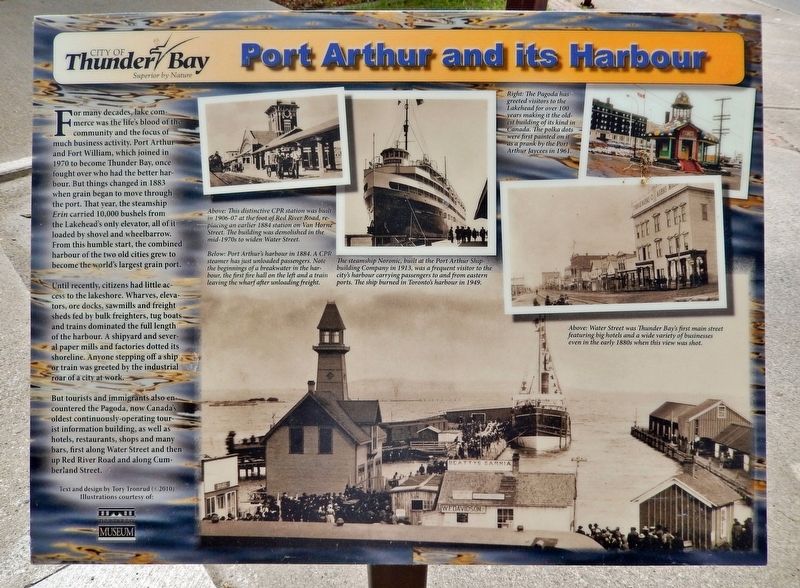
For many decades, lake commerce was the life's blood of the community and the focus of much business activity. Port Arthur and Fort William, which joined in 1970 to become Thunder Bay, once fought over who had the better harbour. But things changed in 1883 when grain began to move through the port. That year, the steamship Erin carried 10,000 bushels from the Lakehead's only elevator, all of it loaded by shovel and wheelbarrow. From this humble start, the combined harbour of the two old cities grew to become the world's largest grain port.
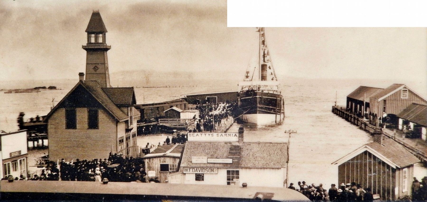
Until recently, citizens had little access to the lakeshore. Wharves, elevators, ore docks, sawmills and freight sheds fed by bulk freighters, tug boats and trains dominated the full length of the harbour. A shipyard and several paper mills and factories dotted its shoreline. Anyone stepping off a ship or train was greeted by the industrial roar of a city at work.
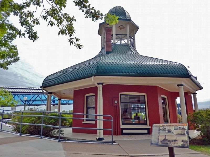
But tourists and immigrants also encountered the Pagoda, now Canada's oldest continuously-operating tourist information building, as well as hotels, restaurants, shops and many bars, first along Water Street and then up Red River Road and along Cumberland Street.
[photo captions]
• This distinctive CPR station was built in 1906-07 at the foot of Red River Road, replacing an earlier 1884 station on Van Horne Street. The building was demolished in the mid-1970s to widen Water Street.
• The steamship Noronic, built at the Port Arthur Shipbuilding Company in 1913, was a frequent visitor to the city's harbour carrying passengers to and from eastern ports. The ship burned in Toronto's harbour in 1949.
• The Pagoda has greeted visitors to the Lakehead for over 100 years making it the oldest building of its kind in Canada. The polka dots were first painted on it as a prank by the Port Arthur Jaycees in 1961.
• Water Street was Thunder Bay’s first main street featuring big hotels and a wide variety of businesses even in the early 1880s when this view was shot.
Illustrations courtesy of
Thunder Bay Museum
Erected by City of Thunder Bay.
Topics. This historical marker is listed in these topic lists: Industry & Commerce • Waterways & Vessels. A significant historical year for this entry is 1883.
Location. 48° 26.072′ N, 89° 13.094′ W. Marker is in Thunder Bay, Ontario, in Thunder Bay District. Marker is on Red River Road just west of North Water Street, on the right when traveling west. The marker is located along the walkway on the west side of the Thunder Bay Tourist Pagoda. Touch for map.
Marker is at or near this postal address: 170 Red River Road, Thunder Bay ON P7A 4K8, Canada. Touch for directions.
Other nearby markers. At least 8 other markers are within walking distance of this marker. The Tourist Pagoda (a few steps from this marker); Thunder Bay Tourist Pagoda (a few steps from this marker); Port Arthur (within shouting distance of this marker); The Railway (within shouting distance of this marker); Red River Road (within shouting distance of this marker); Canadian Northern Railway Station (within shouting distance of this marker); Canadian Navy (about 120 meters away, measured in a direct line); Whalen Building (about 150 meters away). Touch for a list and map of all markers in Thunder Bay.
Also see . . . Port Arthur, Ontario (Wikipedia). Excerpt:
Port Arthur was a city in Northern Ontario, Canada, located on Lake Superior. In January 1970, it amalgamated with Fort William and the townships of Neebing and McIntyre to form the city of Thunder Bay. Port Arthur had been the district seat of Thunder Bay District. It is historically notable as a temporary (1882–1885) eastern terminus of the Canadian Pacific Railway (CPR). It served as a major transshipment point for lakers that carried cargo to Port Arthur from across the Great Lakes. CPR's completion to the east did little to affect the city's importance for shipping; the Canadian Northern Railway was constructed to serve the port, and it built numerous grain silos to supply lakers. This rail and grain trade diminished in the latter half of the 20th century.(Submitted on April 1, 2024, by Cosmos Mariner of Cape Canaveral, Florida.)
Credits. This page was last revised on April 1, 2024. It was originally submitted on March 28, 2024, by Cosmos Mariner of Cape Canaveral, Florida. This page has been viewed 51 times since then. Photos: 1, 2, 3. submitted on April 1, 2024, by Cosmos Mariner of Cape Canaveral, Florida.


