Key West in Monroe County, Florida — The American South (South Atlantic)
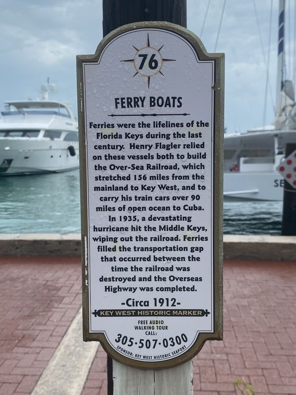
Ferry Boats
-Circa 1912-
Key West Historic Marker
Free Audio Tour Call: 305-507-0300
Erected by Key West Historic Seaport. (Marker Number 76.)
Topics. This historical marker is listed in these topic lists: Disasters • Railroads & Streetcars • Waterways & Vessels. A significant historical year for this entry is 1912.
Location. 24° 33.752′ N, 81° 47.956′ W. Marker is in Key West, Florida, in Monroe County. Marker can be reached from Grinnell Street west of Caroline Street. Touch for map. Marker is at or near this postal address: 201 Grinnell St, Key West FL 33040, United States of America. Touch for directions.
Other nearby markers. At least 8 other markers are within walking distance of this marker. Welcome to Key West's Historic Seaport! (here, next to this marker); Flagler's Train Terminal (within shouting distance of this marker); The Steamplant (within shouting distance of this marker); The Railroad that Died at Sea (about 400 feet away, measured in a direct line); The Maggie Atwell House (about 500 feet away); Key West Electric Company (about 500 feet away); Turtle Kraals Museum (about 500 feet away); Southern Terminus the Over-Sea Railway (about 500 feet away). Touch for a list and map of all markers in Key West.
Credits. This page was last revised on March 31, 2024. It was originally submitted on March 29, 2024, by Darren Jefferson Clay of Duluth, Georgia. This page has been viewed 38 times since then. Photos: 1, 2. submitted on March 30, 2024, by Darren Jefferson Clay of Duluth, Georgia. • Bernard Fisher was the editor who published this page.

