Key West in Monroe County, Florida — The American South (South Atlantic)
La Brisa House
-Circa 1896-
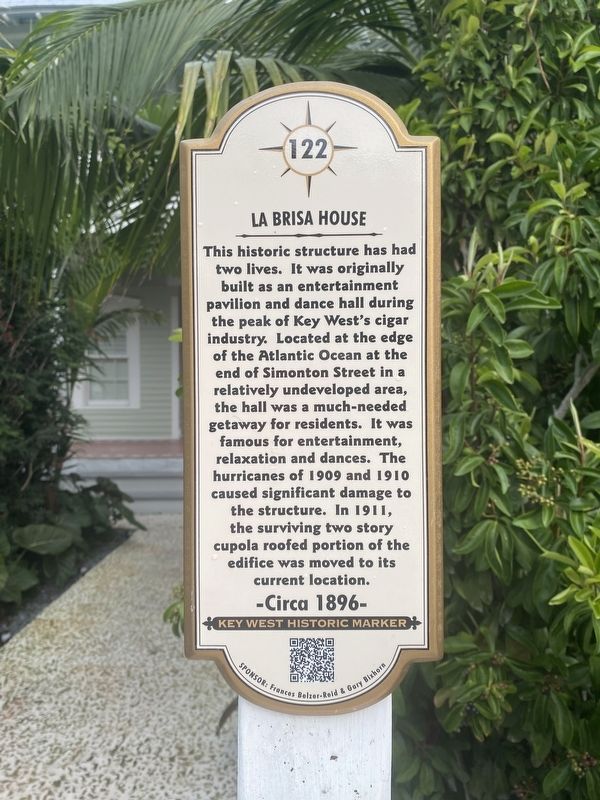
Photographed by Darren Jefferson Clay, March 22, 2024
1. La Brisa House Marker
Erected by Fraces Belzer-Reid & Gary Bixhorn. (Marker Number 122.)
Topics. This historical marker is listed in this topic list: Notable Buildings. A significant historical year for this entry is 1896.
Location. 24° 33.077′ N, 81° 47.405′ W. Marker is in Key West, Florida, in Monroe County. It is on South Street south of Whalton Street, on the right when traveling west. Touch for map. Marker is at or near this postal address: 1013 South St, Key West FL 33040, United States of America. Touch for directions.

Regionally, this marker is on the Florida Keys. It is also in the American
this page online
Other nearby markers. At least 8 other markers are within walking distance of this marker: Josephine Parker City Hall (about 700 feet away, measured in a direct line); Key West City Hall (about 700 feet away); 1846 "Havana" Hurricane (approx. 0.2 miles away); Ferdinand Hirsh Cigar Factory (approx. 0.2 miles away); 1909 & 1910 Hurricanes (approx. 0.2 miles away); El Siboney (approx. 0.2 miles away); "Rambler" Wheel (approx. ¼ mile away); Bruce Hall (approx. ¼ mile away). Touch for a list and map of all markers in Key West.
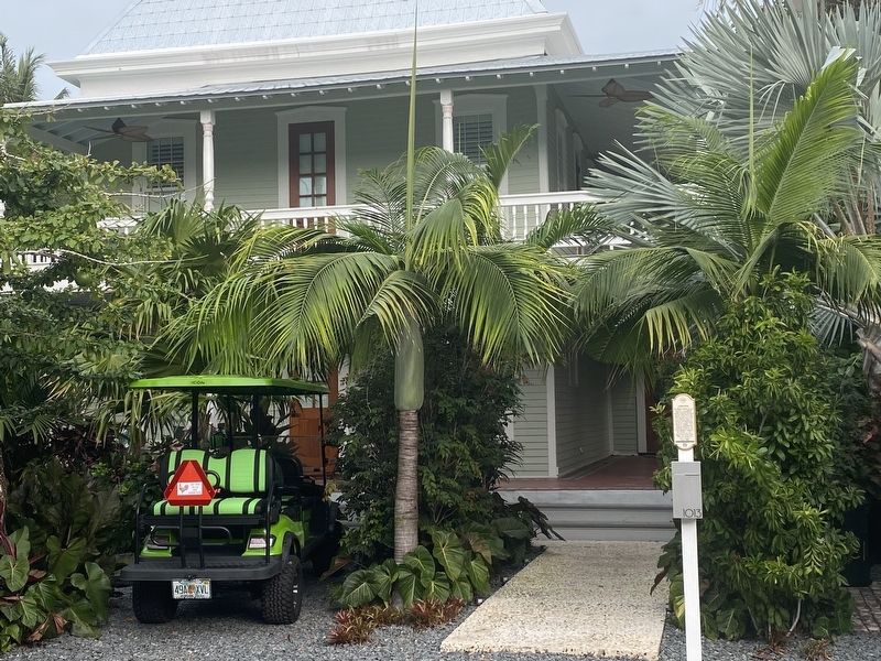
Photographed by Darren Jefferson Clay, March 22, 2024
2. La Brisa House Marker
Credits. This page was last revised on April 8, 2024. It was originally submitted on March 29, 2024, by Darren Jefferson Clay of Duluth, Georgia. This page has been viewed 444 times since then and 77 times this year. Photos: 1, 2. submitted on April 4, 2024, by Darren Jefferson Clay of Duluth, Georgia. • Bernard Fisher was the editor who published this page.
