Gambles Hill in Richmond, Virginia — The American South (Mid-Atlantic)
Tredegar Spike Mill
Topics. This historical marker is listed in these topic lists: Industry & Commerce • Railroads & Streetcars. A significant historical year for this entry is 1957.
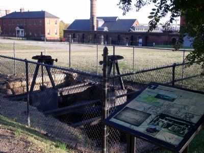
Location. 37° 32.161′ N, 77° 26.767′ W. Marker is in Richmond, Virginia. It is in Gambles Hill. Marker can be reached from Tredegar Street, 0.1 miles west of South 5th Street. This marker is located outside the Civil War Visitor Center at Tredegar Iron Works. Touch for map. Marker is at or near this postal address: 470 Tredegar Street, Richmond VA 23219, United States of America. Touch for directions.
Other nearby markers. At least 8 other markers are within walking distance of this marker. Rutherfoord’s Mill (a few steps from this marker); Cupolas from the Virginia State Penitentiary (within shouting distance of this marker); Worker Housing (within shouting distance of this marker); Rail Lines at Tredegar (within shouting distance of this marker); The Canal and the Civil War (within shouting distance of this marker); Raceways (within shouting distance of this marker); President Lincoln Visits Richmond (within shouting distance of this marker); Tredegar in 1951 (within shouting distance of this marker). Touch for a list and map of all markers in Richmond.
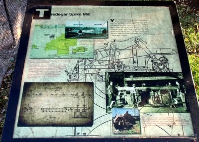
More about this marker. On the upper left is a photograph of the spike mill with the caption, “In 1859 Joseph Reid Anderson built the first spike mill (above) on the ruins of the former Rutherfoord flour mill, just north of where you are standing along the canal.” Also on the left is a site map with the caption, “The 20th century Spike Mill was a much larger building, housing spike machines and several rolling mills.”
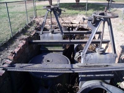
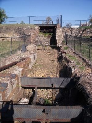
On the lower left is a schematic of the mill's power plant with the caption, “From the mid-19th century to the 1950s the rolling mills, spike machines and other equipment were powered through the use of water turbines, sophisticated water wheels housed in the pit behind you. Water flowed down the hill from the canal in underground “raceways” (the brick openings), and was channeled through metal tubes into the metal cases you can see below ground. The shafts coming upward from the turbines turned a set of gears, transferring power to equipment."
On the lower right is a photograph of a mill in operation with the caption, “Spike production involved reheating meta “billets,” and rolling them into long thin rods. These rods would then be cut into shorter pieces about six feet long. After another heating, the rod was fed into a machine that cut and formed the spike automatically. The photo to the left is a spike machine recovered at the Tredegar plant in Chesterfield County.”
Credits. This page was last revised on February 1, 2023. It was originally submitted on November 11, 2009, by Bernard Fisher of Richmond, Virginia. This page has been viewed 788 times since then and 16 times this year. Photos: 1, 2, 3, 4, 5. submitted on November 11, 2009, by Bernard Fisher of Richmond, Virginia.
