Van Buren in Crawford County, Arkansas — The American South (West South Central)
The Heart of Van Buren
Main Street
Photographed by Mark Hilton, March 19, 2024
1. The Heart of Van Buren Marker
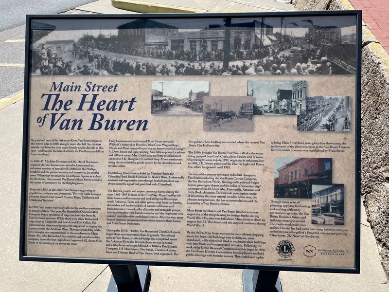
In 1836-37, Mr. John Drennen and Mr. David Thompson acquired the Van Buren town-site which contained an unknown number of acres for $11,000 from the Phillips brothers and the partners conducted a survey to lay out the town. When they set aside the Courthouse Square as a place for the future, they assured Van Buren's Main Street would be the center of commerce for the fledgling town.
From the 1830's to the 1860's Van Buren was growing in population, industry and commerce. The river traffic brought pioneers headed west toward Mexico, Texas, California and Oklahoma Territory.
In 1858, Van Buren was vitally affected by another revolution in transportation. That year, the Butterfield Overland Mail Company began operation of stagecoach service from St. Louis to San Francisco. While there were other Butterfield stage stops at Cedarville and
this page online
Early businesses on and around Main Street included: Wilhauf's bakery; Joe Hawkins/John Greer Wagon Shop; Phelps and Penn engaged in putting up frame houses; George A. Davis house and sign painting. Sam Miles operated a saloon and billiards room. Mrs. Cady's cake and beer establishment sat next to S.D. Daughterty's cabinet shop. Many warehouses along the river held the goods needed by the steamboats and travelers alike.
Hotels along Main Street included the Mansion House, the Columbus Hotel, Brodie Hotel and the Bostick Hotel. As river traffic increased and wagon trains came through headed west, there was always a need for a good bed, good food and a 25 cent bath.
Van Buren's growth and major commerce halted during the years 1862-1865
Photographed by Mark Hilton, March 19, 2024
2. The Heart of Van Buren Marker
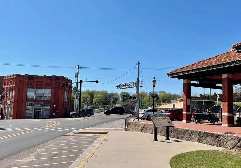
Main St runs from on left and curves left.
During the 1870s'- 1880's, Van Buren and Crawford County began their next important phase of growth. The railroad came to Van Buren, a railroad bridge was completed across the Arkansas River, the first telephone service is noted, and a telephone exchange followed in 1886 by Pan Electric Company, 515 Main Street. Two banks, Crawford County Bank and Citizens Bank of Van Buren, both organized. The first public school building was erected where the current Van Buren City Hall now sits.
The 1890's brought Van Buren First Water Works, the water being pumped from Lee's Creek, about 5 miles west of town. Electric lights came in

Photographed by Mark Hilton, August 3, 2016
3. Crawford County Courthouse on Main Street.
The turn of the century saw many industrial changes to Van Buren, including the Van Buren Cotton Compress, the Van Buren Iron Works, flooring mills, railroad freight depots, passengers depots and the influx of "excursion trip" passengers from St Louis, Mo,. Fayetteville, Arkansas and Little Rock, Arkansas. The railroads were a great source of advertising the many natural wonders of the area, the pleasant temperatures, the fine accommodations and the hospitality of Van Buren's citizens.
Main Street merchants and Van Buren families were very supportive of the troops leaving for foreign battles during World War I. Parades were held down Main Street to drum up support for U.S. War Bonds and this support continued during World War II.
By the 1960's, Main Street was not the once vibrant shopping area it had been. Old buildings were in disrepair, some abandoned, while others had tried to modernize their buildings with false fronts and contemporary materials. Following the work of the Urban Renewal Commission which began in 1968, the Van Buren Historic Commission hired a planner and held public meetings with business owners. They established a plan to bring Main Street back to its glory days showcasing the architecture of the great structures in the Van Buren Historic District, which of course was highlighted by Main Street.
Through many years of planning, applying for funding and working with many government agencies, the Van Buren Historic District and building owners persevered. The results would take years and the District has had issues over time; however, what you see before you is the gift of a beautiful, vibrant and growing Main Street. The Heart of Van Buren.
Erected by Van Buren Lions Club · Williams/Crawford Associates.
Topics. This historical marker is listed in these topic lists: Industry & Commerce • Railroads & Streetcars • Settlements & Settlers. A significant historical month for this entry is July 1897.
Location. 35° 26.217′ N, 94° 21.131′ W. Marker is in Van Buren, Arkansas, in Crawford County. It is at the intersection of Main Street and Fayetteville Road, on the right when traveling west on Main Street. Located on west side of the Arkansas & Missouri Train Depot. Touch for map. Marker is at or near this postal address: 813 Main St, Van Buren AR 72956, United States of America. Touch for directions.

Regionally, this marker is in the Arkansas River Valley, in the Cherokee Heritage Region, and in Osage Territory. It is also in the American South, specifically in the Upper South, and in the Ozarks. Globally, it is in North America, the Western Hemisphere, the Western World, and the Anglosphere. Historically, it finds itself in what was once the territory of the Mississippian Culture, the Louisiana Purchase, one of the Confederate States of America, and the Antebellum South.
Other nearby markers. At least 8 other markers are within walking distance of this marker: The Frisco Depot (within shouting distance of this marker); The Civil War Comes to Van Buren (within shouting distance of this marker); The War Comes Home (within shouting distance of this marker); Veteran's Memorial Plaza (within shouting distance of this marker); Four Freedoms (about 300 feet away, measured in a direct line); The Stars of Freedom ★ ☆ ★ (about 400 feet away); GFWC Women's League Veterans Memorial (about 400 feet away); Camp Jesse Turner (about 400 feet away). Touch for a list and map of all markers in Van Buren.
Related marker. Click here for another marker that is related to this marker. Butterfield Stage Route
Credits. This page was last revised on March 30, 2024. It was originally submitted on March 30, 2024, by Mark Hilton of Montgomery, Alabama. This page has been viewed 686 times since then and 49 times this year. Photos: 1, 2, 3. submitted on March 30, 2024, by Mark Hilton of Montgomery, Alabama.
