Rotterdam-West , South Holland, Netherlands — Northwestern Europe
Herenhuis
⎯⎯⎯
Mansion
Photographed by Andrew Ruppenstein, March 20, 2024
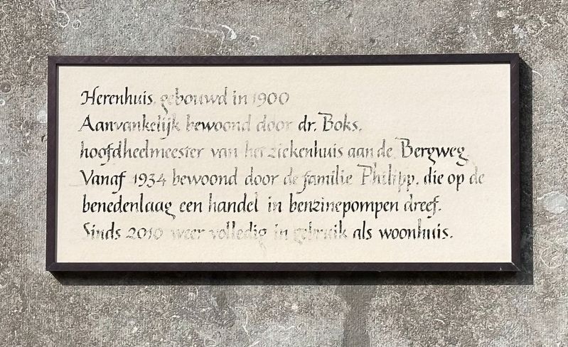
1. Herenhuis / Mansion Marker

Aanvankelijk bewoond door dr. Boks, hoofdheelmeester van het ziekenhuis aan de Bergweg.
Vanaf 1934 bewoond door de familie Philipp, die op de benedenlaag een handel in benzinepompen dreef. Sinds 2010 weer volledig in gebruik als woonhuis.
Mansion built in 1900
Initially occupied by Dr. Boks, head surgeon of the hospital on Bergweg. Inhabited from 1934 by the Philipp family, who had a petrol pump business on the ground floor. Since 2010 it has been fully used as a residential home again.
Topics. This historical marker is listed in this topic list: Notable Buildings. A significant historical year for this entry is 1900.
Location. 51° 54.847′ N, 4° 27.883′ E. Marker is in Rotterdam, Zuid-Holland (South Holland). It is in Rotterdam-West. It is on Nieuwe Binnenweg, on the left when traveling east. Touch for map. Marker is at or near this postal address: Nieuwe Binnenweg 169, Rotterdam, Zuid-Holland 3015 BJ, Netherlands. Touch for directions.

Regionally, it is in Europe, the European Union, Atlantic Europe, the Benelux Low Countries, the Schengen Area,
this page online
Other nearby markers. At least 8 other markers are within walking distance of this marker: Het Israëlietisch Weeshuis / The Jewish Orphanage (about 90 meters away, measured in a direct line); Branco van Dantzig (approx. 0.3 kilometers away); Claes de Vrieselaan (approx. 0.3 kilometers away); Jacobus Henricus van ‘t Hoff (approx. 0.3 kilometers away); Toni Koopmanplein (approx. 0.3 kilometers away); Israëlietisch Oudeliedengesticht / Jewish Old Age Home (approx. 0.4 kilometers away); Lew Jom Sjoel (approx. half a kilometer away); 1ste Middellandstraat (approx. 0.6 kilometers away). Touch for a list and map of all markers in Rotterdam.
Photographed by Andrew Ruppenstein, March 20, 2024
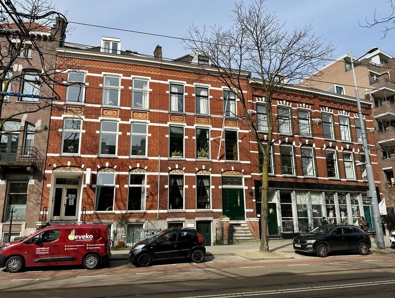
2. Herenhuis / Mansion Marker - wide view
The marker is visible here peeking above the black car in the center of the picture.
Credits. This page was last revised on March 30, 2024. It was originally submitted on March 30, 2024, by Andrew Ruppenstein of Lamorinda, California. This page has been viewed 107 times since then and 6 times this year. Photos: 1, 2. submitted on March 30, 2024, by Andrew Ruppenstein of Lamorinda, California.
