Nauvoo in Hancock County, Illinois — The American Midwest (Great Lakes)
Nauvoo

Photographed by Jason Voight, March 28, 2024
1. Nauvoo Marker
Nauvoo has been designated a Registered National Historic Landmark under the provisions of the Historic Sites Act of August 21, 1935. This site possesses national significance in commemorating the history of the United States.
Erected 1961 by National Park Service - U.S. Department of the Interior.
Topics and series. This historical marker is listed in this topic list: Settlements & Settlers. In addition, it is included in the National Historic Landmarks series list. A significant historical date for this entry is August 21, 1935.
Location. 40° 33.033′ N, 91° 22.999′ W. Marker is in Nauvoo, Illinois, in Hancock County. It is on Bluff Street north of Mulholland Street (Illinois Route 96), on the right when traveling north. Plaque is in Nauvoo City Park, next to Nauvoo City Hall. Touch for map. Marker is at or near this postal address: 60 Bluff St, Nauvoo IL 62354, United States of America. Touch for directions.

Regionally, this marker is in Central Illinois. It is also in the American Midwest, in the Corn Belt, and in the Great River Road Region. Globally, it is in North America, the Western Hemisphere, the Western World,
this page online
Other nearby markers. At least 8 other markers are within walking distance of this marker: Commerce on the River (here, next to this marker); The Prophet's Last Ride (about 600 feet away, measured in a direct line); West Grove (approx. 0.2 miles away); Edward & Anne Hunter Home (approx. 0.2 miles away); William and Elizabeth Jones Property (approx. ¼ mile away); William & Caroline Weeks Home (approx. ¼ mile away); Nauvoo's Wards (approx. ¼ mile away); "O My Father" (approx. ¼ mile away). Touch for a list and map of all markers in Nauvoo.
Also see . . . Nauvoo Historic District on Wikipedia. The historic district, which is located west of town, was designated a National Historic District. This includes buildings such as Joseph Smith's Mansion House and his burial spot, Brigham Young House, Nauvoo Visitors Center, as well as many old restored shops. Some of the buildings are private residences. In the mid-1950s, preservationists were beginning to restore the old Mormon places.
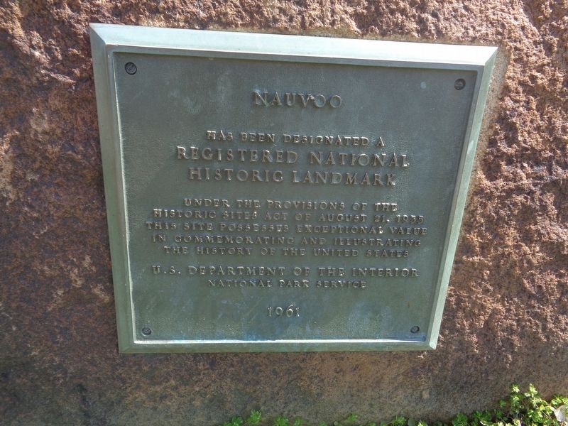
Photographed by Jason Voigt, March 28, 2024
2. Nauvoo Marker
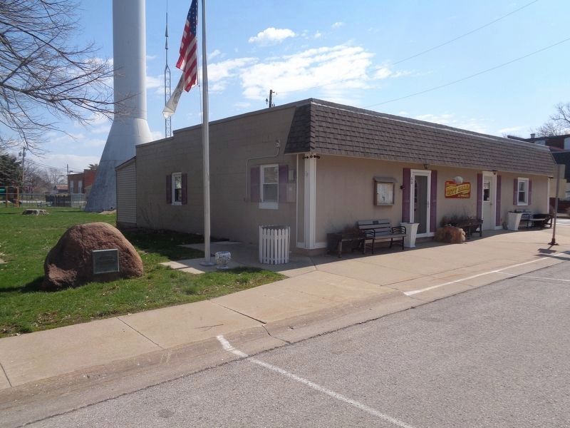
Photographed by Jason Voigt, March 28, 2024
3. Nauvoo Marker
Located at Nauvoo City Park and next to Nauvoo City Hall.
Credits. This page was last revised on November 23, 2024. It was originally submitted on March 31, 2024, by Jason Voigt of Glen Carbon, Illinois. This page has been viewed 686 times since then and 98 times this year. Photos: 1. submitted on May 14, 2024. 2, 3. submitted on March 31, 2024, by Jason Voigt of Glen Carbon, Illinois.
