Benning Ridge in Southeast Washington in Washington, District of Columbia — The American Northeast (Mid-Atlantic)
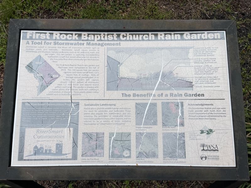
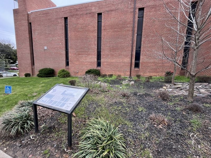
First Rock Baptist Church Rain Garden
A Tool for Stormwater Management

Photographed By Devry Becker Jones (CC0), March 30, 2024
1. First Rock Baptist Church Rain Garden Marker
Stormwater runoff is rainwater that flows off impervious surfaces such as rooftops, roads, and sidewalks. Runoff causes erosion in streambeds and displaces harmful pollutants such as oil, sediment, trash, and pet waste. This rain garden is capturing and infiltrating stormwater runoff that would otherwise run directly to Rock Creek and then eventually into the Potomac River.
The First Rock Baptist Church rain garden and BayScape were completed in the Fall of 2014. This 150 square foot rain garden captures and treats runoff from 1,872 square feet of rooftop. With an average annual precipitation of 42 inches, the garden will capture around 1,416.5 gallons of stormwater each 1.2" rain event, and around 42,833 gallons each year. This garden is planted with native plants that tolerate both wet conditions and periods of drought. These plants attract native wildlife such as butterflies and birds.
The Benefits of a Rain Garden
Rainwater flows to the rain garden, reducing erosion by capturing and holding onto stormwater runoff.
Native plants create natural habitat for birds and butterflies.
Surface layer of plants and mulch help to remove pollutants that are picked up by rainwater runoff.
Engineered soils help to infiltrate rainwater and maintain our natural hydrology.
Gravel drainage layer.
Sustainable Landscaping
Native plants provide wildlife habitat and reduce the need for pesticides and herbicides. These plants also require less maintenance and less watering. The principles of sustainable design have been applied in many other regions, and are referred to by a variety of terms including "BayScaping" or "conservation landscaping."
Virginia Sweetspire Itea Virginica • Butterfly weed Asclepias tuberosa • Little Joe Pye Weed Eupatorium dubium 'Little Joe' • Marsh Hibiscus Hibiscus moscheutos • Lady fern Athyrium filix-femina • Blue Eyed Grass Sisyrinchium angustifolium
Acknowledgements
This bioretention feature and sign were made possible with funds from the District Department of the Environment through a program administered by the Anacostia Watershed Society.
The RiverSmart Communities Program
The RiverSmart Communities program provides financial and technical assistance to commercial properties, embassies, houses of worship, property owners, residents and managers of multi-family residential housing, small businesses, and universities. This program helps to install stormwater Best Management Practices (BMPs) to better manage stormwater runoff to prevent it from entering our streams and

Photographed By Devry Becker Jones (CC0), March 30, 2024
2. First Rock Baptist Church Rain Garden Marker
To apply visit http://ddoe.dc.gov/service/riversmart-communities or call (202) 654-6131 for more information.
Erected by DC Department of the Environment; Watershed Stewards Academy; Anacostia Watershed Society; First Rock Baptist Church.
Topics. This historical marker is listed in these topic lists: Churches & Religion • Environment. A significant historical year for this entry is 2014.
Location. 38° 52.806′ N, 76° 56.377′ W. Marker has been reported damaged. Marker is in Southeast Washington in Washington, District of Columbia. It is in Benning Ridge. Marker is on G Street Southeast just west of Alabama Avenue Southeast, on the left when traveling west. Touch for map. Marker is at or near this postal address: 4630 Alabama Ave SE, Washington DC 20019, United States of America. Touch for directions.
Other nearby markers. At least 8 other markers are within walking distance of this location. First Rock Baptist Church (a few steps from this marker); Woodlawn Cemetery (approx. 0.4 miles away); Fort DuPont (approx. half a mile away); a different marker also named Fort DuPont (approx. half a mile away); Fort Chaplin (approx. half a mile away); Original Federal Boundary Stone, District of Columbia, Southeast 2 (approx. 0.6 miles away in Maryland); St. John Baptist Church of Marshall Heights, SE, Inc.
More about this marker. The market has significantly weathered but remains generally legible.
Credits. This page was last revised on March 31, 2024. It was originally submitted on March 31, 2024, by Devry Becker Jones of Washington, District of Columbia. This page has been viewed 32 times since then. Photos: 1, 2, 3. submitted on March 31, 2024, by Devry Becker Jones of Washington, District of Columbia.
