Bourbon in Marshall County, Indiana — The American Midwest (Great Lakes)
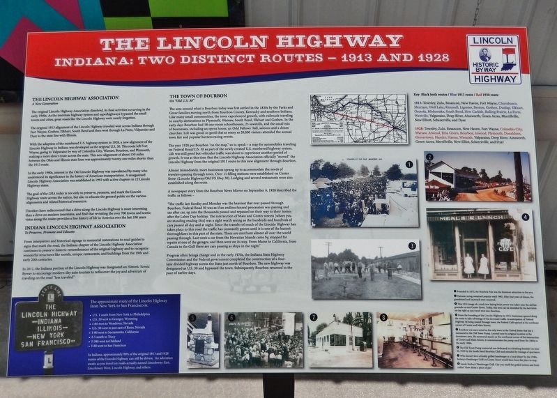
The Lincoln Highway
Indiana: Two Distinct Routes - 1913 and 1928
The Lincoln Highway Association
A New Generation
The original Lincoln Highway Association dissolved, its final activities occurring in the early 1940s. As the interstate highway system and superhighways bypassed the small towns and cities, great roads like the Lincoln Highway were nearly forgotten.
The original 1913 alignment of the Lincoln Highway traveled west across Indiana through Fort Wayne, Goshen, Elkhart, South Bend and then west through La Porte, Valparaiso and Dyer to the state line with Illinois.
With the adoption of the numbered U.S. highway system in 1928, a new alignment of the Lincoln Highway in Indiana was developed as the original U.S. 30. This route left Fort Wayne, going to Valparaiso by way of Columbia City, Warsaw, Bourbon, and Plymouth, making a more direct route across the state. This new alignment of about 150 miles between the Ohio and Illinois state lines was approximately twenty-one miles shorter than the 1913 route.
In the early 1990s, interest in the Old Lincoln Highway was reawakened by many who understood its significance in the history of American transportation. A reorganized Lincoln Highway Association was established in 1992 with active chapters in 12 Lincoln Highway states.
The goal of the LHA today is not only to preserve, promote, and mark the Lincoln Highway route across the nation, but also to educate the general public on the various alignments and related historical resources.
Travelers have rediscovered that a drive along the Lincoln Highway is more interesting than a drive on modern interstates, and find that revisiting the over 700 towns and scenic vistas along the routes provides a fine history of life in America over the last 100 years.
Indiana Lincoln Highway Association
To Preserve, Promote and Educate
From interpretive and historical signage to memorial restorations to road guides to signs that mark the road, the Indiana chapter of the Lincoln Highway Association continues to preserve historic remembrances of the original highway and to recognize wonderful structures like motels, unique restaurants, and buildings from the 19th and early 20th centuries.
In 2011, the Indiana portion of the Lincoln Highway was designated an Historic Scenic Byway to encourage modern-day auto tourists to rediscover the joy and adventure of traveling on the road "less traveled."
The Town of Bourbon
On "Old U.S. 30"
The area around what is Bourbon today was first settled in the 1830s by the Parks and Greer families moving north from Bourbon County, Kentucky and southern Indiana. Like many small communities, the town experienced growth, with railroads traveling
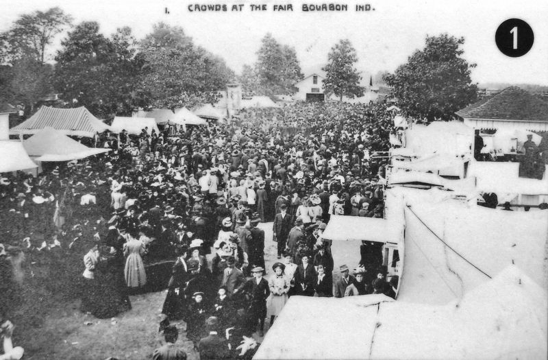
to nearby destinations in Plymouth, Warsaw, South Bend, Elkhart and Goshen. In the early days Bourbon had 18 one-room schoolhouses, 25 sawmills, and the usual mix of businesses, including an opera house, an Odd Fellows Hall, saloons and a dozen churches. Life was good; so good that as many as 20,000 visitors attended the annual town fair and popular harness racing events.
The year 1928 put Bourbon "on the map," so to speak — a map for automobiles traveling on Federal Road/U.S. 30 as part of the newly created U.S. numbered highway system. Life was still good but vehicular traffic was about to experience another period of growth. It was at this time that the Lincoln Highway Association officially "moved" the Lincoln Highway from the original 1913 route to this new alignment through Bourbon.
Almost immediately, more businesses sprang up to accommodate the needs of travelers passing through town. Over 11 filling stations were established on Center Street (Lincoln Highway/Old US Hwy 30). Lodging and several restaurants were also established along the route.
A newspaper story from the Bourbon News Mirror on September 6, 1928 described the traffic as follows —
"The traffic last Sunday and Monday was the heaviest that ever passed through Bourbon. Federal Road 30 was as if an endless funeral procession was passing and car after car, up into the thousandsProgress often brings change and in the early 1970s, the Indiana State Highway Commission and the Federal government completed the construction of a four-lane divided highway across the State just north of Bourbon. The new highway was designated as U.S. 30 and bypassed the town. Subsequently Bourbon returned to the pace of earlier days.passed and repassed on their way to their homes after the Labor Day holiday. The intersection of Main and Center streets [where you are standing reading this] was a sight worth seeing as the hundreds and hundreds of cars passed all day and at night. Since the transfer of much of the Lincoln Highway has taken place to this road the traffic has constantly grown until it is one of the busiest thoroughfares in this part of the state. There are cars from almost all over the world passing through. Last week a car from the Hawaiian Islands came by, stopped for repairs at one of the garages, and then went on its way. From Maine to California, from Canada to the Gulf there are cars passing as ships in the night."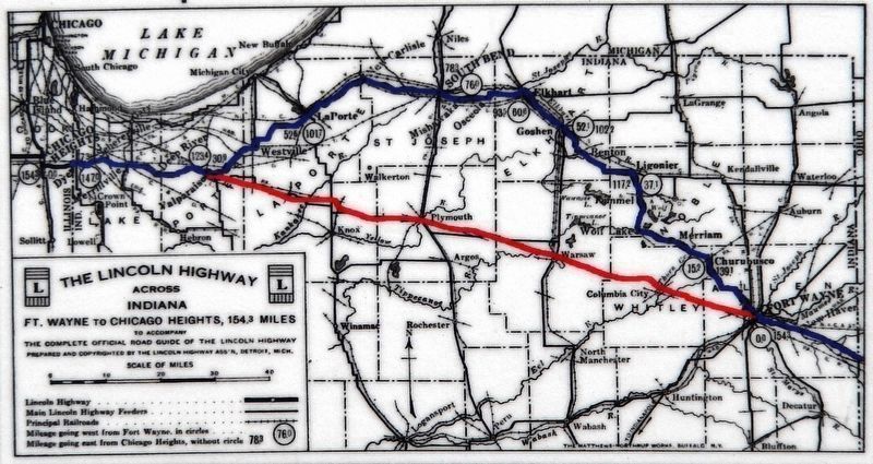 3. Marker detail: The Lincoln Highway Across IndianaKey: Black both routes / Blue 1913 route / Red 1928 route
1913: Townley, Zulu, Besancon, New Haven, Fort Wayne, Churubusco, Merriam, Wolf Lake, Kimmell, Ligonier, Benton, Goshen, Dunlap, Elkhart, Osceola, Mishawaka, South Bend, New Carlisle, Rolling Prairie, La Porte, Westville, Valparaiso, Deep River, Ainsworth, Green Acres, Merrillville, New Elliott, Schererville, and Dyer
1928: Townley, Zulu, Besancon, New Haven, Fort Wayne, Columbia City, Warsaw, Atwood, Etna Green, Bourbon, Inwood, Plymouth, Donaldson, Grovertown, Hamlet, Hanna, Wanatah, Valparaiso, Deep River, Ainsworth, Green Acres, Merrillville, New Elliot, Schererville, and Dyer
[sidebar]
The approximate route of the Lincoln Highway from New York to San Francisco is:
• U.S. 1 south from New York to Philadelphia
• U.S. 30 west to Granger, Wyoming
• I-80 west to Wendover, Nevada
• U.S. 50 west to just east of Reno, Nevada
• I-80 west to Sacramento, California
• I-5 south to Tracy
• I-580 west to Oakland
• I-80 west to San Francisco
In Indiana, approximately 90% of the original 1913 and 1928 routes of the Lincoln Highway can still be driven. An adventure awaits as you travel on roads actually named Lincolnway East, Lincolnway West, Lincoln Highway, and others.
[photo legend]
1 • Founded in 1872, the Bourbon Fair was the foremost attraction in the area.
2 • Harness racing remained popular until 1962. After four years of disuse, the grandstand and racetrack were removed.
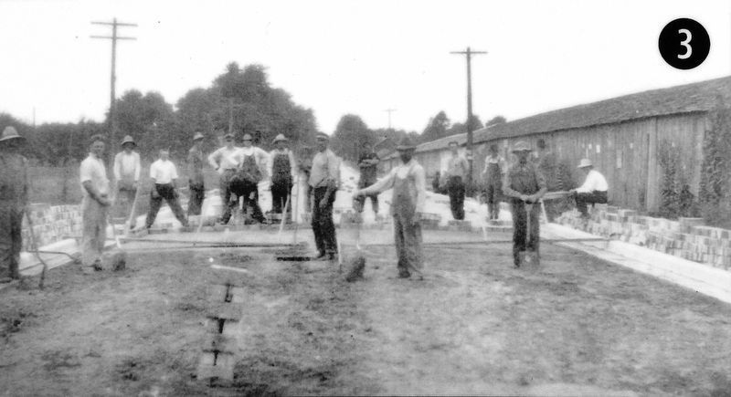
3 • This 1912 image of a road crew laying brick pavers was taken near the old fair grounds on east Center Street. Today, this area can be identified by the ball fields on the right as you travel west into Bourbon.
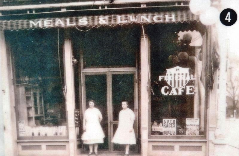
4 • From the founding of the Lincoln Highway in 1913, businesses opened along the route to take advantage of the increased traffic. In anticipation of Federal Highway 30 being routed through town, the Federal Café opened at the northeast corner of Center and Main Streets.
5 • Bourbon was once noted as the only town in the United States that has a memorial to the Old Town Pump. Located near its original location in the downtown area, the memorial stands on the northwest corner of the intersection of Center and Main Streets. It commemorates the pump used from the 1860s to the early 1900s.
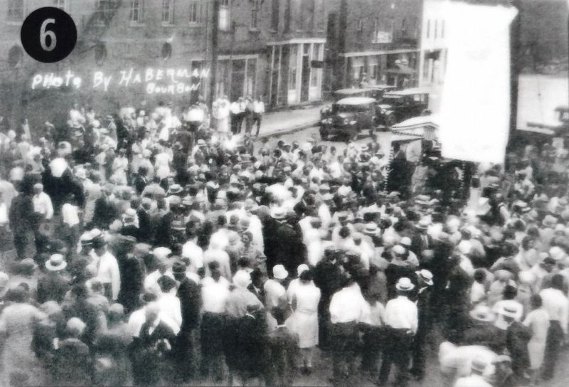
6 • The Old Town Pump memorial was dedicated as a drinking fountain on June 30, 1929 by the South Bend Bourbon Club and attended by throngs of spectators.
7 • Who doesn't love a freshly grilled hamburger at a local diner? In the 1940s, Berkey's Hamburger Grill on Center Street would have been the place to stop.
8 • Inside Berkey's Hamburger Grill. Can you smell the grilled onions and fresh coffee? How about a piece of pie?
Topics and series. This historical marker is listed in these topic lists: Charity & Public Work • Industry & Commerce • Roads & Vehicles. In addition, it is included in the Lincoln Highway series list.
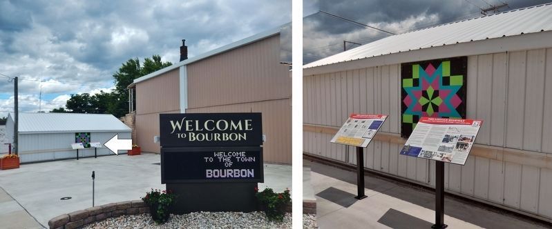
Location. 41° 17.725′ N, 86° 6.955′ W. Marker is in Bourbon, Indiana, in Marshall County. Marker is at the intersection of South Main Street (Indiana Route 331) and Lincoln Highway (Center Street), on the right when traveling north on South Main Street. Marker is located in the Bourbon Farmers Market plaza at the southeast corner of the intersection. Touch for map. Marker is at or near this postal address: 103 South Main Street, Bourbon IN 46504, United States of America. Touch for directions.
Other nearby markers. At least 8 other markers are within 4 miles of this marker, measured as the crow flies. A different marker also named The Lincoln Highway (here, next to this marker); The Bourbon Boys (within shouting distance of this marker); Old Town Pump (within shouting distance of this marker); Parks IOOF Cemetery (approx. 0.4 miles away); Early Bourbon Cemetery (approx. half a mile away); Pleasant Hill Cemetery (approx. 1½ miles away); Mount Pleasant South Cemetery (approx. 3.7 miles away); Mount Pleasant North Cemetery (approx. 3.7 miles away). Touch for a list and map of all markers in Bourbon.
Related markers. Click here for a list of markers that are related to this marker.
Credits. This page was last revised on April 2, 2024. It was originally submitted on October 29, 2021, by Cosmos Mariner of Cape Canaveral, Florida. This page has been viewed 351 times since then and 62 times this year. Last updated on April 1, 2024, by Lou Donkle of Valparaiso, Indiana. Photos: 1, 2, 3, 4, 5, 6, 7. submitted on October 29, 2021, by Cosmos Mariner of Cape Canaveral, Florida. • Devry Becker Jones was the editor who published this page.
