Kranzburg in Codington County, South Dakota — The American Midwest (Upper Plains)
Holy Rosary Catholic Church
March 31, 2024
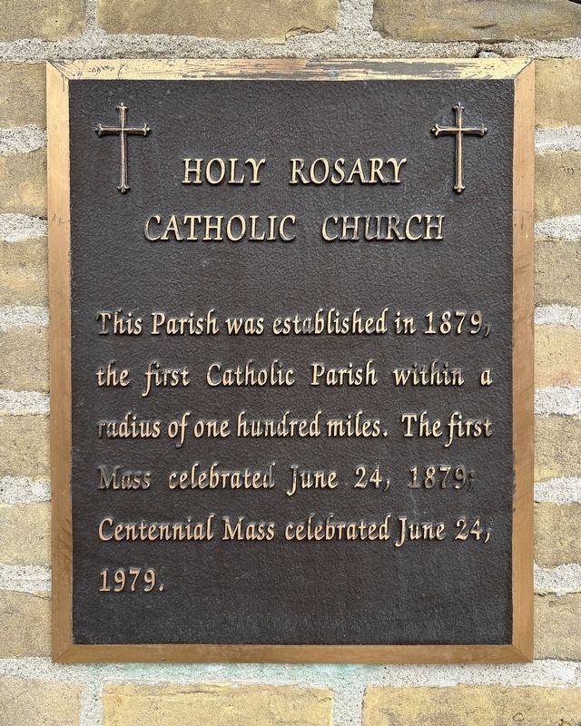
1. Holy Rosary Catholic Church Marker
Topics and series. This historical marker is listed in this topic list: Religion & Religious Structures. In addition, it is included in the National Register of Historic Places (NRHP) series list. A significant historical date for this entry is June 24, 1879.
Location. 44° 53.581′ N, 96° 55.072′ W. Marker is in Kranzburg, South Dakota, in Codington County. It is on Minnesota Avenue south of Saint Joseph Street Northwest, on the right when traveling north. Touch for map. Marker is at or near this postal address: 204 Minnesota Ave, Kranzburg SD 57245, United States of America. Touch for directions.

Regionally, this marker is in East River. It is also in the American Midwest, in the Lewis & Clark Corridor, in the Corn Belt, on the prairies, and on the Northern Plains. Globally, it is in North America, the Western Hemisphere, the Western World, and the Anglosphere. Historically, it finds itself in what was once Rupert’s Land and also the Louisiana
this page online
Other nearby markers. At least 8 other markers are within 10 miles of this marker, measured as the crow flies: Holy Rosary Cemetery of Kranzburg / Holy Rosary Catholic Church (about 300 feet away, measured in a direct line); District No. 5 Public School (approx. 0.2 miles away); Dedicated to Veterans (approx. 9 miles away); Mount Hope Cemetery Mausoleum (approx. 9 miles away); Freeman Thayer Post Memorial (approx. 9 miles away); Public Opinion & City Hall (approx. 9.4 miles away); Downtown History (approx. 9.4 miles away); Retail Building (approx. 9½ miles away). Touch for a list and map of all markers in Kranzburg.
Also see . . . South Dakota SP Holy Rosary Church | National Archives NextGen Catalog. (Submitted on April 1, 2024.)
March 31, 2024
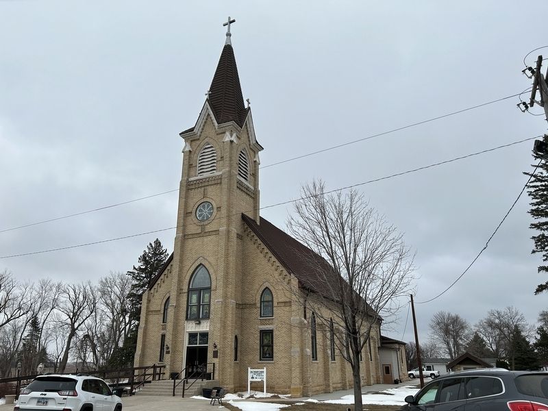
2. Holy Rosary Catholic Church & Marker
March 31, 2024
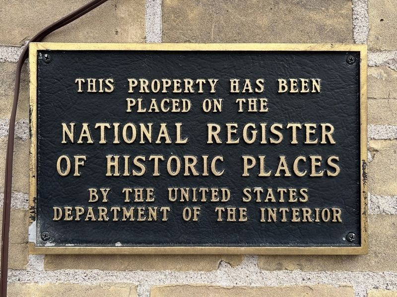
3. Holy Rosary Church NRHP Marker
Credits. This page was last revised on April 2, 2024. It was originally submitted on April 1, 2024. This page has been viewed 411 times since then and 63 times this year. Photos: 1, 2, 3. submitted on April 1, 2024.
