Princeton in Caldwell County, Kentucky — The American South (East South Central)
William Prince
Founder of Princeton
| — | Born May 19, 1752 - Died August 10, 1810 | — |
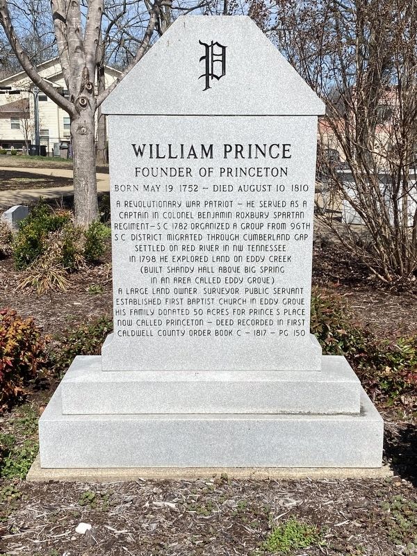
Photographed by Darren Jefferson Clay, March 16, 2024
1. William Prince Marker
Topics. This historical marker is listed in these topic lists: Settlements & Settlers • War, US Revolutionary.
Location. 37° 6.485′ N, 87° 52.819′ W. Marker is in Princeton, Kentucky, in Caldwell County. It is at the intersection of East Market Street and Hopkinsville Street, on the left when traveling east on East Market Street. Touch for map. Marker is at or near this postal address: 206 E Market St, Princeton KY 42445, United States of America. Touch for directions.

Regionally, this marker is in the American Midwest,
this page online
Other nearby markers. At least 8 other markers are within walking distance of this marker: Shandy Hall (Princeton) (within shouting distance of this marker); William Prince, 1752-1810 / Founder of Princeton (within shouting distance of this marker); a different marker also named Shandy Hall (Princeton) (about 400 feet away, measured in a direct line); Trail of Tears (about 400 feet away); County Named, 1809 (about 500 feet away); Black Patch War (about 700 feet away); Courthouse Burned (about 700 feet away); Ogden Memorial United Methodist Church (approx. ¼ mile away). Touch for a list and map of all markers in Princeton.
Another marker is no longer nearby. Converging of Indian Trails (was about 400 feet away but has been confirmed missing).

Photographed by Darren Jefferson Clay, March 16, 2024
2. William Prince Marker
Credits. This page was last revised on April 6, 2024. It was originally submitted on April 3, 2024, by Darren Jefferson Clay of Duluth, Georgia. This page has been viewed 302 times since then and 40 times this year. Photos: 1, 2. submitted on April 4, 2024, by Darren Jefferson Clay of Duluth, Georgia. • James Hulse was the editor who published this page.
