Nauvoo in Hancock County, Illinois — The American Midwest (Great Lakes)
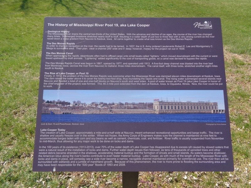
The History of Mississippi River Pool 19, aka Lake Cooper
Nauvoo Riverwalk
Inscription.
Geological History
The Mississippi River drains two-thirds of the United States. With the advance and decline of ice ages, the course of the river has changed many times. Submerged limestone stretched nearly bluff to bluff, resulting in a water depth of just two to three feet with a very strong current as the river raced down a steep gradient from Nauvoo to Keokuk, Iowa. All came together to create what was known as the Des Moines Rapids.
The Des Moines Rapids
In order to improve navigation on the river, the rapids had to be tamed. In 1837, the U.S. Army ordered Lieutenants Robert E. Lee and Montgomery C. Meigs to survey the area. Their plan: clear a channel 200' wide and 5' deep; however, money for the project ran out in 1839.
The Des Moines Canal
When approaching the rapids, steamboats often had to offload cargo onto small boats called "lighters," which moved downstream with the current or were towed upstream by draft animals. "Lightering" added significantly to the cost of transporting goods, so a canal was devised to bypass the rapids.
The Des Moines Rapid Canal was begun in 1867, opened by 1877, and operated until 1913. A five-foot deep channel was blasted into the river bed from Montrose, Iowa. (across the river from Nauvoo) to Galland, three miles downstream. The canal itself, with three locks, stretched another eight miles south to Keokuk.
The Rise of Lake Cooper, or Pool 19
Finally, in 1913, the problem of the Des Moines Rapids was overcome when the Mississippi River was dammed eleven miles downstream at Keokuk, Iowa. The dam raised the water above it to cover the twenty-two-foot drop, thus inundating the rapids and canal. The rising water submerged several islands near Nauvoo and flooded a total of one and one-half blocks on Nauvoo's south and west sides. A pool of water known as Pool 19 (aka Lake Cooper in honor of the chief engineer of the project) was formed. This 46.3-mile pool extended from the dam at Keokuk, Iowa, to Oquawka, Illinois. Now, the river could be put to work.
Lake Cooper Today
The creation of Lake Cooper, approximately a mile-and-a-half wide at Nauvoo, meant enhanced recreational opportunities and barge traffic. The river is shallow and usually freezes over in the winter. When not frozen, the Army Corps of Engineers makes sure the channel is maintained at nine feet to accommodate barges laden with corn and soy beans as well as cement, chemicals, coal, and fertilizer. River traffic is usually suspended from November to mid-March, thus allowing for any major work to be done on locks and dams.
In the 100 years of its existence (1913-2013), over 70% of the water
depth of Lake Cooper has disappeared due to excess silt caused by slowed waters that were a natural result of the installation of locks and dams. Further water-depth issues then followed, as tens of thousands of uprooted trees and other related debris became stranded in the shallows, accelerating material buildup and the formation of shoals and small islands. As waters become shallower, the American lotus along the river's banks contribute to even faster material buildup. Lake Cooper, as with much of the length of the Mississippi River with locks and dams in place, will someday see a wide river become a narrow, navigable channel maintained primarily for commercial use. The river then will be surrounded with wetlands and a jumble of marshland growth. Because of this phenomenon, the river is more prone to flooding the surrounding area and may have been responsible for the "500-year" floods of 1993 and 2008.
Topics. This historical marker is listed in this topic list: Waterways & Vessels. A significant historical year for this entry is 1837.
Location. 40° 32.447′ N, 91° 23.621′ W. Marker is in Nauvoo, Illinois, in Hancock County. Marker is on Water Street west of Granger Street, on the right when traveling east. Touch for map. Marker is at or near this postal address: 575 Water St, Nauvoo IL 62354, United States of America. Touch for directions.
Other nearby markers. At least 8 other markers are within walking distance of this marker. Joseph Smith's Red Brick Store (within shouting distance of this marker); Smith Family Cemetery (about 400 feet away, measured in a direct line); Joseph, Emma and Hyrum Smith (about 400 feet away); The Mississippi Flyway (about 400 feet away); Joseph Smith, Sr. and Lucy Mack Smith (about 400 feet away); Smith Family Homestead (about 500 feet away); Nauvoo Survey Stone (about 500 feet away); Bidamon Stable (about 600 feet away). Touch for a list and map of all markers in Nauvoo.
Credits. This page was last revised on April 4, 2024. It was originally submitted on April 4, 2024, by Jason Voigt of Glen Carbon, Illinois. This page has been viewed 51 times since then. Photos: 1, 2. submitted on April 4, 2024, by Jason Voigt of Glen Carbon, Illinois.

