Smithfield in Isle of Wight County, Virginia — The American South (Mid-Atlantic)
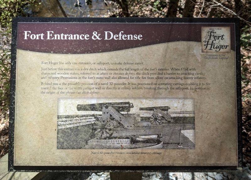
Fort Entrance & Defense
Gateway to the Confederate Capital
— Historic Fort Huger —
Just before this entrance is a dry ditch which extends the full length of the fort's exterior. When filed with sharpened wooden stakes, referred to as abatis or chevaux de frise, the ditch provided a barrier to attacking cavalry and infantry. Protrusions in the fort's outer wall also allowed for rifle fire from above on attacking enemy infantry.
Behind you is the probable position of a naval 32-pounder. It was positioned on a rotating carriage enabling it to fire toward the face of the north parapet wall or directly at enemy soldiers breaking through the sallyport. Its position is the origin of the phrase last ditch defense
(caption) Naval 32-pounder cannon on a similar rotating carriage
Erected by Isle of Wight County.
Topics. This historical marker is listed in these topic lists: Forts and Castles • War, US Civil.
Location. 37° 6.577′ N, 76° 39.505′ W. Marker is in Smithfield, Virginia, in Isle of Wight County. Marker can be reached from the intersection of Talcott Terrace and Lawnes Neck Drive, on the right when traveling east. Touch for map. Marker is at or near this postal address: 15080 Talcott Ter, Smithfield VA 23430, United States of America. Touch for directions.
Other nearby markers. At least 8 other markers are within walking distance of this marker. The Fort (within shouting distance of this marker); Powder Magazine (within shouting distance of this marker); African Americans at Fort Huger (within shouting distance of this marker); Hot Shot Furnace & Shell House (within shouting distance of this marker); The Historic James and its Tributaries (within shouting distance of this marker); Fort Architecture (within shouting distance of this marker); North Bastion (about 300 feet away, measured in a direct line); South Bastion (about 300 feet away). Touch for a list and map of all markers in Smithfield.
Also see . . . Fort Huger. Isle of Wight County Museum (Submitted on April 6, 2024.)
Credits. This page was last revised on April 6, 2024. It was originally submitted on April 5, 2024, by Bernard Fisher of Richmond, Virginia. This page has been viewed 48 times since then. Photos: 1. submitted on April 5, 2024, by Bernard Fisher of Richmond, Virginia. 2. submitted on April 6, 2024, by Bernard Fisher of Richmond, Virginia.

