Lewes in Sussex County, Delaware — The American Northeast (Mid-Atlantic)
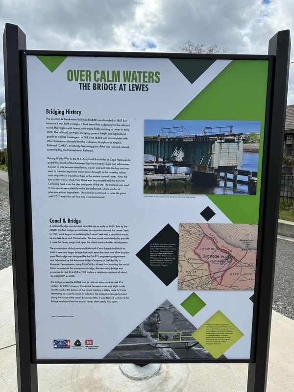
Over Calm Waters
The Bridge at Lewes
Bridging History
The Junction & Breakwater Railroad (J&BRR) was founded in 1857 but because it was built in stages, it took more than a decade for the railroad to link Harrington with Lewes, with trains finally running to Lewes in early 1870. The railroad ran trains carrying general freight and agricultural goods as well as passengers. In 1883 the J&BRR was consolidated with other Delaware railroads into the Delaware, Maryland & Virginia Railroad (DM&V), eventually becoming part of the vast railroad network controlled by the Pennsylvania Railroad.
During World War II, the U.S. Army built Fort Miles at Cape Henlopen to guard the mouth of the Delaware Bay from enemy ships and submarines. As part of this defense installation, a pier was built into the bay and was used to transfer explosive naval mines brought to the coast by railcar onto ships which would lay them in the waters around Lewes. After the end of the war in 1945, Fort Miles was deactivated and the Barcroft Company took over the pier and parts of the site. The railroad was used to transport raw materials to the Barcroft plant, which produced pharmaceutical ingredients. The railroad continued to serve the plant until 2017 when the rail line was decommissioned.
Canal & Bridge
A railroad bridge was located near this site as early as 1869. Built by the J&BRR, this first bridge was a timber structure that crossed the Lewes Creek. In 1913, work began on widening the Lewes Creek into a canal that would be six-feet deep and 50-feet wide. The new canal was intended to provide a route for heavy cargo and open the inland area to further development.
The construction of the Lewes and Rehoboth Canal forced the DM&V to build a new and larger bridge that could span the canal and allow boats to pass. The bridge was designed by DM&V's engineering department and fabricated by the American Bridge Company at their facility in Pencoyd, Pennsylvania, using 116,000 lbs. of steel. Not counting the cost of labor or material for a temporary bridge, the new swing bridge was projected to cost $24,658 in 1915 dollars-a relative project cost of about $4,020,000* in 2020.
The bridge served the DM&V and its railroad successors into the 21st century. By 2017, however, it had sunk between seven and eight inches into the mud at the bottom of the canal, creating a safety issue for trains attempting to cross the canal. In addition, the bridge had caused erosion along the banks of the canal. Because of this, it was decided to remove the bridge, ending rail service east of Lewes after nearly 150 years.
[Captions]
Lewes Bridge in open position. (Ron MacArthur, May 2019, Cape Gazette)
An 1868 atlas plate shows the newly built J&BRR crossing Lewes Creek via a timber bridge en route to the Delaware Bay steamboat pier. (Beers, D.G. Atlas of the State of Delaware: From Actual Surveys. Philadelphia: Pomeroy & Beers, 1868, Special Collections, University of Delaware Library, Museums and Press, Newark, Delaware)
A mid-to-late 20th century aerial photograph looking northwest at the Lewes-Rehoboth Canal (center) with the Route 9 Bridge and the DM&V Railroad bridge visible in the center of the photo. The railroad bridge is in the open position to allow boat traffic to pass. (Delaware Public Archives, Delaware Economic Development Office Photograph Collection)
Erected 2022 by Delaware Department of Transportation.
Topics. This historical marker is listed in these topic lists: Bridges & Viaducts • Railroads & Streetcars • Waterways & Vessels. A significant historical month for this entry is May 2019.
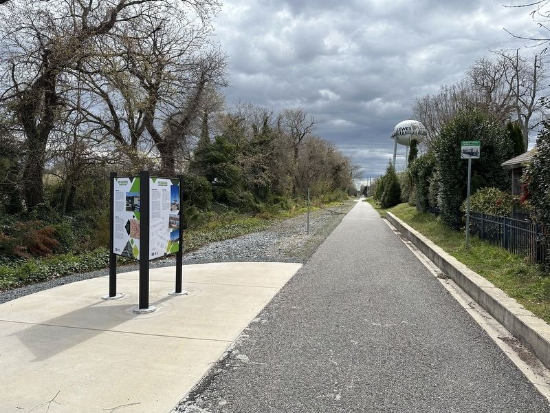
Location. 38° 46.386′ N, 75° 8.068′ W. Marker is in Lewes, Delaware, in Sussex County. Marker is on Lewes Georgetown Trail just south of Gills Neck Road (Local Road 267), on the right when traveling north. Touch for map. Marker is at or near this postal address: 300 Gills Neck Rd, Lewes DE 19958, United States of America. Touch for directions.
Other nearby markers. At least 8 other markers are within walking distance of this marker. Saving History (here, next to this marker); Preservation (here, next to this marker); David Hall House (approx. ¼ mile away); The Fisher-Martin House (approx. ¼ mile away); H.M. Brig DeBraak (approx. ¼ mile away); Lewes (approx. ¼ mile away); Zwaanendael Museum (approx. ¼ mile away); Zwaanendael House (approx. ¼ mile away). Touch for a list and map of all markers in Lewes.
Additional commentary.
1.
Thanks to my son, Isaac Skillman, for helping to find and document this marker with me.
— Submitted April 11, 2024, by Pete Skillman of Townsend, Delaware.
Credits. This page was last revised on April 12, 2024. It was originally submitted on April 6, 2024, by Pete Skillman of Townsend, Delaware. This page has been viewed 68 times since then. Photos: 1, 2. submitted on April 6, 2024, by Pete Skillman of Townsend, Delaware. • Devry Becker Jones was the editor who published this page.

