Lewes in Sussex County, Delaware — The American Northeast (Mid-Atlantic)
Preservation
A Bridge on the Move
Bridge Mechanics
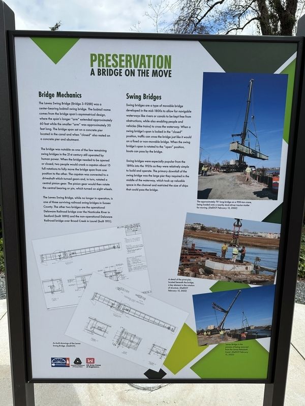
The Lewes Swing Bridge (Bridge 3-928R) was a center-bearing bobtail swing bridge. The bobtail name comes from the bridge span's asymmetrical design, where the span's longer "arm" extended approximately 60 feet while the smaller "arm" was approximately 30 feet long. The bridge span sat on a concrete pier located in the canal and when "closed" also rested on a concrete pier and abutment.
The bridge was notable as one of the few remaining swing bridges in the 21st century still operated by human power. When the bridge needed to be opened or closed, two people would crank a capstan about 15 full rotations to fully move the bridge span from one position to the other. The capstan was connected to a driveshaft which turned gears and, in turn, rotated a central pinion gear. The pinion gear would then rotate the central bearing or pin, which turned on eight wheels.
The Lewes Swing Bridge, while no longer in operation, is one of three surviving railroad swing bridges in Sussex County. The other two bridges are the operational Delaware Railroad bridge over the Nanticoke River in Seaford (built 1890) and the non-operational Delaware Railroad bridge over Broad Creek in Laurel (built 1911).
Swing Bridges
Swing bridges are a type of movable bridge developed in the mid-1800s to allow for navigable waterways like rivers or canals to be kept free from obstructions, while also enabling people and vehicles (like trains) to cross the waterway. When a swing bridge's span is locked in the "closed" position, traffic can cross the bridge just like it would on a fixed or non-movable bridge. When the swing bridge's span is rotated to the "open" position, boats can pass by the bridge.
Swing bridges were especially popular from the 1890s into the 1920s as they were relatively simple to build and operate. The primary downfall of the swing bridge was the large pier they required in the middle of the waterway, which took up valuable space in the channel and restricted the size of ships that could pass the bridge.
[Captions]:
As-built drawings of the Lewes Swing Bridge. (DelDOT).
The approximately 70' long bridge on a 900-ton crane, being loaded onto a nearby dual-driver tractor-trailer for moving. (DelDOT February 15, 2022)
A detail of the pivot pier, located beneath the bridge, a key element in the rotation of structure. (DelDOT February 15, 2022)
Lewes Bridge in the process of being removed from the Lewes-Rehoboth Canal. (DelDOT February 15, 2022)
Erected 2022 by Delaware Department of Transportation.
Topics. This historical marker is listed in these topic lists: Bridges & Viaducts • Railroads & Streetcars • Waterways & Vessels. A significant historical year for this entry is 2022.
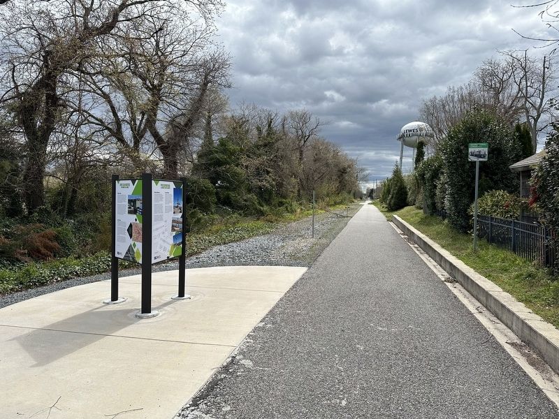
Location. 38° 46.387′ N, 75° 8.069′ W. Marker is in Lewes, Delaware, in Sussex County. Marker is on Lewes Georgetown Trail just south of Gills Neck Road (Local Road 267), on the right when traveling north. Touch for map. Marker is at or near this postal address: 300 Gills Neck Rd, Lewes DE 19958, United States of America. Touch for directions.
Other nearby markers. At least 8 other markers are within walking distance of this marker. Over Calm Waters (here, next to this marker); Saving History (here, next to this marker); David Hall House (approx. ¼ mile away); The Fisher-Martin House (approx. ¼ mile away); H.M. Brig DeBraak (approx. ¼ mile away); Lewes (approx. ¼ mile away); Zwaanendael Museum (approx. ¼ mile away); Zwaanendael House (approx. ¼ mile away). Touch for a list and map of all markers in Lewes.
Credits. This page was last revised on April 8, 2024. It was originally submitted on April 6, 2024, by Pete Skillman of Townsend, Delaware. This page has been viewed 42 times since then. Photos: 1, 2. submitted on April 6, 2024, by Pete Skillman of Townsend, Delaware. • Devry Becker Jones was the editor who published this page.

