Lawrenceburg in Anderson County, Kentucky — The American South (East South Central)
Salt River Church
1/2 mile
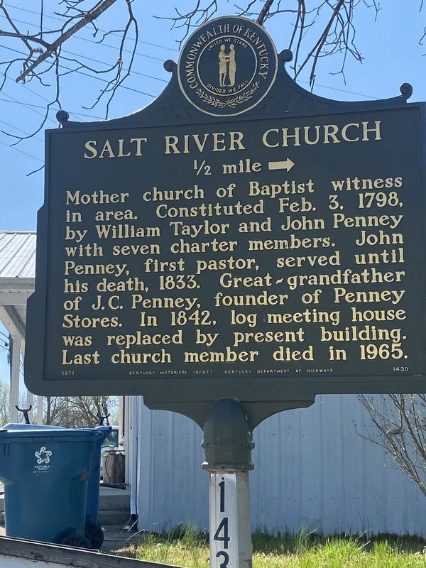
Photographed by Darren Jefferson Clay, April 7, 2024
1. Salt River Church Marker
Erected 1971 by Kentucky Historical Society, Kentucky Department of Highways. (Marker Number 1430.)
Topics. This historical marker is listed in this topic list: Religion & Religious Structures.
Location. 38° 0.48′ N, 84° 52.835′ W. Marker is in Lawrenceburg, Kentucky, in Anderson County. It is at the intersection of Harrodsburg Road (Business U.S. 127) and Salt River Road, on the right when traveling south on Harrodsburg Road. Touch for map. Marker is at or near this postal address: 1500 Harrodsburg Rd, Lawrenceburg KY 40342, United States of America. Touch for directions.

Regionally, this marker is in the Bluegrass Region. It is also in the American South and specifically in the Upper South. Globally, it is in North America,
this page online
Other nearby markers. At least 8 other markers are within 4 miles of this marker, measured as the crow flies: William H. Townsend (approx. 1.8 miles away); Anna Mac Clarke (1919-44) (approx. 2.1 miles away); Kavanaugh School / Mrs. "K" (approx. 2.2 miles away); Distinguished Officers - Alumni of Kavanaugh / Kavanaugh School (approx. 2.2 miles away); County Named, 1827 (approx. 2.3 miles away); Hebron Church (approx. 3 miles away); McCall's Spring (approx. 3 miles away); Renowned Congressman (approx. 4 miles away). Touch for a list and map of all markers in Lawrenceburg.
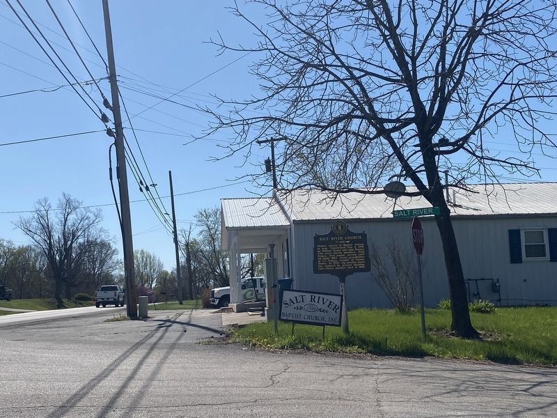
Photographed by Darren Jefferson Clay, April 7, 2024
2. Salt River Church Marker
Credits. This page was last revised on April 14, 2024. It was originally submitted on April 8, 2024, by Darren Jefferson Clay of Duluth, Georgia. This page has been viewed 519 times since then and 65 times this year. Photos: 1, 2. submitted on April 11, 2024, by Darren Jefferson Clay of Duluth, Georgia. • James Hulse was the editor who published this page.
