Wills Point in Van Zandt County, Texas — The American South (West South Central)
County Seat War
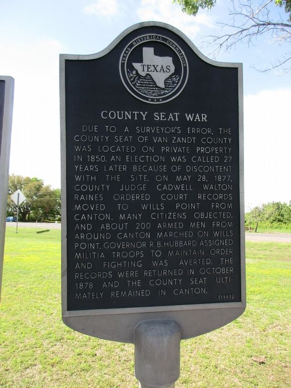
Photographed by Jeff Leichsenring, April 7, 2024
1. County Seat War Marker
Erected 1997 by Texas Historical Commission. (Marker Number 11392.)
Topics. This historical marker is listed in this topic list: Government & Politics.
Location. 32° 41.965′ N, 95° 59.5′ W. Marker is in Wills Point, Texas, in Van Zandt County. It is at the intersection of Houston Street (County Road 3415) and Corky Boyd Avenue (State Highway 64), on the right when traveling east on Houston Street. Touch for map. Marker is in this post office area: Wills Point TX 75169, United States of America. Touch for directions.

Regionally,
this page online
Other nearby markers. At least 8 other markers are within 2 miles of this marker, measured as the crow flies: William A. Wills (here, next to this marker); Dallas-Shreveport Road (here, next to this marker); White Rose Cemetery (approx. 0.3 miles away); Fin & Feather Hunting and Fishing Club (approx. half a mile away); Russell Memorial United Methodist Church (approx. 1.1 miles away); McKain Family Home (approx. 1.1 miles away); First Christian Church of Wills Point (approx. 1.1 miles away); First Baptist Church (approx. 1.1 miles away). Touch for a list and map of all markers in Wills Point.
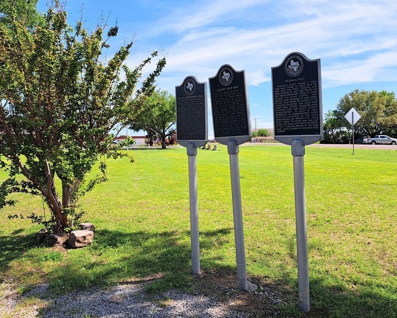
Photographed by Jason Sullivan, April 12, 2024
2. County Seat War Marker
The County Seat War, Dallas-Shreveport Road and William A. Wills Markers are grouped together.
Credits. This page was last revised on May 10, 2024. It was originally submitted on April 8, 2024, by Jeff Leichsenring of Garland, Texas. This page has been viewed 610 times since then and 92 times this year. Photos: 1. submitted on April 8, 2024, by Jeff Leichsenring of Garland, Texas. 2. submitted on April 20, 2024, by Jason Sullivan of Arlington, Texas. • James Hulse was the editor who published this page.
