Hawthorne in Louisville in Jefferson County, Kentucky — The American South (East South Central)
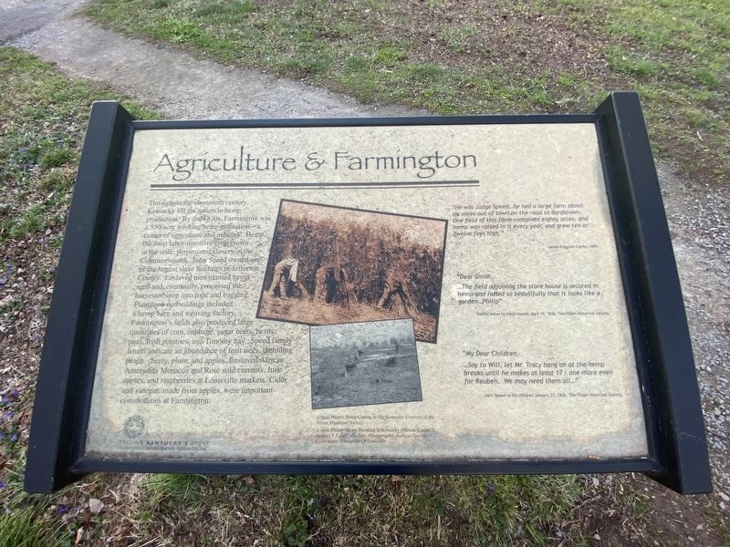
Agriculture & Farmington
Photographed by Darren Jefferson Clay, April 7, 2024
1. Agriculture & Farmington Marker
"He was Judge Speed...he had a large farm about six miles out of town on the road to Bardstown. One field of this farm contained eighty acres, and hemp was raised in it every year, and grew ten or twelve feet high."
James Freeman Clarke 1899
"Dear Smith,
...The field adjoining the store house is secured in hemp and rolled so beautifully that it looks like a garden...Philip"
Family letter to Smith Speed, April 19. 1835. The Filson Historical Society
"My Dear Children, ...Say to Will, let Mr. Tracy hang on at the hemp breaks until he makes at least 17 - one more even for Reuben. We may need them all..."
John Speed to his children January 27, 1836, The Filson Historical Society
Captions
(Upper Photo) Hemp Cutting in Old Kentucky. Courtesy of the Filson Historical Society.
(Lower Photo): Hemp Breaking in Kentucky (Mercer County?) Arthury Y Ford Collection. Photographic Archives/Special Collections University Of Louisville
Erected by Kentucky
this page online
Topics. This historical marker is listed in these topic lists: African Americans • Agriculture • Industry & Commerce. A significant historical date for this entry is January 27, 1836.
Location. 38° 12.86′ N, 85° 40.064′ W. Marker is in Louisville, Kentucky, in Jefferson County. It is in Hawthorne. It can be reached from Farmington Access Rd. east of Lowell Avenue. Touch for map. Marker is at or near this postal address: Farmington Access Rd, Louisville KY 40205, United States of America. Touch for directions.

Regionally, this marker is in the American South, specifically in the Upper South, and in the Ohio River Valley. Globally, it is in North America, the Western Hemisphere, the Western World, and the Anglosphere. Historically, it finds itself in what was once the territory of the Mississippian Culture and also the Antebellum South.
Other nearby markers. At least 8 other markers are within walking distance of this marker: The Brothers Speed — Joshua and James (about 300 feet away, measured in a direct line); The Cabin at Farmington (about 300 feet away); Abraham Lincoln & Farmington — 1841 (about
Photographed by Darren Jefferson Clay, April 7, 2024
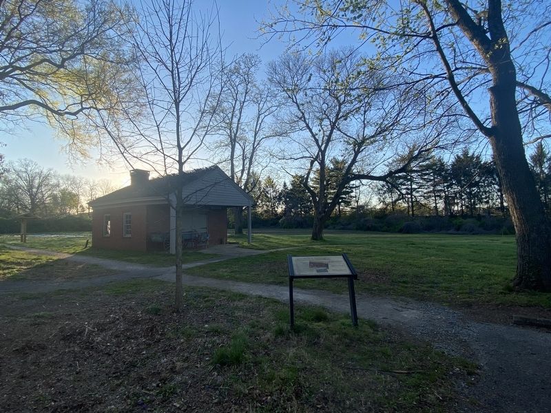
2. Agriculture & Farmington Marker
Credits. This page was last revised on April 15, 2024. It was originally submitted on April 8, 2024, by Darren Jefferson Clay of Duluth, Georgia. This page has been viewed 247 times since then and 23 times this year. Photos: 1, 2. submitted on April 10, 2024, by Darren Jefferson Clay of Duluth, Georgia. • James Hulse was the editor who published this page.
