Near Oktaha in Muskogee County, Oklahoma — The American South (West South Central)
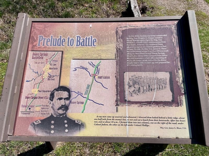
Prelude to Battle
Honey Springs Battlefield
— Interpretive Trail One · Federal Bivouac —
Inscription.
In July 1863, Confederate troops commanded
by Brig. Gen. Douglas H. Cooper waited at
Honey Springs supply depot for Brig. Gen.
William L. Cabells 3,000 reinforcements from
Fort Smith, Arkansas. The combined forces
planned to capture the Federal garrison at Fort
Gibson. On July 16, Maj. Gen. James G. Blunt
led 3,000 Federal troops from Fort Gibson south
along the Texas Road toward Honey Springs.
Blunt's plan was to defeat Cooper's force before
the reinforcements arrived. After marching all
night, the troops rested, waited for the slower
supply wagon train to catch up, and prepared for
the coming battle.
As my men came up wearied and exhausted, I directed them halted behind a little ridge, about one-half mile from the enemy's line, to rest and eat a lunch from their haversacks. After two hours rest, and at about 10a.m., I formed them into two columns, one on the right of the road, under Colonel Judson, the other on the left under Colonel Phillips.
Maj. Gen. James G. Blunt, USA
Erected 2020 by Friends of Honey Springs Battlefield.
Topics and series. This historical marker is listed in this topic list: War, US Civil. In addition, it is included in the Honey Springs Battlefield series list. A significant historical month for this entry is July 1863.
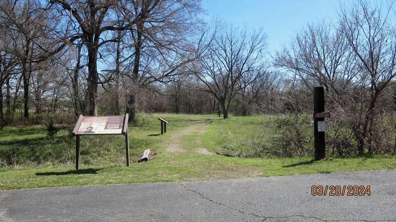
Location. 35° 33.886′ N, 95° 28.374′ W. Marker is near Oktaha, Oklahoma, in Muskogee County. Marker is on Honey Springs Battlefield Road, 2.3 miles north of East 1020 Road, on the right when traveling north. Touch for map. Marker is in this post office area: Oktaha OK 74450, United States of America. Touch for directions.
Other nearby markers. At least 8 other markers are within walking distance of this marker. The Army of the Frontier (a few steps from this marker); The March from Fort Gibson (within shouting distance of this marker); 3rd Wisconsin Cavalry (within shouting distance of this marker); 2nd Indian Home Guard (about 300 feet away, measured in a direct line); Smith's Battery of Kansas Artillery (about 700 feet away); The Battle Begins (about 700 feet away); The Federal Right · Judson's Brigade (about 700 feet away); Short Trail to the Creek (about 700 feet away). Touch for a list and map of all markers in Oktaha.
Credits. This page was last revised on April 12, 2024. It was originally submitted on April 12, 2024, by Mark Hilton of Montgomery, Alabama. This page has been viewed 41 times since then. Photos: 1, 2, 3, 4. submitted on April 12, 2024, by Mark Hilton of Montgomery, Alabama.


