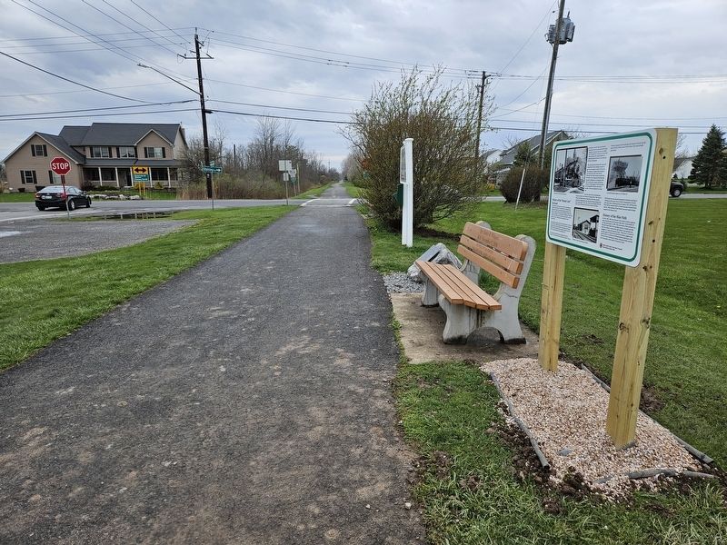
Clarence in Erie County, New York — The American Northeast (Mid-Atlantic)
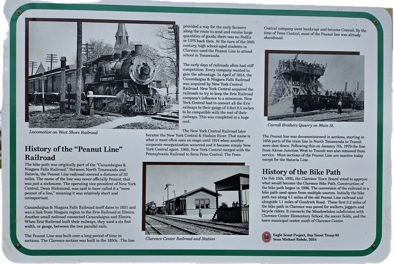
History of the "Peanut Line" Railroad
Inscription.
The bike path was originally part of the “Canandaigua & Niagara Falls Railroad.” Between North Tonawanda and Batavia, the Peanut Line railroad covered a distance of 32 miles. The name of the line was never officially Peanut; that was just a nickname. The operating vice president of New York Central, Dean Richmond, was said to have called it a “mere peanut of a line,” meaning it was relatively short and unimportant.
Canandaigua & Niagara Railroad itself dates to 1851 and was a link from Niagara region to the Erie Railroad at Elmira. Another small railroad connected Canandaigua and Elmira. When Erie Railroad built their railways, they used a six foot width, or gauge, between the two parallel rails.
The Peanut Line was built over a long period of time in sections. The Clarence section was built in the 1850s. The line provided a way for the early farmers along the route to send and receive large quantities of goods; there was no FedEx or UPS back then. At the turn of the 20th century, high school-aged students in Clarence used the Peanut Line to attend school in Tonawanda.
The early days of railroads often had stiff competition. Every company wanted to gain the advantage. In April of 1854, the Canandaigua & Niagara Falls Railroad was acquired by New York Central Railroad. New York Central acquired the railroads to try to keep the Erie Railroad company’s influence to a minimum. New York Central had to convert all the Erie railways to their gage of 4 feet 8.5 inches to be compatible with the rest of their railways. This was completed at a huge cost.
The New York Central Railroad later became the New York Central & Hudson River. That name is what is most often seen on maps until 1914 when another corporate reorganization occurred and it became simply New York Central again. 1968, New York Central merged with the Pennsylvania Railroad to form Penn Central. The Penn Central company when bankrupt and became Conrail. By the time of Penn Central, most of the Peanut line was already abandoned.
The Peanut line was decommissioned in sections, starting in 1956 parts of the train line in North Tonawanda to Transit were shut down. Following this on January 7th, 1979 the line from Akron Junction West to Transit was also removed from service. Most sections of the Peanut Line are inactive today except for the Batavia Line.
History of the Bike Path On Feb 15th, 1995, the Clarence Town Board voted to approve what would become the Clarence Bike Path. Construction of the bike path began in 1996. The conversion of the railroad to a bike path used space from multiple sources. Initially the bike path ran along 4.1 miles of the old Peanut Line railroad and alongside 1.1 miles of Goodrich
Road. These first 5.2 miles of the bike path in Clarence was paved for walkers, joggers and bicycle riders. It connects the Meadowlakes subdivision with Clarence Center Elementary School, the soccer fields, and the town municipal center south of Clarence Center.
Locomotive on West Shore Railroad. Clarence Center Railroad and Station. Carroll Brothers Quarry on Main St.
Erected 2024 by Boy Scout Troop 93, Sean Michael Rohde.
Topics. This historical marker is listed in these topic lists: Parks & Recreational Areas • Railroads & Streetcars. A significant historical date for this entry is January 7, 1979.
Location. 43° 0.999′ N, 78° 39.72′ W. Marker is in Clarence, New York, in Erie County. Marker is at the intersection of Clarence Center Road and Stahley Road, on the left when traveling east on Clarence Center Road. Touch for map. Marker is in this post office area: Clarence NY 14031, United States of America. Touch for directions.
Other nearby markers. At least 8 other markers are within 4 miles of this marker, measured as the crow flies. J. Eschelman and Company Store (approx. 1.3 miles away); Clarence Center (approx. 1.3 miles away); a different marker also named Clarence Center (approx. 1.4 miles away); Veterans Memorial (approx. 2.2 miles away); Town of Clarence - Swormville (approx. 2.3 miles away); Harris Hill (approx. 3.7 miles away); Clarence Veterans Memorial (approx. 4.1 miles away); In Memory of Our Comrades (approx. 4.1 miles away). Touch for a list and map of all markers in Clarence.
Credits. This page was last revised on April 13, 2024. It was originally submitted on April 13, 2024, by Anton Schwarzmueller of Wilson, New York. This page has been viewed 77 times since then. Photos: 1, 2. submitted on April 13, 2024, by Anton Schwarzmueller of Wilson, New York.

