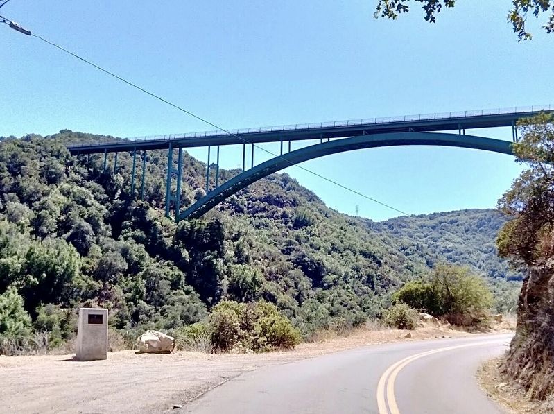
Near Santa Barbara in Santa Barbara County, California — The American West (Pacific Coastal)
Cold Spring Arch Bridge
Historic Civil Engineering Landmark
— ASCE —
The Cold Spring Arch Bridge, built by the California Department of Transportation, at the time of construction was one of the longest steel arch bridges built in the United States. It was also one of the first major arch structures to use all welded steel sections. This bridge, with its accompanying road realignment, resulted in a safer and shorter travel from the City of Santa Barbara to and from the Santa Ynez Valley. George Hood was the senior design engineer and Mr. Fred Yoshino was the resident engineer during construction.
Construction started June 1962.
Construction completed January 1964.
Designated 1976.
Plaque placed 2004.
Erected 2004 by American Society of Civil Engineers.
Topics and series. This historical marker is listed in these topic lists: Architecture • Roads & Vehicles. In addition, it is included in the ASCE Civil Engineering Landmarks series list. A significant historical month for this entry is January 1964.
Location. 34° 31.669′ N, 119° 49.996′ W. Marker is near Santa Barbara, California, in Santa Barbara County. Marker is on Stagecoach Road near San Marcos Pass Road (California Route 154). Touch for map. Marker is in this post office area: Santa Barbara CA 93105, United States of America. Touch for directions.
Other nearby markers. At least 8 other markers are within 8 miles of this marker, measured as the crow flies. Old Stagecoach Route (approx. 0.3 miles away); Cold Spring Tavern (approx. 0.6 miles away); Chumash Painted Cave (approx. 3.1 miles away); Goleta Depot (approx. 6 miles away); Ovington's Hangar (approx. 6.4 miles away); Earle Ovington Terminal (approx. 7.1 miles away); Hope House (approx. 7.3 miles away); Egg McMuffin (approx. 7.6 miles away). Touch for a list and map of all markers in Santa Barbara.
Regarding Cold Spring Arch Bridge. This is currently the highest arch bridge in California and among the highest bridges in the United States. The bridge deck is 400 feet above the canyon floor. At 1,217 feet long, is also the largest steel arch bridge in the state. The structure won awards for engineering, design, and beauty. It was determined to be eligible for the National Register of Historic Places with exceptional significance.
Stagecoach Road is the stretch of original highway bypassed by the bridge.
Credits. This page was last revised on April 16, 2024. It was originally submitted on April 16, 2024, by Craig Baker of Sylmar, California. This page has been viewed 66 times since then. Photos: 1, 2. submitted on April 16, 2024, by Craig Baker of Sylmar, California.

